MichaelA
Weather Analyst

Reged:
Posts: 952
Loc: Pinellas Park, FL
|
|
Quote:
Sorry for the trouble - lets get back to the storm.
My area, Bradenton, Fla, has receieved a few inches of rain and some gusty winds, perhaps as high as 35-40 in my neighborhood. It's been surprisingly quiet around here most of the afternoon which leads me to believe that is tracking further west than expected.
20-30 MPH in Pinellas County now. Nothing to get excited about. Looking at the GOM Vis loop and the Tampa Bay long range radar loop, the NW motion is continuing in general.
--------------------
Michael
PWS
|
gavsie
Verified CFHC User

Reged:
Posts: 18
Loc: Seminole Fl
|
|
Let it go already. People are wrong everyday about all sorts of things. I doubt being wrong about something as unpredictable as the weather is a crime. Have you read all of the site? Not to be taken as a replacement for other local news. This is just a bunch of people who enjoy trying to figure out whats going on. I am a student and happen to have a Met class right now and I enjoy hearing all views and idea whether they are wrong or right. It is all just educated guessing. Do you have any better ideas?
|
dolfinatic
Weather Guru
Reged:
Posts: 129
Loc: St. Petersburg, Fl
|
|
Well said Michael A. History tells us that even a wobble can mean the difference between TS winds and hurricane winds effecting you.
|
pcola
Storm Tracker

Reged:
Posts: 344
Loc: pensacola/gulf breeze
|
|
NHC says will be a CAT 3 by tonight...new track brings it to the FL/AL border.
--------------------
Erin 95 , Opal 95, Ivan 04, Dennis 05, and that's enough!!!!
|
hurricane_run
Storm Tracker

Reged:
Posts: 366
Loc: USA
|
|
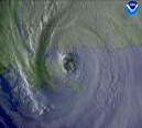
look at that eye
|
nl
Storm Tracker

Reged:
Posts: 207
Loc: nsb,fl
|
|
ok guys i admit i was wrong this time. im now 3-1 this year. but the models were absolutely great. very accurate. ok bout that other storm des the models look bad news for florida again? all my prayers too panhandle and all the other states who get drilled with rain. 
|
Colleen A.
Moderator

Reged:
Posts: 1432
Loc: Florida
|
|
Okay, pcola. You and I may be hearing different things from different outlets. But the turn is predicted to turn BEFORE making landfall, not as it is.
That being said, wherever it hits will be within the "cone". However, if it starts its turn sooner, then it will make a big difference to those who are EAST of the forecasted path.
I'm not going to beat another dead horse; we have enough dead ones lying on floor to supply an entire school district with Elmers glue.
NW movement on the 5pm advisory is still there, so we'll just have to wait and see what happens.
For now...I'm gonna go have a beer and watch the feeder bands come through. I had enough hurricanes last year to last me a lifetime, so there's no wishcasting going on HERE, believe me. 
--------------------
You know you're a hurricane freak when you wake up in the morning and hit "REFRESH" on CFHC instead of the Snooze Button.
|
stormchazer
Storm Tracker

Reged:
Posts: 315
Loc: Central Florida
|
|
Yep....been trying to look at that but obviously is the main action. Been seeing a lot of post info here and other boards, both Hobbiest and Professional, with experts saying that SSTs and low Shear is more like Mid-August then July. It is going to be a long and interesting season.
First we must get rid of .
--------------------
Jara
*************************************************************
|
BillD
User
Reged:
Posts: 398
Loc: Miami
|
|
What some people seem to forget is that did exactly what the said it might do. The landfall was within the cone. This is why "watching the line" is a not a good thing to do. As far as a South Florida hit, there was a short period of time a couple of days ago when we were in the cone, but the cone gradually shifted to the left until all of Florda but the Panhandle was out of it.
Bill
|
hurricane_run
Storm Tracker

Reged:
Posts: 366
Loc: USA
|
|
the disscusion metions the possibillity of of regain Cat 4 status
|
pcola
Storm Tracker

Reged:
Posts: 344
Loc: pensacola/gulf breeze
|
|
I agree Coleen, I have had enough too. I think they follow me. My first was Agnes in the early 70's. We had a condo at Longboat and went to Disney to ride it out. Got back to Pittsburgh only to have 6FT water in house from Agnes flooding. Since moving to Pcola, have had way to many. This may be my last. Snowstorms are looking pretty good.
--------------------
Erin 95 , Opal 95, Ivan 04, Dennis 05, and that's enough!!!!
|
Margie
Senior Storm Chaser

Reged:
Posts: 1191
Loc: Twin Cities
|
|
Quote:
NHC says will be a CAT 3 by tonight...new track brings it to the FL/AL border.
Where do you see the info about the new track? Was it in Discussion #21 (I don't see that yet on wunderground, just adv #21).
So now the pressure is down to what it was when was a CAT 3 earlier, and adv #21 is certain will increase in intensity to CAT 3. So this means the winds will catch up with the pressure drops right? Also am I understanding this correctly - did just go througth an ? The eye has appeared and is larger, does this mean that the eye will now shrink a bit, and the winds increase?
--------------------
Katrina's Surge: http://www.wunderground.com/hurricane/Katrinas_surge_contents.asp
|
stormchazer
Storm Tracker

Reged:
Posts: 315
Loc: Central Florida
|
|
Its cool. We have a good group who live on the Penisular here and our a bit jumpy when you see sudden moves towards you. I wonder if anyone said that last year with ? I'm just saying that you have to sift through some post that are a little emotion driven and weed out the good stuff. I'm done with this because it is to tense watching .
Dennis may be trying to go more North but still looks NW to me and on s track.
--------------------
Jara
*************************************************************
|
Clark
Meteorologist
Reged:
Posts: 1710
Loc:
|
|
firestar_1 -- yeah, that's about where you'd want to look for that turn.
To address another comment I saw (forgot the poster) -- isn't going to ever do anything that would potentially bring more criticism their way. Their time is pretty limited during each 6hr advisory cycle as it is, so it is highly unlikely that you'll ever see anything like a "hobbyist" discussion on their end. But, that's what the rest of the web is good for.
--------------------
Current Tropical Model Output Plots
(or view them on the main page for any active Atlantic storms!)
|
AndyG
Weather Watcher
Reged:
Posts: 35
Loc: Bradenton, FL
|
|
Does it look to anyone else that has slowed/stalled a little?
|
WeatherNLU
Meteorologist

Reged:
Posts: 212
Loc: New Orleans, LA
|
|
Man guys, I don't like this at all. is bombing out again, and in my opinion it's going to get ugly. You're not going to find a much better looking early July hurricane and is really getting it together quickly. The pressure is down to 955, and I promise you the winds are higher than 105. Of course, this is just my opinion, but I think is going to be a mininmal CAT 4 by landfall. Not trying to scare anyone, but I think it needs to be said.
--------------------
I survived Hurricane Katrina, but nothing I owned did!
|
susieq
Weather Watcher
Reged:
Posts: 49
Loc: Panhandle
|
|
What's happening to the right quadrant here? http://www.ssd.noaa.gov/PS/TROP/DATA/RT/gmex-wv-loop.html
--------------------
Gulf Breeze girl still not over Ivan
|
bn765
Weather Hobbyist
Reged:
Posts: 60
|
|
Wow they are now saying a Cat 4 is possible. This thing is really strengthening and fast.
|
BobVee
Verified CFHC User
Reged:
Posts: 15
Loc: Florida
|
|
Thanks for that reminder. My recollection as well is that the and contributors on this site all discussed this at length prior to any landfall. Everyone knew that it was going to turn, just not exactly when thus where. The only bashing that I would ever do would be at the news media who talk so much that it confuses the dickens out of most people. I for one appreciate the people who contribute to this forum and lend a great deal of credibility to the extremely dynamic study of weather. I am not a met. but am an engineer who understands probability. In a constant changing environment, probability is the only mechanism for determination.
|
Clark
Meteorologist
Reged:
Posts: 1710
Loc:
|
|
damejune2, there was just the one person there who continually tried to push the storm into S. Florida. Others may have posted questions asking if it were possible, but it was just the one poster with those comments. You are making a broad assumption about everyone here with your remarks, one that I feel is unearned. I apologize if my post came across as blunt, but I felt it necessary to defend the integrity of this website, as it is (IMO) the best such site on the Internet. The community here is relatively small, but most everyone either knows their stuff or wants to learn more about these things...you don't find that much of anywhere else.
--------------------
Current Tropical Model Output Plots
(or view them on the main page for any active Atlantic storms!)
|


 Threaded


