superfly
Weather Watcher
Reged:
Posts: 33
Loc: New Orleans
|
|
Got bored so decided to hit the coordinates up on GoogleEarth. Image here.
|
wxman007
Meteorologist
Reged:
Posts: 617
Loc: Tuscaloosa, AL
|
|
New Special Advisory calling for a Cat 4 at landfall...
I just did a live interview with Max Mayfield...they are VERY concerned with the rapid deepining that is ongoing...his words, "If you live with 50 miles of the coast from Panama City west, get out".
--------------------
Jason Kelley
Edited by wxman007 (Sat Jul 09 2005 11:15 PM)
|
drcrazibob
Weather Watcher

Reged:
Posts: 30
Loc: Daytona Beach, Fl
|
|
Aside from the Technical aspects of Hurricane , I want to wish everyone up in the panhandle and those of you that have friends and family wherever lands, all the best and to be as safe as possible. I know we're all doing our best to see where this hurricane is going and how big it's getting, but regardless of that, my prayers are with ya'all. I spent 2 hurricanes in Deltona, Fl last year with my sister and brother-in-law and she was 30 weeks pregnant! What a crazy scary time. So Godspeed to everyone, and be safe!
|
NewWatcher
Storm Tracker

Reged:
Posts: 388
Loc: Port Orange, FL
|
|
does anyone have the website that was posted, i think last night, with the pics of topography, they were really nice, and i cant find the link grrrr
|
WeatherNLU
Meteorologist

Reged:
Posts: 212
Loc: New Orleans, LA
|
|
.2N and .0W in the last hour.........maybe this is FINALLY the turn.
--------------------
I survived Hurricane Katrina, but nothing I owned did!
|
Kevin
Weather Master

Reged:
Posts: 524
Loc: EC Florida
|
|
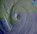
Been away from the computer this afternoon...and look what happens. With each new image that comes onto the visible floater loop, you can see the eye contracting. A sign of intensification. Another sign of a rapidly deepen storm: the stadium look that the eyewall has been taking on over the past couple of hours or so.
|
MikeC
Admin
Reged:
Posts: 4544
Loc: Orlando, FL
|
|
Classic Discussion pair with the 5PM and special 7PM. I think he was taken off guard by this... I know I am.
HURRICANE DISCUSSION NUMBER 21
NWS TPC/NATIONAL HURRICANE CENTER MIAMI FL
5 PM EDT SAT JUL 09 2005
WHAT A DIFFERENCE 6 HOURS MAKES! SATELLITE...RADAR...AND NOAA AND
AIR FORCE RECONNAISSANCE DATA INDICATE HAS POSSIBLY STARTED
A RAPID DEEPENING PHASE. THE EYE HAS BECOME BECOME DEFINED IN BOTH
RADAR AND SATELLITE IMAGERY..
Then at 7PM..
HURRICANE SPECIAL DISCUSSION NUMBER 22
NWS TPC/NATIONAL HURRICANE CENTER MIAMI FL
7 PM EDT SAT JUL 09 2005
WHAT A DIFFERENCE 2 HOURS MAKES! AIR FORCE AND NOAA HURRICANE
HUNTER AIRCRAFT INDICATE THE CENTRAL PRESSURE OF DROPPED 11
MB IN AN HOUR AND A HALF.
.
|
Steve777
Registered User
Reged:
Posts: 5
Loc: St. Cloud FL
|
|
Hello fellow hurricane hunters. I believe this is only the 3rd post ever. I live in St Cloud Fl. I work for Orlando utilities and have been tuned into this site for 8 years now. Lots of times I've used it to just enjoy learning and i do enjoy reading the posts and laughing at the tempermental posts and I've even felt like defending the idiots sometimes cause we all shouldn't take everything so personal and serious.well, last year we got hit with and francis and jeanne and i lost shingles, then bedroom ceiling and garage ceiling and porch ceiling and all pool room screens and pool frame damage ect..seems like a nightmare year and i'm really glad storm is west of us cause i've just recieved 1 and half inches of rain in less than hour here and strong gusts. Just wanted to say hi to whoever and thanks for this site always enjoyed it. Stay Kewl.
|
LanceW-Home
Registered User
Reged:
Posts: 4
|
|
Have not posted this year myself. I am in Poinciana, kinda gusty, lotsa rain. Had lots of damage last year, hopeing for NONE this...
|
Clark
Meteorologist
Reged:
Posts: 1710
Loc:
|
|
This is not good. That's about all I can say. has blown past expectations, climatology, and everything else yet another time. It's well on its way towards being a category 4 storm.
The only saving grace is a pool of colder waters just south of Pensacola. If the storm is moving slow enough, it could have an impact on the storm's intensity just before landfall. A recent wobble north may be the signal of the long-awaited turn moreso towards the north. The system is due south of St. George Island, Florida right now; a north-northwest movement to landfall pretty much takes it to the area Max Mayfield highlighted in his interview with JK.
Stay tuned...this thing's on a tear right now.
--------------------
Current Tropical Model Output Plots
(or view them on the main page for any active Atlantic storms!)
|
Lysis
User

Reged:
Posts: 451
Loc: Hong Kong
|
|
So Clark... this may be the most intense July hurricane in recorded history *twice* Absolutely incredible. 
--------------------
cheers
Edited by Lysis (Sat Jul 09 2005 11:41 PM)
|
Allison
Weather Guru

Reged:
Posts: 134
Loc: Laredo, Texas
|
|
Quote:
The only saving grace is a pool of colder waters just south of Pensacola. If the storm is moving slow enough, it could have an impact on the storm's intensity just before landfall.
Any opinion on how slow he'd have to be going to be weakend by the cooler SST's (a' la Lili)?
Allison
|
Clark
Meteorologist
Reged:
Posts: 1710
Loc:
|
|
Allison -- no idea. If it's moving 15-20mph, it'll see little impact (I believe). If it's moving 5-10mph, it'll see a greater impact. Can't pin down a number, though.
--------------------
Current Tropical Model Output Plots
(or view them on the main page for any active Atlantic storms!)
|
bn765
Weather Hobbyist
Reged:
Posts: 60
|
|
any guesses on the wind speed at the 8 advisory?
|
Steve H1
Storm Tracker
Reged:
Posts: 309
Loc: Palm Bay FL USA
|
|
he actually running almost due north now. When you observe the eye, be sure to take into account the sun angle and the dense overcast that intermittently covers the east side of the eye. I'd say he's nearing 350 - 355 degrees. On the other question, I don't think he's going to slow down much. The cooler water you're talking about still is above 27c.
|
Clark
Meteorologist
Reged:
Posts: 1710
Loc:
|
|
There won't be another advisory until 9p ET/8p CT, but assuming current trends have continued, it should be increased by 5-15mph.
--------------------
Current Tropical Model Output Plots
(or view them on the main page for any active Atlantic storms!)
|
stormchazer
Storm Tracker

Reged:
Posts: 315
Loc: Central Florida
|
|
I was wondering about the warmer tops (blue) that seam to be spinning in to the storm from the southeast side. Could this help slow this rapid intensification or is this just an indication of a tightening core?
--------------------
Jara
*************************************************************
|
Big Red Machine
Storm Tracker
Reged:
Posts: 223
Loc: Polk City, FL
|
|
Clark, I hate to even mention it, but could we be looking at a possible Camille scenario? Fast moving, fast developing storm, in the central gulf? Or am I just being overly concerned.
Also, I appreciate the time and expertise you devote to this site. I know your are extraordinarily busy right now.
|
Clark
Meteorologist
Reged:
Posts: 1710
Loc:
|
|
stormchazer -- probably just a sign of the differentiation between the well-defined core of the storm and an outer convective band and not a sign of dry air entrainment. I could be wrong, but I don't believe that there is dry air becoming entrained into the storm.
Big Red Machine -- probably not, as there is still likely an eyewall replacement cycle ahead (and shallower, cooler waters) to slow/halt intensification, but we don't know how strong it is going to get before then. Camille was a once-in-a-lifetime scenario and is the furthest north category 5 hurricane in Atlantic basin recorded history; I think is not likely to approach those levels. This may be a similar scenario to Opal in 1995, but I'm not willing to call for such drastic weakening right before landfall.
--------------------
Current Tropical Model Output Plots
(or view them on the main page for any active Atlantic storms!)
|
Frank P
Veteran Storm Chaser
Reged:
Posts: 1299
|
|
long range radar loop out of tampa indicates that looks to be on a pretty good NNW track... wobbling between NW and N... my opinion only...
|


 Threaded


