WeatherNLU
Meteorologist

Reged:
Posts: 212
Loc: New Orleans, LA
|
|
Yeah little doubt that Emily is getting it back together. According to that vortex, pressure down 11mb and the winds should be back up to 110 or 115.
Center is near 15 and 73.3.
--------------------
I survived Hurricane Katrina, but nothing I owned did!
|
ShanaTX
Storm Tracker
Reged:
Posts: 226
Loc: Texas
|
|
Quote:
Quote:
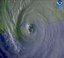
The last satellite photo shows that it looks like Emily has split in two. That was about 10 minutes ago
Huh?
That must have been right when the antenna got hit by lightning ... and then came back online later
-------------------------------------------------------
Thank you for the update and link to antenna problem info Hurricane Fredrick 1979 
---------------------------------------------------------
'shana
Edited by ShanaTX (Sat Jul 16 2005 12:01 AM)
|
Margie
Senior Storm Chaser

Reged:
Posts: 1191
Loc: Twin Cities
|
|
Quote:
Yeah little doubt that Emily is getting it back together. According to that vortex, pressure down 11mb and the winds should be back up to 110 or 115.
Center is near 15 and 73.3.
Oh, wow! I was correct? Maybe I'm learning something...came here to find info for when I was worried about my brother, and have stayed because it is so very interesting to analyze these storms.
--------------------
Katrina's Surge: http://www.wunderground.com/hurricane/Katrinas_surge_contents.asp
|
WeatherNLU
Meteorologist

Reged:
Posts: 212
Loc: New Orleans, LA
|
|
Repeating the 8 PM AST position...14.9 N... 73.4 W. Movement
toward...west-northwest near 18 mph. Maximum sustained winds...115
mph. Minimum central pressure... 958 mb.
--------------------
I survived Hurricane Katrina, but nothing I owned did!
|
Allison
Weather Guru

Reged:
Posts: 134
Loc: Laredo, Texas
|
|
Quote:
The last satellite photo shows that it looks like Emily has split in two. That was about 10 minutes ago
The IR pictures between 17:15 and 19:15 UTC showed a large flare-up on the east side of the outflow... and when viewed as a still image, may have given the impression that the storm was disorganized... is that what you were looking at, or something else?
--------------------
Allison
|
WeatherNLU
Meteorologist

Reged:
Posts: 212
Loc: New Orleans, LA
|
|
Not sure if anyone noticed, but the track at 5PM had a point of 15.2 and 75.4 for the 12HR position. At 8PM they have it at 14.9 and 73.4, although if you look at sat views, it's clearly at 15.0 and 73.4. Their 12HR position may be a flop, and that's not good for Jamaica. The Jams need one more of those due west jogs.
--------------------
I survived Hurricane Katrina, but nothing I owned did!
|
Margie
Senior Storm Chaser

Reged:
Posts: 1191
Loc: Twin Cities
|
|
Yes - huge difference between 19:15 and the next pic at...22:46? Is this the sat outage that was mentioned. I was pretty busy this aft and I didn't even notice. I'm looking at infared and just went back and checked and visual & water vapor not updated yet. Anyway looks like what I thought I saw did happen; the inner part of the storm is breaking away from the outer edges on the N and E and they don't appear to be connected to the storm's motion in a strong way.
--------------------
Katrina's Surge: http://www.wunderground.com/hurricane/Katrinas_surge_contents.asp
|
pcola
Storm Tracker

Reged:
Posts: 344
Loc: pensacola/gulf breeze
|
|
I could have used one of those west jogs last Sunday
--------------------
Erin 95 , Opal 95, Ivan 04, Dennis 05, and that's enough!!!!
|
Clark
Meteorologist
Reged:
Posts: 1710
Loc:
|
|
Gotta agree with you there, Shawn -- on the current course, it's headed straight for the western part of the island. They need one of those or -type jogs to the west as it approaches, or they are going to take it on the chin from a yet-again rapidly intensifying hurricane.
Recon reports pressure down to 956mb. Eyewall is elliptical in nature and pretty steady; probably should hold for awhile, allowing for more intensification (given favorable upper level winds). It might yet make one more run at its previous intensity, unfortunately. Emily's proving yet again to be quite the bugger intensity-wise...no one has really called this one right so far.
--------------------
Current Tropical Model Output Plots
(or view them on the main page for any active Atlantic storms!)
|
Margie
Senior Storm Chaser

Reged:
Posts: 1191
Loc: Twin Cities
|
|
I wonder if we'll see it back to Cat 4 status tomorrow. It is looking very clean and tight on the sat pics.
--------------------
Katrina's Surge: http://www.wunderground.com/hurricane/Katrinas_surge_contents.asp
|
Margie
Senior Storm Chaser

Reged:
Posts: 1191
Loc: Twin Cities
|
|
Quote:
I could have used one of those west jogs last Sunday
Well?...are you going to tell us about your experience!!!
--------------------
Katrina's Surge: http://www.wunderground.com/hurricane/Katrinas_surge_contents.asp
|
HCW
Storm Tracker

Reged:
Posts: 287
Loc: Mobile,AL
|
|
Cat 4 again winds 135 954 mb
--------------------
Over 4,000 members and now on a new server
http://www.hardcoreweather.com
|
Margie
Senior Storm Chaser

Reged:
Posts: 1191
Loc: Twin Cities
|
|
Quote:
Cat 4 again winds 135 954 mb
I was too conservative...well then, we may see Cat 5 by tomorrow.
Whoa! Hold on there. She just got to CAT 4
--------------------
Katrina's Surge: http://www.wunderground.com/hurricane/Katrinas_surge_contents.asp
Edited by danielw (Sat Jul 16 2005 03:01 AM)
|
danielw
Moderator

Reged:
Posts: 3525
Loc: Hattiesburg,MS (31.3N 89.3W)
|
|
Emily continues pressure fall. Latest Vortex message is indicating Emily's pressure is down to 954mb.
Update:
Clark has a new post in the Resident Meteorologist Discussions forum.
There are several new forums that Mike has created.
Foreceast Lounge
Hurricane Ask/Tell old Question and Answer forum
Blogger Discussion
|
CaneTrackerInSoFl
Storm Tracker

Reged:
Posts: 395
Loc: Israel
|
|
Quote:
Quote:
Cat 4 again winds 135 954 mb
I was too conservative...well then, we may see Cat 5 by tomorrow.
Wow that strengthened REALLY quickly. What a fickle storm. It weakens and strenghtens faster than you can say wow.
--------------------
Andrew 1992, Irene 1999, Katrina 2005, Wilma 2005
|
Margie
Senior Storm Chaser

Reged:
Posts: 1191
Loc: Twin Cities
|
|
Well where the sam hill is everybody...things are starting to get very interesting (as in a Chinese curse: may you live in interesting times). It looks favorable for holding strong intensity, and the course may be closer to Jamaica tomorrow.
--------------------
Katrina's Surge: http://www.wunderground.com/hurricane/Katrinas_surge_contents.asp
|
Terra
Storm Tracker
Reged:
Posts: 286
Loc: Kingwood, Texas
|
|
I'm guessing that means the eyewall replacement cycle is over!! It's amazing that winds can strenghten by 20 mph in 3 hours!!!
--------------------
Terra Dassau Cahill
|
gailwarning
Weather Watcher

Reged:
Posts: 35
Loc: Satellite Beach FL
|
|
Quote:
Every day I am hearing about a couple of homes going up in flames from cloud to ground lightning in C FL.
There is a meteorologist at Melbourne FL NWS named Matt Bragaw who is a lightning specialist. Might be interesting to ask him via their web site.
|
52255225
Weather Guru

Reged:
Posts: 166
Loc: Parrish Fl
|
|
http://www.caribbean360.com/Weather/custom/insiteinc_sat.jpg cool picture!
|
Margie
Senior Storm Chaser

Reged:
Posts: 1191
Loc: Twin Cities
|
|
Quote:
I'm guessing that means the eyewall replacement cycle is over!! It's amazing that winds can strenghten by 20 mph in 3 hours!!!
How about in two hours.
From Discussion 21, just in:
"Very recent maximum 700 mb flight level winds from the aircraft were as high as 128 kt in the northeastern quadrant...up from 108 kt in that same quadrant just a couple of hours ago."
--------------------
Katrina's Surge: http://www.wunderground.com/hurricane/Katrinas_surge_contents.asp
|


 Threaded


