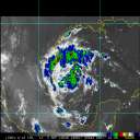
Current Radar or Satellite Image

Flhurricane.com - Central Florida Hurricane Center - Tracking Storms since 1995Hurricanes Without the Hype! Since 1995


Clean up and rescue operations in the wake of major hurricanes Milton and Helene continue. No new threatening storms on the immediate horizon.
Days since last H. Landfall - US: Any 15 (Helene) , Major: 15 (Helene) Florida - Any: 15 (Helene) Major: 15 (Helene)
31.3N 45.9W
Wind: 50MPH
Pres: 1002mb
Moving:
Ne at 24 mph
Click for Storm Spotlight
Invest 94LClick for Invest Information from CIMSS
COMMUNICATION
STORM DATA
CONTENT
FOLLOW US


General Discussion >> Other Storm Basins

Pages: 1
danielwAdministrator
Moderator


Reged:
Posts: 3527
Loc: Hattiesburg,MS (31.3N 89.3W)
Tropical Storm Calvin
      #37551 - Mon Jun 27 2005 03:32 AM

TROPICAL STORM CALVIN INTERMEDIATE ADVISORY NUMBER 2A
NWS TPC/NATIONAL HURRICANE CENTER MIAMI FL
11 PM PDT SUN JUN 26 2005

...TROPICAL STORM CALVIN DEVELOPS SOUTH-SOUTHEAST OF ACAPULCO...
...HEAVY RAINFALL AFFECTING THE MEXICAN COAST...

A TROPICAL STORM WATCH REMAINS IN EFFECT FROM LAGUNAS DE CHACAHUA WESTWARD TO LAZARO CARDENAS. A TROPICAL STORM WATCH MEANS THAT TROPICAL STORM CONDITIONS ARE POSSIBLE WITHIN THE WATCH AREA...GENERALLY WITHIN 36 HOURS.

AT 11 PM PDT...0600Z...THE CENTER OF TROPICAL STORM CALVIN WAS ESTIMATED TO BE NEAR LATITUDE 14.3 NORTH...LONGITUDE 98.1 WEST OR ABOUT 145 MILES...235 KM...SOUTH OF PUNTO MALDONADO MEXICO AND ABOUT 205 MILES...325 KM...SOUTH-SOUTHEAST OF ACAPULCO MEXICO.
MAXIMUM SUSTAINED WINDS ARE NEAR 40 MPH... 65 KM/HR...WITH HIGHER GUSTS.
THE ESTIMATED MINIMUM CENTRAL PRESSURE IS 1002 MB...29.59 INCHES.


Post Extras: Print Post   Remind Me!   Notify Moderator  
Tazmanian93
Weather Master


Reged:
Posts: 495
Loc: Tampa
Re: Tropical Storm Calvin [Re: danielw]
      #37553 - Mon Jun 27 2005 06:18 AM

Thanks for being up and alert!!

--------------------
Don't knock the weather; nine-tenths of the people couldn't start a conversation if it didn't change once in a while.

Go Bucs!!!!!!!!!

****************

Ed


Post Extras: Print Post   Remind Me!   Notify Moderator  
Lysis-in-Texas
Unregistered


Re: Tropical Storm Calvin [Re: Tazmanian93]
      #37573 - Mon Jun 27 2005 07:57 PM

Calvin is really looking like crap now. Downgraded to 40mph. He should be moving into colder waters, and is allready experiencing light shear. Will he recover?

Post Extras: Print Post   Remind Me!   Notify Moderator  
Ryan
Storm Tracker


Reged:
Posts: 281
Loc: Long Island, NY / Stuart, FL
Re: Tropical Storm Calvin [Re: Lysis-in-Texas]
      #37577 - Mon Jun 27 2005 09:40 PM

my input, no he will not, moving into cold waters in the next few days, he will discipate. Peace out Calvin

--------------------
2006 Atlantic Season Summary:
Bad, But Not AS Bad.

Life's a Storm, Watch Your Back


Post Extras: Print Post   Remind Me!   Notify Moderator  
B.C.Francis
Storm Tracker


Reged:
Posts: 331
Loc: Indiatlantic Florida
Typhoon Haitang [Re: Ryan]
      #43559 - Sun Jul 17 2005 08:45 AM

One of two monsters raging at this moment. Winds sustained at 125kts and gusts to 150 kts. Looks like Taiwan will be facing the same scenerio that the Yucatan will see in the next 36 to 48 hours......One interesting point, they had a maximum wave height of 48 + feet near the storm in the last 24 hours....Weatherchef

Post Extras: Print Post   Remind Me!   Notify Moderator  
Pages: 1


Extra information
0 registered and 7 anonymous users are browsing this forum.

Moderator:  

Print Topic

Forum Permissions
      You cannot start new topics
      You cannot reply to topics
      HTML is disabled
      UBBCode is enabled

Rating:
Topic views: 6189

Rate this topic

Jump to

Note: This is NOT an official page. It is run by weather hobbyists and should not be used as a replacement for official sources. 
CFHC's main servers are currently located at
Hostdime.com in Orlando, FL.
Image Server Network thanks to Mike Potts and Amazon Web Services. If you have static file hosting space that allows dns aliasing contact us to help out! Some Maps Provided by:
Great thanks to all who donated and everyone who uses the site as well. Site designed for 800x600+ resolution
When in doubt, take the word of the National Hurricane Center