Kevin
Weather Master

Reged:
Posts: 524
Loc: EC Florida
|
|
Quote:
Looking at the latest sat. run, seems like it is slowing down and trying to spin around itself and tighten up, then again my eyes are untrained.
I"ve noticed that as well, seems like 92 is trying to "trim some fat". Could also be that we're in the nighttime hours, and this wave has shown a history of decreasing convection past sunset.
|
Kevin
Weather Master

Reged:
Posts: 524
Loc: EC Florida
|
|
Quote:
kevin-would you happen to know a link for the global models?
thanks, Ryan
Yes, however, I can't currently get the link to work. It comes off of 's website. When the link is working again, I'll pass it on to you.
|
Big Red Machine
Storm Tracker
Reged:
Posts: 223
Loc: Polk City, FL
|
|
Quote:
kevin-would you happen to know a link for the global models?
thanks, Ryan
http://moe.met.fsu.edu/tcgengifs/ 
|
Hurricane Fredrick 1979
Weather Guru

Reged:
Posts: 116
Loc: Mobile,Alabama
|
|
Quote:
Quote:
kevin-would you happen to know a link for the global models?
thanks, Ryan
Yes, however, I can't currently get the link to work. It comes off of 's website. When the link is working again, I'll pass it on to you.
It's working for me.
http://moe.met.fsu.edu/tcgengifs
|
52255225
Weather Guru

Reged:
Posts: 166
Loc: Parrish Fl
|
|
yeah im not so sure about the animal thing. seems theres shark attacks every year. im not sure about the frog and squirrel thing either. I live in a very secluded area not in a neighborhood basically in the woods and ive got tons of squirrels green tree frogs and mostly the dreaded cuban tree frog and they dont seem to have a clue when the weather gets weird. the snails only come out after a really heavy rain they probably sense that they might drown otherwise.
|
orlandocanewatcher
Verified CFHC User
Reged:
Posts: 16
Loc: E Central Florida
|
|
Hi all...just reading all the comments. Am very new to this art of hurricane predictions, but after last year..... hope not to repeat all of that this year.
|
k___g
Weather Guru

Reged:
Posts: 112
Loc: Leesburg, FL
|
|
This post was sent to the Hurricane Graveyard
|
orlandocanewatcher
Verified CFHC User
Reged:
Posts: 16
Loc: E Central Florida
|
|
did everyone go to bed????
|
oil trader
Weather Watcher
Reged:
Posts: 27
|
|
Quote:
i'd say thats a safe bet for 92L but saying 93L is surely heading into the GOM is a little far fetched, just my opinion
EDIT: to answer your last question, i think that 92L is a threat to the Bahamas and 93L is or will be a threat to the Lesser Antilles...just give em some time
.Ryan
I’ve said that in a tentative approach since the low latitude of the wave and the latest track pointing even more to the south.
|
Ryan
Storm Tracker

Reged:
Posts: 281
Loc: Long Island, NY / Stuart, FL
|
|
old traider--"I’ve said that in a tentative approach since the low latitude of the wave and the latest track pointing even more to the south. "
you mean 92L or 93L is aiming more southerly
EDIT:im gonna head off to bed i ahve to work tomorrow night
--------------------
2006 Atlantic Season Summary:
Bad, But Not AS Bad.
Life's a Storm, Watch Your Back
Edited by Ryan (Fri Jul 29 2005 12:24 AM)
|
oil trader
Weather Watcher
Reged:
Posts: 27
|
|
Quote:
old traider--"I’ve said that in a tentative approach since the low latitude of the wave and the latest track pointing even more to the south. "
you mean 92L or 93L is aiming more southerly
EDIT:im gonna head off to bed i ahve to work tomorrow night
93L as you can see in the last images from "Flhurricane Animated Storm Model Plots for (2005)"
|
Clark
Meteorologist
Reged:
Posts: 1710
Loc:
|
|
To answer a few questions...
* Waves behind 92L: the SSTs out there are just marginal, while shear has picked up a little. There is some hint of a little dry air in the region; add all three minor factors together and you get a suppression of the activity...for now. They'll pick up much like 92L did once they get to about 50W, assuming they hold together until then.
* Future paths of 92L and 93L: 92L looks to be one to moreso potentially affect the SE US coast, yes, while 93L looks like it'd head on a more southerly course through the Caribbean. We don't know if either will actually impact land, however. But yes, the threat may be there in a few days down the line.
* 92L organization: it's trying, but the surface reflection and the convection don't quite match up yet. Probably a day or two away from developing...we'll see if the recon flight gets canceled or not. My guess is they'll use the QuikSCAT data from the morning overpass to make that determination (along with satellite imagery, of course).
* model plots are working once again, for those interested or having troubles earlier. A backup of some of the model output can be found at http://met.psu.edu/tropical/tcgengifs/, in case the site is ever down.
--------------------
Current Tropical Model Output Plots
(or view them on the main page for any active Atlantic storms!)
|
Big Red Machine
Storm Tracker
Reged:
Posts: 223
Loc: Polk City, FL
|
|
Correct me if I'm wrong, but it appears that 00Z build the ridge back fairly strongly. Does this suggest that if 92L develops it would head into SE FL or even perhaps, the gulf?
http://www.nco.ncep.noaa.gov/pmb/nwprod/analysis/carib/gfs/00/fp1_168.shtml
|
k___g
Weather Guru

Reged:
Posts: 112
Loc: Leesburg, FL
|
|
by whom??? and for what reason???
|
tpratch
Moderator

Reged:
Posts: 341
Loc: Maryland
|
|
My guess would be for inflamatory or off-topic posts.
This year there seems to be a lot more negativity than I recall seeing for and Jeanne. The tolerance level has gone down, and if/when things pick up, expect even more moderation goodness to occur.
Address the poster? Bad form. Address the content? Usually okay, so long as it's on-topic.
You've been here a while, I thought you'd know this 
|
ShanaTX
Storm Tracker
Reged:
Posts: 226
Loc: Texas
|
|
Quote:
This year there seems to be a lot more negativity than I recall seeing for and Jeanne. The tolerance level has gone down, and if/when things pick up, expect even more moderation goodness to occur.
Weather forums all over the net have been more tense than usual for oh... almost a week now. Maybe because we're heading into the most productive part of the season? Maybe, but I think it's everyone waiting for the other shoe to drop re 92L and 93L. I know *I'm* more than ready for them to get on with what ever is gonna happen - the suspense is higher than it ought to be. And Franklin is out there ... and may live till Christmas, but we've talked him to death
So... the "cold" front that came through... has anybody figured out if it's really going to contribute to a homegrown GOM storm? And how long before we know it won't?
'shana
|
scottsvb
Weather Master
Reged:
Posts: 1184
Loc: fl
|
|
Its very hard to pinpoint the exact center of circulation due to the high clouds but there are t-storms near the center now (although weak). My guess its near 17N and 61W near the furthest west blowup of convection and on the south side. It maybe also near 59W...hard to tell. Anyway if the center is there, I would expect the plane to find this a TD by later tomorrow afternoon( Friday) near 64W just east of Puerto Rico, infact many might see the circulation on radar by noon. Of course that is saying its fully closed. Not sure if there is any sw winds yet.....there is S, Se, ENE but Sw we need recon or ship report or island report from down there.
Models Ukmet and have to correct run on the OZ but still not sure how strong the ridge builds over the Se US by Sunday into Tuesday.
Correction ,,,center or vortex found near 16N and 59.5W as of 0600z. Its weak and shallow but there. Currently windshear is preventing this from becoming better organized but its doing it slowly.
Edited by scottsvb (Fri Jul 29 2005 01:50 AM)
|
Juanky
Registered User
Reged:
Posts: 3
|
|
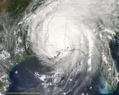
On the sat. image, it looks like this thing has been torn apart a bit.  Not to mention looks rather stuck in the mud. Not to mention looks rather stuck in the mud.
|
HanKFranK
User

Reged:
Posts: 1841
Loc: Graniteville, SC
|
|
sfc obs out of guadeloupe show weak sw winds... suggests there is a poorly defined closed low pushing into the leeward islands right now. there is more convection near the western, active part of this system now that the large flareup northeast of the actual center has waned some. scott has the state of this thing pretty much on the mark. should continue to take shear, but some ridging is trying to build in near the system... modeling suggests that shear conditions should abate over the weekend. next question is.. does this thing start running over the larger islands or pass north of them. my guess would be north... most models show that.. but the initializations are questionable. do think this will make depression status friday if the convection becomes more concentrated near the center.
other features:
franklin heading out, not showing much inclination to deepen. franklin was only pesky, affecting the bahamas.
93L is still on a low trajectory. a trade wind surge and coincident saharan layer air is digging into this thing from behind.. not conducive for development. should keep it on a low glide towards the caribbean... development chances increase as it gets closer... if this low-amplitude feature can maintain its identity.
wave behind 93L is slightly lower in latitude and roughly in the same state. not going to develop soon.
complex deep layer system in the northeast atlantic is digging in. not much at the surface right now except for troughiness, but globals still showing nontropical low pressure out there. activity here is unlikely.
close-in development chances near the bahamas and gulf still yet to take any shape. the weak trough passing through the bahamas is getting close to the upper weakness forecast to propagate nw and n towards the carolinas/mid atlantic. almost no convection in the area but some may spring up shortly. most globals still indicating a low developing near the carolinas... looking somewhat baroclinic, but still noteworthy since it may have a tropical character.
late weekend/next week a variety of models are showing weak low pressure in near the louisiana coast as the dying front offshore and mid level weakness begin to tail away to the west. like the feature near the bahamas.. not showing anything yet.
looks like a new system will take franklin's place. as noted by several, the feature near the islands may present a threat to the southeast mid-late next week.
HF 0802z29july
|
scottsvb
Weather Master
Reged:
Posts: 1184
Loc: fl
|
|
good job Hank...always good to read your good obs.... whatcha doing up soo late?
|


 Threaded


