NONAME
Weather Guru

Reged:
Posts: 136
|
|
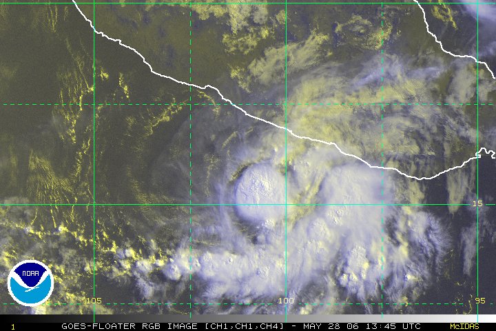
On visible satilite doesnt even look like there is a circulation center if 10 opens to a wave what are the chances it could reform into a depression?
|
Margie
Senior Storm Chaser

Reged:
Posts: 1191
Loc: Twin Cities
|
|
Regarding JB: yes I totally agree and in a normal world if someone were to wishcast so many storms one after the other into these potential disaster scenarios, you'd think it would hurt them. Because it doesn't, one can only assume that accuracy in reporting over time is not important to the general public, at least not as important as sensationalism. People seem to watch the news each day with no memory or concern about what was said yesterday.
OK I have a question about Irene. I realize that day-to-day intensity variations are one of the things that are hard to predict. I've been watching Irene the last couple days and every time she gets some good convection going everything looks improved for awhile and then it falls apart. Is the dry air contributing in a big way? Because I am not seeing the same effects as I saw before on mature hurricanes, where you could see the dry air making inroads between bands. In this case the blob of convection over the LLC seems round and complete, but then it never seems to turn into the cloud pattern you'd expect.
--------------------
Katrina's Surge: http://www.wunderground.com/hurricane/Katrinas_surge_contents.asp
|
Lee-Delray
Weather Master

Reged:
Posts: 429
|
|
Speaking as a "layman". I have problems with JB. When he was on the O'Reilly Factor last month he was too excited that storms would hit the US. I realize his position, but we have to remember that we're talking billionsof dollars of damage, injury and death. I'm not wishcasting storms away from the US either; let's face it someone somewhere on the east coast or the GOM is going to get hit this year.
When O'Reilly said I hope you're wrong at the end (thinking like I do); he said with too much glee, "I hope not".
Just a minor vent.
|
GuppieGrouper
Weather Master
Reged:
Posts: 596
Loc: Polk County, Florida
|
|
Not Necessarily. I know this topic is wandering away from subject, but I think we must be aware of who is reading this site and keep it honest and reliable. Just because a large number of storms are forecast to form does not mean that they will hold together, go to any one place, or be a category storm when it gets there.
The hoopla has been driven by an anomaly of 3 storms hitting and crossing south and central Florida all in the same year and it is also driven by the unusally hot weather, early storm formation and we could go on. However, we know that many many news outlets nowdays are relying on the most twisted, outlandish, and highly exaggerated news that they can get while sitting behind a computer sorting for rumors. Intelligent people know this and the rest of society does not care. Please remember that JB is a business man first and maybe very talented in reading weather patterns, but he is not psychic.( I don't think)
Take care to only rely on the for good forecasting done by hardworking people who get a government controlled salary that does not go up or down based on popularity but on the taxes contributed by hardworking people. IF there is any problems with the integrity of the reporting it is always an error towards caution rather than media popularity.
--------------------
God commands. Laymen guess. Scientists record.
Edited by GuppieGrouper (Sun Aug 14 2005 11:31 AM)
|
Lee-Delray
Weather Master

Reged:
Posts: 429
|
|
Thanks for the reply.
I agree with you, the only reliable source is the . I don't fall into the hype, but don't enjoy watching it be fed by the media.
I really like reading this site though, it has helped me understand the science.
|
lonny307
Unregistered
|
|
Would the favorable enviroment of June/July last all season. I sure doubt it. Will the unfavorable enviroment of late July,early August last all season. I surely doubt it. We were treated with a rare glimpse into the future that this season beholds. We broke all kinds of early records and I think more to come. It's almost like a switch. Somebody turned it off and soon to be turned back on. Get ready for sleepless again. 
|
Clark
Meteorologist
Reged:
Posts: 1710
Loc:
|
|
Well, TD 10 was downgraded at 11a, though I'm not sure why the call was made to discontinue this one versus not discontinuing Irene. Maybe they don't think it'll regenerate, maybe the slight differences in wind speeds lead to cancelling this one entirely, I'm not sure, but given a LLC, I'm left wondering (just a little) why this one was canceled and not Irene way-back-when. Oh well. It's still one to watch, as once the shear lets up (if it does) it has the pieces to become organized, but it may not do so until later in the period.
--------------------
Current Tropical Model Output Plots
(or view them on the main page for any active Atlantic storms!)
|
Steve H1
Storm Tracker
Reged:
Posts: 310
Loc: Palm Bay FL USA
|
|
Former TD 10 is coming back to life (not sure why they didn't wait another advisory to downgrade also) and is moving toward the WNW/NW. I suspect it will be back up to TD status by sometime tomorrow. The low-level circulation is getting some convection on the NW side and the circulation is bacoming more apparent on visible satellite. Condition should improve over the next few days, once it gets by the trough completely.
|
Kevin
Weather Master

Reged:
Posts: 524
Loc: EC Florida
|
|
I noticed that-there is some cloudiness where the detached/remnant LLC is. I think that the system moves wnw or nw in a generally disorganized state for the next few days. We could possibly see redevelopment by Tuesday, but I still wouldn't bet on it.
EDIT: Actually, if that is really is the LLC moving away from the larger area of convection, I'm wondering if it would be possible to see a depression reform with the LLC. It does seem to be gaining thunderstorm activity while moving wnw.
|
Steve
Senior Storm Chaser

Reged:
Posts: 1063
Loc: Metairie, LA
|
|
>>This season and even last seson, JB has been off, waaay off on his hurricane forecasts.
I don't see how you can say that. He doesn't give "forecasts" on storms unless you read the columns (which I don't). He gives scenarios. But his forte is not in forecasting landfalls. He's better at seasonal analysis and pattern recognition. How anyone could come to the conclusion that he was waaay off in 2004 based on his Landfall Intensity Forecast is beyond me. His 2005 LIF forecast remains to be seen and verified. He's not bee great with some storm specific ideas, but he's also been better than the on some (Cindy for instance and Franklin hanging out to dry for a while). He was off on , but only by about 150 miles from 6 days out. I think you're mischaracterizing his intentions and what he does.
>>To the point that I don't consider him a credible source of information anymore. Basicly it comes down to the fact that he seems to see EVERY storm that is moving West coming to Florida or New Orleans and it just isn't happening.
Sometimes it does, sometimes it doesn't. I fell into the same trap with the in 2002 and 2004. They weren't worth squat in 2002 (I know, I got rain from 7 different storms so I paid attention). Last year they over-relied on the model and turned every wave to long tracked hurricane up at 45, 50, 55, 60, 65, 70, etc. etc. etc.
>> appreciate and get much more accurate information from Clark and Ed and others on this site.
I enjoy those guys too, but they're not infailable as they'd both tell you. Hell, I've outguessed both of them a couple of times and I'm not even a doormat to the league they're in. /blind squirrel analogy 
>>I guess it never hurts to read what JB has to say but in my opinion, he is wrong much more than he is right
This stuff gets bantered around the web, but how about some specifics rather than generalities. He's been wrong "how" more than he's right "how."
If you're going to use Joe Bastardi, you don't read a second-hand account of some Bastardi hater on an internet message board to form a conclusion. You have to learn how to use him. He offers clues as to what's going on in the bigger picture that can be interpreted down by the individual who wants to incorporate them into what they're seeing. He also is great for headsup on stuff most of us don't have time to research. He mentioned early this week that the NAO was about to swing strongly positive. I verified that by going to the NAO chart to see for myself. Sure enough, the 7-day lead has been outstanding this season and is calling for a strong positive anomaly in the North Atlantic. So if this verifies as Irene pulls out, the lower pressures will be in the SW Atlantic, Gulf and Caribbean. That's the kind of stuff you want to get from Joe B, not a landfall idea.
JMO
Steve
--------------------
MF'n Super Bowl Champions
|
Old Sailor
Storm Tracker

Reged:
Posts: 293
Loc: Florida
|
|
Finally I think Irene will be our 3rd Hurricane this season Scatt 4.0/4.0 should be update at 5:00 to Hurricane moving NNE. Last pass on use to be TD10 now slows to weak ,still a wait and see what happens..
Dave
|
Margie
Senior Storm Chaser

Reged:
Posts: 1191
Loc: Twin Cities
|
|
My earlier question was not answered:
"I have a question about Irene. I realize that day-to-day intensity variations are one of the things that are hard to predict. I've been watching Irene the last couple days and every time she gets some good convection going everything looks improved for awhile and then it falls apart. Is the dry air contributing in a big way? Because I am not seeing the same effects as I saw before on mature hurricanes, where you could see the dry air making inroads between bands. In this case the blob of convection over the LLC seems round and complete, but then it never seems to turn into the cloud pattern you'd expect. "
The last couple sat frames, am I seeing an eye now with Irene? Appears so on both visual and water vapor.
--------------------
Katrina's Surge: http://www.wunderground.com/hurricane/Katrinas_surge_contents.asp
|
MikeG
Unregistered
|
|
yeah looks like a very tight hurricane...just at or near 75mph. Would expect a hurricane at 5pm adv..... does Irene have an eye? looks like it....TD 10 low level is moving to the wnw....see how long it survives, hey Irene was in worse condition about a week ago and made it...
here she is
|
Old Sailor
Storm Tracker

Reged:
Posts: 293
Loc: Florida
|
|
There no eye wall there, looks to be dry air and lack of convection being drawn into Irene's center,
It seem that Irene has lost some convection, the Scatt reading was taken over hour 1 1/2 ago. Irene was a Hurricane but it may have been very short lived about 2 hours.. See if says the same about Irene at 5:00 PM
Dave
|
MikeG
Unregistered
|
|
i am currently looking at some data and it looks like there is a ship to the NE of Irene heading south....if it kept its course it would pass just east of Irene late monday.....interesting, because they should be hitting ground swell now 
northeast of storm
|
Margie
Senior Storm Chaser

Reged:
Posts: 1191
Loc: Twin Cities
|
|
Quote:
There no eye wall there, looks to be dry air and lack of convection being drawn into Irene's center,
It seem that Irene has lost some convection, the Scatt reading was taken over hour 1 1/2 ago. Irene was a Hurricane but it may have been very short lived about 2 hours.. See if says the same about Irene at 5:00 PM
Dave
That's so interesting, now how can you tell the difference? is it by looking at the sat images or other info? Continues to look like an eye to me. Still learning...
--------------------
Katrina's Surge: http://www.wunderground.com/hurricane/Katrinas_surge_contents.asp
|
MikeG
Unregistered
|
|
latest on Irene keeps her right below hurricane
TROPICAL STORM IRENE FORECAST/ADVISORY NUMBER 41
NWS TPC/NATIONAL HURRICANE CENTER MIAMI FL AL092005
2100Z SUN AUG 14 2005
TROPICAL STORM CENTER LOCATED NEAR 34.5N 69.8W AT 14/2100Z
POSITION ACCURATE WITHIN 20 NM
PRESENT MOVEMENT TOWARD THE NORTH-NORTHEAST OR 20 DEGREES AT 10 KT
ESTIMATED MINIMUM CENTRAL PRESSURE 992 MB
MAX SUSTAINED WINDS 60 KT WITH GUSTS TO 75 KT.
TROPICAL STORM Irene ADVISORY NUMBER 41
NWS TPC/NATIONAL HURRICANE CENTER MIAMI FL
5 PM AST SUN AUG 14 2005
... <b>IRENE NEARLY A HURRICANE</b> .....
Irene 5pm Disc.
....WITH A FAINT EYE FEATURE AND GOOD SYMMETRY TO THE .
Edited by RedingtonBeachGuy (Sun Aug 14 2005 05:17 PM)
|
damejune2
Storm Tracker

Reged:
Posts: 237
Loc: Torrington, CT
|
|
Steve - I guess i never looked at JB's forecast like you put it...i always paid more attention to his landfall predictions. I like his analysis on the tropics, patterns, etc...that part was ok with me it was his landfall points that got me. You did put it into perspective......i guess i should get the info i need about the atmosphere conditions and then turn it off when he starts talking about landfall. Thanks for your insight!!!
--------------------
Gloria 1985 (Eye passed over my house in...get this...northwestern CT!)
|
Hurricane Fredrick 1979
Weather Guru

Reged:
Posts: 116
Loc: Mobile,Alabama
|
|
Looks like Hurricane Irene to me unless this is a earlier report.
URNT12 KNHC 142136
VORTEX DATA MESSAGE
A. 14/21:18:40Z
B. 34 DEG 29 MIN N
069 DEG 49 MIN W
C. 850 MB 1356 M
D. NA KT
E. DEG NM
F. 192 DEG 079 KT
G. 110 DEG 019 NM
H. EXTRAP 991 MB
I. 14 C/ 1824 M
J. 20 C/ 1831 M
K. 16 C/ NA
L. OPEN W-NW
M. C20
N. 12345/ 8
O. 0.02 / 1 NM
P. AF306 WX09A IRENE02 OB 12
MAX FL WIND 79 KT E QUAD 20:55:40 Z
SLP EXTRAP FROM 850 MB
|
Margie
Senior Storm Chaser

Reged:
Posts: 1191
Loc: Twin Cities
|
|
So - it is an eye. Also I see the eye is wobbling, which is something I have seen before on the sat images when hurricanes are in a strengthening phase. And the clouds around the center are starting to have that symmetric tire shape. So it is correct to assume it is still strengthening for now, althought from previous discussions I know there is only a limited time it will have a favorable environment to strengthen.
--------------------
Katrina's Surge: http://www.wunderground.com/hurricane/Katrinas_surge_contents.asp
|


 Threaded


