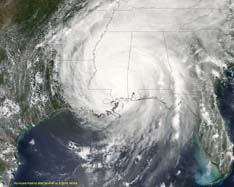
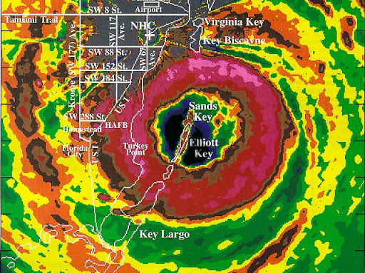
Hurricane Fredrick 1979
Weather Guru

Reged:
Posts: 116
Loc: Mobile,Alabama
|
|
I wonder if this is X-TD10 or another Inves they are sending the plane into on Thursday?
NOUS42 KNHC 161400 COR
WEATHER RECONNAISSANCE FLIGHTS
CARCAH, TPC/NATIONAL HURRICANE CENTER, MIAMI, FL.
1000 AM EDT TUE 16 AUGUST 2005
SUBJECT: TROPICAL CYCLONE PLAN OF THE DAY (TCPOD)
VALID 17/1100Z TO 18/1100Z AUG 2005
TCPOD NUMBER.....05-080 CORRECTION
I. ATLANTIC REQUIREMENTS
1 NEGATIVE RECONNAISSANCE REQUIREMENTS.
2. OUTLOOK FOR SUCCEEDING DAY: PSBL LOW LEVEL INVEST
AT 18/1800Z NEAR 20N AND 60W. -- ADDED
II. PACIFIC REQUIREMENTS
1. NEGATIVE RECONNAISSANCE REQUIREMENTS.
2. OUTLOOK FOR SUCCEEDING DAY.....NEGATIVE.
WVW
Recon
|
HanKFranK
User

Reged:
Posts: 1841
Loc: Graniteville, SC
|
|
as an initial note, irene's appearance dramatically improved earlier today before the sheared look returned. the 5.0 rating, symmetry, and eye definition suggest that it probably peaked at about 90kt around 17z-18z (1-2pm). official track has it remaining tropical until tomorrow night.. sounds about right.
10L is the next item of interest. though it's been declassified since around mid-sunday, the organization of the system hasn't ever really deteriorated. it's been sheared, but as far as it having a defined cyclonic circulation.. well, it's still probably supporting 25-30kt winds in convection. there have been bursts of convection today as the circulation works wnw between 5-10kt (the center appeared to jump west around late morning)... outlooks suggest they see it getting slowly better organized, potentially being reclassified tomorrow or thursday. there's a tentative recon for thursday, also. done the math enough to think it's going to get reclassified and keep tracking wnw during the week. long range tracks of the vorticity/pressure weakness vary into two schools from the models. eta/gfs take it nw past 60w towards bermuda or just to the west where irene went.. euro/nogaps have more favored it moving wnw to the bahamas around the weekend. a lot is dependent on the shortwave supposed to dig near the east coast around the weekend... as highlighted by some others. highly uncertain when we have a system that will probably develop further but as of right now is extremely weak and not well handled by the models.
some convection flaring south of the wave... other convection along the western edge of the central atlantic trough with a surface reflection... vortmax is tracked west by the models. fairly strong wave near the african coast that may well evaporate like the predecessor (only to re-emerge further west, perhaps). around fri-sat a strong wave that immediately develops is shown in the models.. means we'll probably have a westward moving invest around sunday/monday. lowering pressures near the gulf/west caribbean not paired with a conducive surface environment (low convergence and vorticity, fast flow)... should change as the trough weakens and pressures continue to slowly lower. whatever energy splits away from the may help trigger something. scott has an idea on this area that may hold water. bastardi thinks the vorticity out of the could be the culprit. i'm reserved on it... too fluid at this point.
as far as pattern evolution... has been diving from neutral for the last week.. on average slowly coming up. the amplification is present in the western part of the basin coincident with an unfavorable upper pattern. clark has attributed it to blocking in the higher latitudes.. on the ensembles i'm seeing the strength of the blocks weaken but be in constant transition. should keep the shear profile in the basin evolving but moderately unfavorable in many areas. makes me think it'll be later in the month before the heavy action starts.. but probably a system or two active at times in the meanwhile.
HF 0026z17august
|
Frank P
Veteran Storm Chaser
Reged:
Posts: 1299
|
|
ex TD 10 had quite the flare up this afternoon.... looks like he's winding back down a little right now... this will probably be the pattern for a day or two... I think its got a real good chance of developing and moving more west to west north west over time.... from what I can tell the LLC looks more healthier now than earlier today... which is key for redevelopment... see what happens over night... still fighting the shear monster but has the past two days... must be the year of the stubborn wave as Irene did pretty much the same ...
GOES floater link
http://www.ssd.noaa.gov/PS/TROP/DATA/RT/float-ir2-loop.html
|
NONAME
Weather Guru

Reged:
Posts: 136
|
|
T-Numbeer are getting back up 16/2345-UTC-16.4N-53.9W-T1.5/1.5-10 1.5= 25 KTS =29 MPH
TropicalUpdate.com
Guide to Classification of Satellite Images
--------------------------------------------------------------------------------
(T-Numbers/CI Numbers) Sat Image T-Number Description
CI = 0.5 Curved cloud lines define a cloud system center within
a deep cloud layer.
CI = 1.5 This stage should appear 24 hours later. System begins to
exhibit a curved appearance in satellite images.
CI = 2.5 Minimal tropical storm status is reached when curved band
spirals halfway around the center.
CI = 3.5 Strong tropical storm status...reaches hurricane status at
CI=4.0, once cloud band completely circles the center.
CI = 4.5 Eye usually becomes visible at CI=4.5.
CI = 5.5 Once eye is observed, increased CI numbers are based on
several factors, including temperature contrast between the center
and surrounding cloud tops...smoothness of the central dense
overcast, increase in eye definition, and the embedding of the eye
Here is the sites to my information http://www.tropicalupdate.com/atlantic_tropic_watch_guide_to_d.htm
http://www.ssd.noaa.gov/PS/TROP/CI-chart.html
http://www.ssd.noaa.gov/PS/TROP/positions.html
Edited by NONAME (Tue Aug 16 2005 08:57 PM)
|
Steve
Senior Storm Chaser

Reged:
Posts: 1063
Loc: Metairie, LA
|
|
Another item of interest is the energy from the 2 waves that somewhat came toghther near the Yucatan today. A big blob is coming off the west coast of the Peninsula. and from 12Z both close something off and bring it in near where Emily and Bret landfell. UKMET also closes something off down there right at the end of it's run. Results? Inconclusive. Most of the other globals want to spin some energy just off or on-shore of the NC/VA coastal areas around 72 hours. Whether that's a land feature or not is not conclusive either. Just a headsup for a couple of close-in events we might have to deal with before anything of African origin is back on the proverbial radar screen.. As for ex-10, it looks good to me, but I'd think it will be another 48 hours or longer before anything material happens down that way. If anything cranks, High Pressure is firmly entrenched over the Western Atlantic. Some of the models weaken it toward the 96-120 hour range, so anything coming up well could follow the Harvey/Irene/Franklin scenario.
Wait and see dude.
Steve
--------------------
MF'n Super Bowl Champions
|
CruiserMD
Registered User
Reged:
Posts: 1
|
|
Just stay away from my condo!!............ 
|
NONAME
Weather Guru

Reged:
Posts: 136
|
|
Models look more towards Flordia/southeast coast now if it redevlops!
http://weather.net-waves.com/model.php
Edited by NONAME (Tue Aug 16 2005 09:28 PM)
|
MikeG
Unregistered
|
|
wow......nice sats tonight of wave/low east of islands....look at those storms flare up and nice outflow look....even though the center is somewhat exposed now....it looked real good this afternoon.....was a nice rapid flare up for a weak system...i think its near warm water now, to see such flare ups...but the shear is still there and it will have a few more days of it, before it can get a break.... i bet will wait one more day before upgrade back to TD......i think they like to see the storms continue flaring up....seems right now it comes in short bursts.....it looks like more west movement than north right now (last few hrs)
next system
|
Random Chaos
Weather Analyst

Reged:
Posts: 1024
Loc: Maryland
|
|
Quote:
Models look more towards Flordia/southeast coast now if it redevlops!
http://weather.net-waves.com/model.php
Your linked site seems broken 
Here is a direct link to the storm track it is "trying" to find and failing to build a proper link for: http://www.sfwmd.gov/org/omd/ops/weather/plots/storm_10.gif
|
ross
Unregistered
|
|
The wave associated with former TD 10 has a current intensity rating of 1.0. This equates to maximum winds of 25 knots and indicates an improvement over yesterday's "too weak" rating.
At this point in time, regeneration should not be ruled out. The longer this wave maintains its circulation, the better the odds of regeneration. By tomorrow, the environment could be growing more favorable. Hence, it would not surprise me if this system regained tropical depression status in the not-too-distant future.
Longer-term, it could still pose an eventual threat (moderate risk) to part of the S.E. U.S. (coastline from FL to NC, with FL somewhat favored). For now, a west-northwest track is likely to continue as the wave possibly moves toward regeneration.
|
Robert
Weather Analyst

Reged:
Posts: 366
Loc: Southeast, FL
|
|
Well for anyone who has a knowledge on the detailed history of Andrew TC 10 is trying to follow his foot steps and all the key players are right where they were with Andrew excpet for the el nino all TC10 has got to do is survive the shear.
yeah... all the players except.. intensity, synoptic pattern, SST profile, location, and trajectory. other than that they're exactly alike. -HF
Just as a note for everyone, as it has been a particularly touchy subject since Irene went through days upon days of shear. Hurricane Andrew was a deadly, powerful storm that bears no similarities to any of the systems out there in the basin, whether earlier this season, now, or likely later in the season as well. Not every storm that comes across the basin weak and sheared is another Andrew. There are many other ways to discuss the system, the tropics, and the current weather without trying to fit a system to a preconceived mold. Andrew affected the lives of millions of people, some of whom are on this board. Please respect their feelings and the power of that storm. Future comments will be removed. Thank you. -Clark
Edited by Clark (Wed Aug 17 2005 08:09 PM)
|
MikeG
Unregistered
|
|
well it's there, but give another day
TWOAT
1030pm
AN AREA OF LOW PRESSURE...THE REMNANT OF TROPICAL DEPRESSION TEN...
IS LOCATED ABOUT 475 MILES EAST OF THE LEEWARD ISLANDS. THIS
SYSTEM...CURRENTLY MOVING WESTWARD AT ABOUT 10 MPH...HAS BEEN
MAINTAINING A SMALL AREA OF THUNDERSTORM ACTIVITY THIS EVENING AND
IS BETTER ORGANIZED THAN IT WAS AT THIS TIME YESTERDAY.
UPPER-LEVEL WINDS ARE STILL NOT FAVORABLE FOR SIGNIFICANT
DEVELOPMENT...ALTHOUGH THEY ARE EXPECTED TO BECOME MORE FAVORABLE
OVER THE NEXT COUPLE OF DAYS. THIS SYSTEM IS EXPECTED TO MOVE TO
THE WEST-NORTHWEST OVER THE NEXT DAY OR SO AND HAS THE POTENTIAL TO
RE-DEVELOP INTO A TROPICAL DEPRESSION DURING THIS PERIOD.
|
damejune2
Storm Tracker

Reged:
Posts: 237
Loc: Torrington, CT
|
|
I just checked all the models and none of them currently have TD10 doing anything...most have it gone in a few days and one, i think the UKMET, takes it towards the Northeastern Bahamas......
http://moe.met.fsu.edu/tcgengifs/
--------------------
Gloria 1985 (Eye passed over my house in...get this...northwestern CT!)
|
fatmike
Unregistered
|
|
I'm surprised that the models are picking up on anything at all. Someone said that the tropical models have difficulty with weak systems. Stated that the best model for such a shallow and weak system was the BAMM set.
|
Big Red Machine
Storm Tracker
Reged:
Posts: 223
Loc: Polk City, FL
|
|
Quote:
I just checked all the models and none of them currently have TD10 doing anything...most have it gone in a few days and one, i think the UKMET, takes it towards the Northeastern Bahamas......
Actually Damian, check out this site instead
http://www.sfwmd.gov/org/omd/ops/weather/plots/storm_10.gif
Edited by Big Red Machine (Tue Aug 16 2005 11:15 PM)
|
damejune2
Storm Tracker

Reged:
Posts: 237
Loc: Torrington, CT
|
|
This is true.....however, in one model run, you can clearly see a system form in the western GOM, heading toward TX/MEX. Whats even more weird is not only do they not do well on weak systems - had former TD10 strengthening into a pretty good storm the other day. When i checked a little bit ago, has nothing. Weird, very weird.
--------------------
Gloria 1985 (Eye passed over my house in...get this...northwestern CT!)
|
Big Red Machine
Storm Tracker
Reged:
Posts: 223
Loc: Polk City, FL
|
|
Fat Mike, all three BAMM's are along the same lines of thinking now. This means that at all three levels of steering, the BAMM anticipates a more westerly track. Interesting. Obviously way to early to rely on the models, but perhaps an indication that if X-TD 10 can avoid the trough it may come more westward.
Edited by Big Red Machine (Tue Aug 16 2005 11:14 PM)
|
swede
Unregistered
|
|
The BAMM model does a better job on a TD and weak TS, but right now you don't even have a TD. My guess the models do not have any real lock on the track as of now.................
|
NONAME
Weather Guru

Reged:
Posts: 136
|
|
I think x10 will be 10 tommorow morning if not at 5 at 11 well I'm going to call it a night. See ya all later peace out.
|
HanKFranK
User

Reged:
Posts: 1841
Loc: Graniteville, SC
|
|
the low from what was TD 10 sustained a long burst of deep convection this evening, and now is down to bare bones with a bunch of nearby cloud debris. a couple of the globals move 10L very close to the ne caribbean now. dependent on whether you believe in the coastal storm/trough early next week off the east coast, the threat beyond that may or may not exist. if the and company are right the system will get near 70w and lift straight out. if the others are right it's over in the bahamas in about four days. pick your model.
HF 0615z17august
Edited by HanKFranK (Wed Aug 17 2005 02:18 AM)
|


 Threaded
