Steve@work
Unregistered
|
|
Wingman,
The ULL is not going to develop. Nor is the one down in the Caribbean. What I wouldn't rule out is the wave energy to the South of the ULL draped across the Gulf nor would I rule out the energy in the southern Caribbean just SE of the low splitting SW toward Central America. But the ULL's themselves, in these 2 cases, will not form into anything tropical.
Steve
|
Big Kahuna
Weather Hobbyist

Reged:
Posts: 52
Loc: DeLand, Florida
|
|
Not to change the subject, but why does the Navy have 10L also listed as 90L ?(with a tropical cyclone information alert?) ANYONE?
http://tcweb.fnmoc.navy.mil/tc-bin/tc_home.cgi
|
meto
Weather Guru
Reged:
Posts: 140
|
|
look at swfmd models.
|
The Force 2005
Storm Tracker
Reged:
Posts: 299
Loc: Philadelphia
|
|
Can you provide a link to them?
Just a heads-up: you can get to them and many other model plots from the main page. There's also a link directly to the plots on a previous page in this thread. --Clark
Edited by Clark (Wed Aug 17 2005 12:03 PM)
|
none
Unregistered
|
|
Yes, definitley install them it's not because i am thinking anything will come our way(fl) but after last season we've all learned the unpredictability of these storms, besides theres nothing wrong with protecting your investment. I wouldn't close the shutters just yet though that might send the wrong signal.
|
Wanna-Be-Storm-Chaser
Weather Hobbyist
Reged:
Posts: 90
Loc: Deltona, FL
|
|
I see the navy posting it as 10LNONAME.
--------------------
I survived Jeanne, Charley, and Frances
|
Steve H1
Storm Tracker
Reged:
Posts: 310
Loc: Palm Bay FL USA
|
|
Answer to BigKahuna, you are at the backup site for . but they will pick one and drop the other. Perhaps they foresee dropping it as an invest and going with an upgrade at 5pm.....maybe. As a sidenote to another post, I saw the water temps at 20 nmi and 120 nmi east of New Smryna beach at 89 and 90 degrees, respectively. I don't remember seeing the temps that high at those buoys since I've been in Florida (20 years). Point is, there's gasoline out there to fuel any fire that may come this way. Shear still needs to lessen quite a bit for 10L to start wrapping convection. Needs to get past that troughiness out there. Check back at 5. Cheer!!
|
Big Kahuna
Weather Hobbyist

Reged:
Posts: 52
Loc: DeLand, Florida
|
|
Thanks. Now maybe someone can help me with this one.... On the navy site I click on 10L track http://www.nrlmry.navy.mil/tc_pages/ATL/10L.NONAME/ssmi/gif/full/Latest.html then click on Legend just above the pic http://www.nrlmry.navy.mil/atcf_web/docs/graphic_key/ . What is that graph? I understand some of it but which way is 10L going to go?
|
NONAME
Weather Guru

Reged:
Posts: 136
|
|
Looks like convection is getting pretty persistent and look like it should be a TD at 5. The convection is looking fairly organized two.
|
The Force 2005
Storm Tracker
Reged:
Posts: 299
Loc: Philadelphia
|
|
Looking at the bouy data near EX#10, it doesn't show any significant change with the overall weather pattern, ie; pressure, winds, seastate etc. Also reports coming out of the CARIB locations, do not show any decrease in pressure. Not sure if this going to become a depression again due to the shear enviroment it is in. However, with that being said, and what took place with Irene, we cannot take anything for granted this season. My gut insticnt tells me and I believe we will have it again surely by the 11PM post from the if not sooner.
|
Lisa NC
Weather Guru
Reged:
Posts: 102
Loc: North Carolina
|
|
what you are seeing on the Navy site is old Information. Notice the dates for positions( the first 2 number). The last time it was up dated was Aug 14. you can see by Sat loops it still about where they thought it would be.
--------------------
<img src="/hahn/images/graemlins/wink.gif" alt="" />
|
The Force 2005
Storm Tracker
Reged:
Posts: 299
Loc: Philadelphia
|
|
The graph you are looking at is for the far East sysytem. The graph itself is how the Navy sends out their information to all of it's ships in the path of a tropical cyclone, so they can plot it on the computer systems to track.
|
The Force 2005
Storm Tracker
Reged:
Posts: 299
Loc: Philadelphia
|
|
Quote:
The graph you are looking at is for the far East sysytem. The graph itself is how the Navy sends out their information to all of it's ships in the path of a tropical cyclone, so they can plot it on the computer systems to track. [/quote
Has anyone taken a look at the entity behind former#10. I am impressed with it's outflow already. Classic tell tale sign. Might be a depression already.
Edited by The Force 2005 (Wed Aug 17 2005 12:50 PM)
|
rmbjoe1954
Weather Master
Reged:
Posts: 428
Loc: Port Saint Lucie, Florida, USA
|
|
I've noticed the system out near 30 degrees- but it is so far south; yet, an item of interest for next week?
--------------------
________2024 Forecast: 24/14/7________
There is little chance that meteorologists can solve the mysteries of weather until they gain an understanding of the mutual attraction of rain and weekends. ~Arnot Sheppard
|
Big Kahuna
Weather Hobbyist

Reged:
Posts: 52
Loc: DeLand, Florida
|
|
Thanks again. I now see the forcasted track at 20N- 134E Dah.... I guess the names of the Islands should have gave it away too. Because it was a link from http://www.nrlmry.navy.mil/tc_pages/tc_home.html and 10L, thats what I thought I was looking at. Just didnt read all the info..
|
The Force 2005
Storm Tracker
Reged:
Posts: 299
Loc: Philadelphia
|
|
The attachment shows what could possibly be our next invest will be.
|
Ron Basso
Storm Tracker

Reged:
Posts: 267
Loc: hernando beach, FL
|
|
The latest VIS SAT on old TD10 shows a little better organization with improved convection on the eastern band and some new convection starting on the SW side. Overall, shear seems to be lessening and the ULL to the NW looks to be moving off to the NW and weakening. Shear forecasts are favorable after 24 hrs and the SHIPS model takes the system to a 70 knot hurricane in 120 hours.
Where it goes...the numerical models have shifted south and west during the last couple of days but looking at the big global picture, it seems like a fairly vigorous trough is forecast along the east coast from 4-5 days out which would weaken the Atlantic Ridge and possibly cause a more poleward motion. Some mixed assessments on this from the HPC with the model showing less trough amplification and the showing more. Also, depends on the development of a coastal NC low/trough which weakens the ridge as depicted in some of the global models. If the trough is weaker, then maybe a stairstep north and back west again. All in all, too early to tell.
http://www.wunderground.com/data/640x480/atlm_shear.gif
--------------------
RJB
|
Clark
Meteorologist
Reged:
Posts: 1710
Loc:
|
|
Just as a heads-up for everyone...
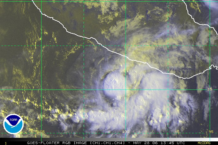
1) The disturbance in the extreme eastern Pacific is the one that model guidance has been harping on to develop for some time now. It is getting organized pretty quickly and has a decent shot at becoming a classified storm later tonight if trends continue.
2) The activity coming off of the Virginia & North Carolina coasts now is the makings of that coastal low that some of the models are picking up on. It remains to be seen what it actually does, if anything, but there's the start.
3) I expect TD 10 to be re-classified at 5pm if the convective pattern at least maintains status quo for the next 3-4 hours. I hate to sound like a broken record, but I don't know why it wasn't reclassified earlier today. It should just miss the islands -- we can thank a weakness in the subtropical ridge partially perpetrated by how far south Irene has stayed -- but turn back a bit more towards the west-northwest from there. What it does beyond 2 days is still up for debate.
4) The wave out in the Atlantic looks fairly impressive, but it's got a pretty stable environment to the north of it's axis & deepest convection. It's also pretty far south and much of the energy is sticking back towards the African coast & Cape Verdes -- as the models called for -- in advance of the big wave they forecast to come off in about 3 days now. it's got a shot, as everything out there does this time of year, but not a big one.
5) The energy in the SW Caribbean looks impressive on IR imagery, but I think the bark is bigger than the bite -- for right now, as it is largely forced by divergent upper-level winds on the west side of the broad west-central Atlantic trough. As the EPac disturbance moves westward, this should pivot around toward the NW (and toward the Yucutan). Some models call for it to do something in the Gulf -- which we've already seen twice this year -- so if the energy can hold together, it might be worth watching.
6) Irene, meet shear. Shear, meet Irene. You two get along now, okay? 
Full update tonight, if I get a chance...otherwise tomorrow.
--------------------
Current Tropical Model Output Plots
(or view them on the main page for any active Atlantic storms!)
|
scottsvb
Weather Master
Reged:
Posts: 1184
Loc: fl
|
|
Well Former TD 10 is looking the same as its been for awhile. I wouldnt upgrade it yet due to the lack of T-Storms near its center, infact only reason its flaring up during the day is due to the upper low to its NW. I still dont expect much to come from this at all. If it does become a TD or TS in a couple days, I expect it to stay east of the bahamas and move N and out to sea near Irenes path.
Area in the SW carribean is in a shear zone. A upper trough and low will enhance T-Storms as the main low pressure develops in the eastern pacific and moves west. As the upper low weakens over central america, expect a low to develop in the next day or 2 and move off Honduras and over the Yucitan. Once in the BOC or Gulf it could strengthn into a TS.
Otherwise, next main area for development will be off of the African coast by this weekend.
scottsvb
|
native
Weather Guru

Reged:
Posts: 148
Loc: SE Florida
|
|
Clark -
Forgive my ignorant question(s);
1. The coastal low off the VA/NC coast...it's the start of what exactly? I am hoping you'll say: One of the components which will have TD10 skirt the Bahamas on the east side and slide up & out into open waters.
2. Where is the current data placing what will most likely be TD10 again, say Saturday AM?
You & RJB are a wealth of information....thanks!
|


 Threaded


