WeatherNLU
Meteorologist

Reged:
Posts: 212
Loc: New Orleans, LA
|
|
I think people are focusing too much on every little whim and wobble. Just lean back from the screen and look at the overall motion of the system, it's STILL towards the WSW, ever so slightly. The motion is probably 265 or 270, and it's easily seen in the fact that the storm is still losing latitude. 5PM was at 24.8 and the 8PM put it at 24.7. I would love to see a northerly component to , but I don't see it yet. The more south and west it moves, the more under the gun we become here in New Orleans. Too many close calls here, I'm just hoping it's not our turn. It's amazing how many people here didn't even know there was a hurricane in the Gulf. It scares me to think that we might have to start an evacuation tomorrow that gives less than 36 hours before conditions begin to deteriate.
--------------------
I survived Hurricane Katrina, but nothing I owned did!
|
Steve
Senior Storm Chaser

Reged:
Posts: 1063
Loc: Metairie, LA
|
|
The old guy is Nash Roberts. He rightfully retired to peace and quiet after the passing of his wife. He was an icon albeit overrated at times.
Anyway, I just wanted to check in and clear a few things up. Don't track centers with long range radar. The apparent move "NNW" that was being debated on S2K and was only on the long range radar and apparently had something to do with the angle of the antenna. It was clear via recon vortex fixes and short range radar that was still moving south of due west. As of the 8pm advisory, she's further south still (yet I haven't checked the reported "dive" that some commented on).
Everything's cool here. I got my wife and kids a hotel in Jackson, MS for Sunday, Monday and Tuesday. Hopefully I'll be able to cancel that tomorrow if my dad is able to hook up with his older sister in Alexandria and head up there as well. I plan on staying (as usual). No telling what 's going to do now that she's continuing to move slowly west of south. I agree with all previous posters that said anyone from Panama City to Brownsville need to still be on alert with a possible concentration of Morgan City, LA to Pensacola. I've got a 12 pack and a big ole bag of ice for the next couple of days. If things continue to look pessimistic (and I hear the early 00Z guidance is even farther west), then I'll probably be heading to the store tomorrow for plenty more. I might grab me some Stoli's or something since is a Ruskie name and it would be apropos, but I don't like it that cheap most of the time.
Anyway, I'm just watching and waiting for the next set of models, views and such while chainsmoking. 
One last thing as I mentioned elsewhere - if Bastardi and Stewart are correct, the Gulf Coast is facing its greatest threat since Camille. Think about that for a minute. JB thinks 910-920 isn't out of the question and that a true catastrophe is possible. Of course we all know Joe gets hyper over severe threats so hopefully he's overplaying it. But combined with Stewart's call for a potential 4 in the 5pm Discussion, well we all need to stop and pause about that.
Steve
--------------------
MF'n Super Bowl Champions
|
MrSpock
Storm Tracker
Reged:
Posts: 296
|
|
Looks like the convection that wrapped around the NW quadrant has persisted and the western eyewall is looking better (worse). The center which had looked ragged, now looks to be more symetrical and tighter. It's hard to tell with only an hour's worth of shots, but it looks to be moving almost due west.
|
bobbutts
Weather Hobbyist

Reged:
Posts: 71
Loc: New Hampshire
|
|
Another site with historical charts
http://weather.unisys.com/hurricane/atlantic/
It does seem rare for a storm to move SW in the gulf.. here are a few others that have.
1941 storm 2
1947 storm 4
1983 Dean
just off the top of my head.... try isidore 2002 and anita 1977. both were quite strong. bess 1978 and brenda 1973 also. larry 2003. it happens, man. by the way, dean was off the mid atlantic. how'd that get on there? anyway, does this make anybody think i've studied historical tracks a bit too much? -HF
Edited by HanKFranK (Sat Aug 27 2005 01:43 AM)
|
Tropics Guy
Storm Tracker

Reged:
Posts: 252
Loc: Miami, Florida
|
|
Well, finally got my power back since losing it around 4:30pm yesterday and was just catching up on all the posts that I missed. There was about 4 hours of strong winds here with a peak gust reported at Port Everglades (about a mile from my house) of 92MPH, which I believe was recorded on the back-side of the cane. A lot of people down here seemed to be caught off guard on the strength of the storm as it went through, especially Miami-Dade county, even though it was still just a Cat 1 storm. There's a lot of tree damage mostly, but I lost a lot of shingles also, and there's a few dangling traffic lights near my house.
The biggest problem down here is the 1 million people still with out power, and the lack of gasoline. The only station near my house that had gas had a line 15-20 cars deep. And all this from a Cat 1 storm, I really feel for the people on the Gulf coast that will feel the brunt of when she hits as a possible Cat 3 or maybe even Cat 4 .
Stay safe everyone!!
TG
--------------------
Tropical Cyclones: "Mother nature's heat transfer machines"
|
Rasvar
Weather Master

Reged:
Posts: 571
Loc: Tallahassee, Fl
|
|
Well, if what i was getting from Accuweather was the 0Z runs on the suite, Katie bar the door! Looks like La is the target zone. If that is the case, better gas up the cars this weekend, becuase the oil speculators are going to freak out on Monday morning oil trading. Kind of scary. Almost reminds me of the docudrama "Oil Storm" that was on one of the cable channels earlier this year.
I just hope she does not turn into a monster. I know the Florida pnahandle does not need another hit. Niether does anyone else.
--------------------
Jim
|
wxman007
Meteorologist
Reged:
Posts: 617
Loc: Tuscaloosa, AL
|
|
Quote:
Hugh, I'm in Tallahassee, so I ain't wishcasting. I'd really like Jason or Clark to give their opinion on this.
My feelings have been blown out of the water today.
I have zero confidence in any model solution at this point...I am currently going old school and doing more diagnostic than model interp right now, trying to get a handle on these model vacillations. This is a TOUGH forecast. I am not ready to commit to anything more narrowed down thatn Apalachicola to Grand Isle at this point. Sorry...but this is a real problem to forecast.
--------------------
Jason Kelley
|
Hugh
Senior Storm Chaser
Reged:
Posts: 1060
Loc: Okaloosa County, Florida
|
|
[quote
One last thing as I mentioned elsewhere - if Bastardi and Stewart are correct, the Gulf Coast is facing its greatest threat since Camille. Think about that for a minute. JB thinks 910-920 isn't out of the question and that a true catastrophe is possible. Of course we all know Joe gets hyper over severe threats so hopefully he's overplaying it. But combined with Stewart's call for a potential 4 in the 5pm Discussion, well we all need to stop and pause about that.
Steve
Absolutely right, Steve. There appears to be no possibility (okay, ANYTHING is possible) that will weaken before landfall as Opal, , and did. Take into account the potential landfall location, and it could really be devastating. With it moving SO slowly... 910 may be very realistic, or even optimistic.
It's going to be a very long weekend for everyone along the Gulf Coast... watching and waiting.. and I have a bad feeling that may decide to change directions multiple times between now and eventual landfall.
--------------------
Hugh
Eloise (1975) - Elena and several other near misses (1985) - Erin & Opal (1995) - Ivan (2004)
|
Psyber
Storm Tracker

Reged:
Posts: 231
Loc: Ontario, Canada
|
|
Well I can't remember a storm that moved west this slowly, this far before...the modelling can't possibly forcast something it hasn't seen before...
|
Hugh
Senior Storm Chaser
Reged:
Posts: 1060
Loc: Okaloosa County, Florida
|
|
Quote:
My feelings have been blown out of the water today.
I have zero confidence in any model solution at this point...I am currently going old school and doing more diagnostic than model interp right now, trying to get a handle on these model vacillations. This is a TOUGH forecast. I am not ready to commit to anything more narrowed down thatn Apalachicola to Grand Isle at this point. Sorry...but this is a real problem to forecast.
Can we take it from that comment that you are ready to commit to narrowing it down to between Apalachicola and Grand Isle? That would be well east of the latest model guidance I believe. I doubt that you meant that, but just checking 
--------------------
Hugh
Eloise (1975) - Elena and several other near misses (1985) - Erin & Opal (1995) - Ivan (2004)
|
Rasvar
Weather Master

Reged:
Posts: 571
Loc: Tallahassee, Fl
|
|
Understandable conumdrum, Jason. Has not been a well behaved storm by the models. Once it starts picking up forward speed, should have a better indication. However, the current situation is a hairpuller for EOC's. I would not be surprised if there has to be a mass evacuation call of a number of areas just to be safe since once starts kicking it in gear, it may be too late tto make the call.
--------------------
Jim
|
wxman007
Meteorologist
Reged:
Posts: 617
Loc: Tuscaloosa, AL
|
|
Quote:
Can we take it from that comment that you are ready to commit to narrowing it down to between Apalachicola and Grand Isle? That would be well east of the latest model guidance I believe. I doubt that you meant that, but just checking 
I meant to say Phoenix instead of Grand Isle...LOL
--------------------
Jason Kelley
|
Terra
Storm Tracker
Reged:
Posts: 286
Loc: Kingwood, Texas
|
|
In my neverending quest for a historical precedent... I began to think Betsy was the perfect analogy, although the southern motion was on the east side of Florida. The storm still ended up in the vicinity of where it is now and well, we all know where it went.... However, Betsy turns out not to be the best match.... damn, is talking about Betsy... my analogy was first.... Anyway, even better...
http://www.wunderground.com/hurricane/at194704.asp
1947, unnamed, almost identical path. Not a good outcome.
--------------------
Terra Dassau Cahill
|
Hugh
Senior Storm Chaser
Reged:
Posts: 1060
Loc: Okaloosa County, Florida
|
|
Quote:
Quote:
Can we take it from that comment that you are ready to commit to narrowing it down to between Apalachicola and Grand Isle? That would be well east of the latest model guidance I believe. I doubt that you meant that, but just checking 
I meant to say Phoenix instead of Grand Isle...LOL
Uh... I'm ready to narrow it down better than that! I can say with 100% certainty that I believe will make landfall somewhere between Cosumel, MX, north and west to Brownville, TX, and north and east to Key West Florida. There, mark it down folks. That's where she's going! If she goes anywhere, I mean... 
(be a little careful here - with a storm like this, comedy doesn't get too appreciated right now)
Edited by Ed Dunham (Sat Aug 27 2005 02:31 AM)
|
Frank P
Veteran Storm Chaser
Reged:
Posts: 1299
|
|
With all the models clustered basically in SE LA attm I don't know how the can't move the forecast track in that general direction at 11pm.... and if there's consistancy with the runs over night (and that's a big IF) I think you will see one hell of an evacuation out of SE LA starting tomorrow morning... of course all this is subject to change and probably will but if it doesn't then NO might just be looking at that really big one
|
ralphfl
Weather Master
Reged:
Posts: 435
|
|
I believe they will move the track more west again with the 11pm update.Many got this storm wrong but the models have done better then those who had it going up the west coast of florida today.At least the models comeback and try again 
|
belleami
Weather Watcher

Reged:
Posts: 31
Loc: St George Island/ Apalachicola
|
|
And I was so happy when the pointed to Apalachicola right off the bat, since we all know the forecasts shift so much!
On St. George Island, we got swept over during ....
The attachment is a photo of my "street"....
--------------------
hang on!
Edited by belleami (Sat Aug 27 2005 01:35 AM)
|
Random Chaos
Weather Analyst

Reged:
Posts: 1024
Loc: Maryland
|
|
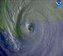
The eye is starting to show up on IR. Go click the radar overlay and you can see the orange area within the red matches up with the eye.
http://www.ssd.noaa.gov/PS/TROP/DATA/RT/float-ir4-loop.html
From that loop you can throw on the track overlay, and it is clear that the system is now south of the projected path.
I'm watching the banding to the north starting to join up with the storm itself. It is starting to take on a very symetric appearence. This isn't good news since it means the system is becoming better defined and potentially more powerful.
--RC
|
Hugh
Senior Storm Chaser
Reged:
Posts: 1060
Loc: Okaloosa County, Florida
|
|
Quote:
1947, unnamed, almost identical path. Not a good outcome.
Sorry, but that path is in no way similar to 's. The 1947 storm moved south to the east of Florida, not to the west. And, it was weaker.
1947 was a high end category 4 when it hit se florida. it was a cat 3 when it hit louisiana. there's a remote similarity, but '47 was trucking... has been crawling. -HF
Edited by HanKFranK (Sat Aug 27 2005 01:51 AM)
|
Frank P
Veteran Storm Chaser
Reged:
Posts: 1299
|
|
and if it goes even farther west the track would sorta be like Andrew, except of course Andrew was so much more powerful when going thru Fl... and perhaps might be more powerful than Andrew while pummeling LA.... (if it goes west of NO)
I wonder where in Lousiana is Phoenix is located???? west of Morgan City .... hehe.... thanks for narrowing it down so tight Jason... funny
|


 Threaded


