Tazmanian93
Weather Master

Reged:
Posts: 495
Loc: Tampa
|
|
Looks like on last model runs, , ,UKMET,NOGAPS all have a version of a loop over TX/LA
--------------------
Don't knock the weather; nine-tenths of the people couldn't start a conversation if it didn't change once in a while.
Go Bucs!!!!!!!!!
****************
Ed
|
Rick on boat in Mobile
Weather Drama Guru

Reged:
Posts: 161
|
|
I think it's impossible to exactly predict where the hurricane will end up. it's a guess...and educated one...but a guess.
Rita has slowed to 9 mph forward speed...indicative of pushing against the high....now that she is as north as she is west...she'll roll off the high eastward.....natural coriolis forces pulling her north are also pushing her west. since she has now hit the nw trajectory....the nnw, n , nne are all next.
imho
|
Tazmanian93
Weather Master

Reged:
Posts: 495
Loc: Tampa
|
|
Your right it is early, but I recall all day yesterday there were some folks that saw those same idiosyncrasies (a slight N move), (Ridge Shift) and look where we are today. Nearly 1/2 of LA is now in the cone. These things change quite a bit as we all know and if someone see's something and wants to voice their fact based or visual based opinion then they should be able to w/o getting quashed by folks. I and many of us, even those that think they are, we're not experts, so if there is going to be an opinion quickly crushed because someone did not say it first, I would rather it come from a MOD or a MET
--------------------
Don't knock the weather; nine-tenths of the people couldn't start a conversation if it didn't change once in a while.
Go Bucs!!!!!!!!!
****************
Ed
Edited by Tazmanian93 (Thu Sep 22 2005 08:35 AM)
|
MadDog
Weather Hobbyist
Reged:
Posts: 51
Loc: DeBary, Florida
|
|
I understand the steering currents vs. hurricanes, that the hurricane will follow the line of least resistance, and I remember being taught that a Cat 5 could "make its own weather", but in a fist match between Cat 5 and a High pressure system, I didn't know who would be stronger.
Edited by MadDog (Thu Sep 22 2005 08:54 AM)
|
SirCane
Storm Tracker

Reged:
Posts: 249
Loc: Pensacola, FL
|
|
Didn't say they will, just that it looks like they could. Look on the loop right now and it's not headed for Galveston at this moment.
--------------------
Direct Hits:
Hurricane Erin (1995) 100 mph
Hurricane Opal (1995) 115 mph
Hurricane Ivan (2004) 130 mph
Hurricane Dennis (2005) 120 mph
http://www.hardcoreweather.com
|
Rick on boat in Mobile
Weather Drama Guru

Reged:
Posts: 161
|
|
I like that idea...that only mets should be allowed to bash us novices....make that a rule. anyone who wants to spend their time proving novices wrong... (which isn't much of a job anyway)....ought to have their posted deleted, and their hand slapped...and banned for 30 minutes....a picture of them posted...and sent to their corner, with NO cookies or milk....
bashing novices, huh? rick, if you're going to spout alarmist doodoo i have to refute it, else this turns into the x-files. -HF
Edited by HanKFranK (Thu Sep 22 2005 09:46 AM)
|
tpratch
Moderator

Reged:
Posts: 341
Loc: Maryland
|
|
I trust you mean 1/2 of S LA is in the cone. The cone doesn't even touch NO...
Which goes back to what I'm attempting to encourage. Let the media hype a second, or direct NO event. Let us take the time to observe and report 
And I'd like to stress that I am not bashing anyone here. If you've taken offesne at my comments, it isn't because they were intended to bash you. Consider me the calming voice of reason for now 
Cheers
Edited by tpratch (Thu Sep 22 2005 08:35 AM)
|
Tazmanian93
Weather Master

Reged:
Posts: 495
Loc: Tampa
|
|
I was wondering this yesterday and still today if there is any way or reason these storms get drawn into that loop current and or follow it as a strength souce
--------------------
Don't knock the weather; nine-tenths of the people couldn't start a conversation if it didn't change once in a while.
Go Bucs!!!!!!!!!
****************
Ed
|
SMOKE
Weather Watcher

Reged:
Posts: 33
Loc: USA, Ga.
|
|
Quote:
Let us take the time to observe and report 
Sounds like the meterologist/observer job description. 
--------------------
|
Ron Basso
Storm Tracker

Reged:
Posts: 267
Loc: hernando beach, FL
|
|
Quote:
I think it's impossible to exactly predict where the hurricane will end up. it's a guess...and educated one...but a guess.
Rita has slowed to 9 mph forward speed...indicative of pushing against the high....now that she is as north as she is west...she'll roll off the high eastward.....natural coriolis forces pulling her north are also pushing her west. since she has now hit the nw trajectory....the nnw, n , nne are all next.
imho
If you take a look at the upper air pattern over the last several days you'll see that the hugh High over TX has weakened considerably and the center actually shifted NW into North-Central TX. Now, there is a weakness over the FL panhandle between the weakened TX high and a building high just east of FL. This eastern high looks to be getting stronger and building to the S & SW of the storm. It looks like is entering a Col region (area of weak steering flow) between the two centers of high pressure. There may be even more slowing of forward speed then we've already seen over the last 24 hours. The high over TX is forecast to move eastward and allow to slide around the west side. But so far, that hasn't happened yet.
http://cimss.ssec.wisc.edu/tropic/real-time/atlantic/movies/wg8dlm6/wg8dlm6java.html
--------------------
RJB
|
TAZMAN
Weather Watcher

Reged:
Posts: 48
Loc: Clermont, Fl
|
|
Quote:
I natural coriolis forces pulling her north are also pushing her west. ..........
imho
Rick... I posted this earlier this morning "
What is it that make all storms eventually turn north ?? I understand what is keeping her to the west but uninhibited, it would be going north correct ? Is it a weather thing or an earth thing? "
Is what you stated, my answer?
|
Tazmanian93
Weather Master

Reged:
Posts: 495
Loc: Tampa
|
|
I think I recall some time ago Clark or someone mentioning this as polar related, earths axis?
--------------------
Don't knock the weather; nine-tenths of the people couldn't start a conversation if it didn't change once in a while.
Go Bucs!!!!!!!!!
****************
Ed
|
MadDog
Weather Hobbyist
Reged:
Posts: 51
Loc: DeBary, Florida
|
|
Please look at the attached and tell me if this is the weakness in the high that we are talking about.
http://www.esl.lsu.edu/webpics/goes/Storm/AOI0/latest_wv_loop.gif
|
Rick on boat in Mobile
Weather Drama Guru

Reged:
Posts: 161
|
|
the higher the latitude...the less likely a hurricane will go west. curvature of the earth. the farther north they go...the more likely they will continue to do so...barring forces that are stronger. Now, if the high pressures are competing and interfering with the steering currents...or if there are none...she will follow the more northerly trend....
explained as only a true novice can....
|
The Force 2005
Storm Tracker
Reged:
Posts: 299
Loc: Philadelphia
|
|
That sometimes plays a role. Lets look at Noreaster's for a moment, they hug the eastern seaboard all the way up along the coast. And they are sometimes just as strong as a hurricane if not stronger, the low pressure never turns as it goes north.
|
The Force 2005
Storm Tracker
Reged:
Posts: 299
Loc: Philadelphia
|
|
My take on all this NW movement is this:
If by chance is making her move to the North, the forecastors have the uneven task to report even more bad news for all the areas affected by . It seems to me that all the models now are trending more to the North and East, as the hours go by, and the contention between the high and , I believe that will win out just on her power alone, and she will go where she absolutly wants to go. This can and will be problematic for the forecasters cause I think they don't want this to turn, of course no one else wants it to. But again, we see mother nature in it's full fury, it's all a guessing game.
|
pryord1
Weather Watcher
Reged:
Posts: 49
Loc: Navarre, FL
|
|
Quote:
My take on all this NW movement is this:
If by chance is making her move to the North, the forecastors have the uneven task to report even more bad news for all the areas affected by . It seems to me that all the models now are trending more to the North and East, as the hours go by, and the contention between the high and , I believe that will win out just on her power alone, and she will go where she absolutly wants to go. This can and will be problematic for the forecasters cause I think they don't want this to turn, of course no one else wants it to. But again, we see mother nature in it's full fury, it's all a guessing game.
I'm not looking to borrow trouble here, but, if it does eventually move N-NNE, does it have enough room to turn even further to the east than LA? I live the the NW FL Panhandle and I thought we would catch a break on this storm. I'm beginning to become concerned again. I hope I shouldn't be!
--------------------
The key to a good life is higher thought. Challenge yourself, push your personal limits and go for the brass ring!
|
NewWatcher
Storm Tracker

Reged:
Posts: 388
Loc: Port Orange, FL
|
|
me either pry as i am leaving daytona beach tomorrow at noon to drive
to YOUR city for the weekend 
i would say no as of now... i cant see it moving THAT far east
--------------------
Pam in Volusia County
According to Colleen A ... "I AM A HURRICANE FREAK"
2007 Predictions 16/9/6
|
Rick on boat in Mobile
Weather Drama Guru

Reged:
Posts: 161
|
|
I doubt seriously she will head due west...to catch up on the forecasted plot of Galveston/Houston. and in a sense..the petrochemical complexes there will be spared. However, not all. at the current path...up through Baton Rouge would be equally disruptive.
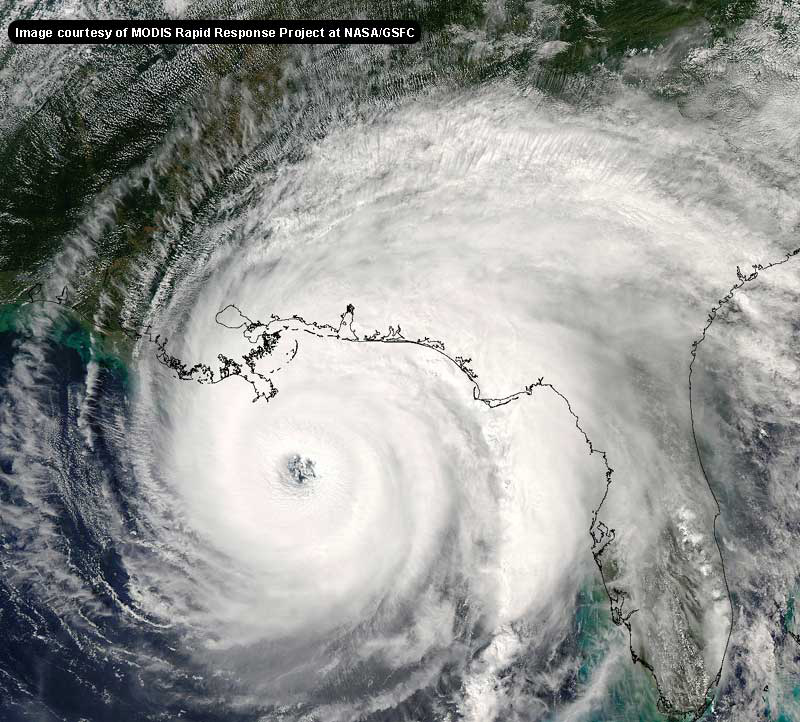
I will be interesting to see if she is gonna continue to weaken. Looks to me like she is starting to regain the convection on the last satellites....
Edited by John C (Thu Sep 22 2005 12:08 PM)
|
tpratch
Moderator

Reged:
Posts: 341
Loc: Maryland
|
|
Positive news if she changes course drastically... she'd slough off the Cat 5 storm surge - at least, that which she garnered while she was sub 900mb.
That being said, she hasn't turned due N yet - which would almost be required before any NE turn.
There's a strong chance the 11AM will take the path more toward the east, but it's still too early to know for certain.
|


 Threaded


