superfly
Weather Watcher
Reged:
Posts: 33
Loc: New Orleans
|
|
0431. 1656N 08155W 01540 5580 115 154 174 174 162 01006 0000000100
This is a cat 5 folks. 154kts sustained FL with gusts to 162kts.
|
typhoon_tip
Meteorologist
Reged:
Posts: 576
|
|
000
URNT12 KNHC 190446
VORTEX DATA MESSAGE
A. 19/04:32:40Z
B. 16 deg 52 min N
081 deg 56 min W
C. 850 mb 516 m
D. NA kt
E. NA deg nm
F. 116 deg 162 kt
G. 15 deg 003 nm
H. EXTRAP 901 mb
I. 17 C/ 1537 m
J. 26 C/ 1557 m
K. 25 C/ NA
L. CLOSED WALL
M. C4
N. 12345/ 8
O. 0.02 / 1 nm
P. AF308 0724A OB 07
MAX FL WIND 162 KT NE QUAD 04:31:30 Z
SLP EXTRAP FROM 850 MB
|
twizted sizter
Weather Guru
Reged:
Posts: 184
|
|
Sorry for the one line post.Wilma becomes a cane in the morning & bombs by evening?!?!?
|
typhoon_tip
Meteorologist
Reged:
Posts: 576
|
|
How many times in history as a hurricane gone from tropical storm strength to category 5 in a 24 hour period? Not sure if this is officially at that rank - it's likely they'll call her a cat 4.. 90% conversion to the surface is a cat 5 however.
|
Margie
Senior Storm Chaser

Reged:
Posts: 1191
Loc: Twin Cities
|
|
Quote:
Iif it does get to cat 5, it'll be the first season in recorded history in the Atlantic to see 3 category 5 storms.
I thought so...but wasn't sure.
Practically all day I've been convinced will get to Cat 5 (but not today!). I just found out from reading Steve Gregory's update that the water temps in that area of the Caribbean are actually still a couple of degrees warmer than the SSTs, below the surface. I was glad to see this because as I posted early this morning, I expected to hit the warm deep water starting Thursday (then pulled that back to Wed aft/evng as her speed increased) on through Friday. I was wondering where I'd gone wrong reading the HHC map, because I didn't expect Cat 4/5 this evng. Steve, while being a litle behind the eight ball on this one (he's been busy with a family emergency), nevertheless managed to provide, as he almost always does, some interesting and relevant piece of information. Anyway that explains the rapid intensification tonight.
The dry air on the periphery may prove to be a limiting factor on initial organization, particularly in terms of dry air intrusion, but once the inner core becomes established, it can actually help to supress the outer banding features and lead to a very tight inner core that can spin up in quite a hurry.
I felt something along these lines earlier in the evng when I posted that the feeder bands, being partially separated by the dry air from the center convection, were more easily being as I thought of it "sloughed off" to leave the pure central convective core. I've seen several times now where the irregular or banding features are let go and separated from the central rounded core, as part of the intensification process.
But I also noticed that even in the purest smoothest central core visual sat images, such as 's when her winds were at their peak, the seeds of the original spiral bands are still somehow maintained, because when weakening occurs, then the consistency of the falls away and spiral banding again becomes evident (as could be seen with once the dry air and land started having an affect, before LA landfall).
--------------------
Katrina's Surge: http://www.wunderground.com/hurricane/Katrinas_surge_contents.asp
|
Margie
Senior Storm Chaser

Reged:
Posts: 1191
Loc: Twin Cities
|
|
When I saw the extrap 901 my jaw dropped.
I expected 920s but didn't have the nerve to post that...cautiously said the signature was a Cat 4, didn't have the nerve to post Cat 5.
TS to Cat 5 in 18 hours.
Well will someone do the math and find out how long it took to drop from 954 to 901 while I try to regain composure?
--------------------
Katrina's Surge: http://www.wunderground.com/hurricane/Katrinas_surge_contents.asp
|
Thunderbird12
Meteorologist
Reged:
Posts: 644
Loc: Oklahoma
|
|
Wow, 53mb drop in 5 hours... that must be some kind of record.
I would expect to upgrade to cat 5, assuming they haven't all passed out from astonishment.
|
harmlc.ath.cx
Weather Hobbyist

Reged:
Posts: 54
Loc: Longwood
|
|
Just over 4 hours I believe. That is simply amazing.
Edited by harmlc.ath.cx (Wed Oct 19 2005 12:58 AM)
|
Thunderbird12
Meteorologist
Reged:
Posts: 644
Loc: Oklahoma
|
|
I can't believe they did the recon fix at 850mb, considering the 850mb height was only a little over 500m. 1500 feet is pushing it as far as flying around in an intense hurricane.
|
scottsvb
Weather Master
Reged:
Posts: 1184
Loc: fl
|
|
OMG 175kts now at 1245am,,4mile eye??? Even for me thats incredible and never seen before.... that much of a pressure drop in 12 hrs of about 70mbs and winds at the surface near 160mph.....
You never know how much a pressure is unless the plane happens to go in at the right time....so such storms in the past there were near this level,,we only knew what the recon and sat said,,..I guess the plane went in the right time..
Anyways the 0z models are in and pretty much the same,,,,Nogaps inland near Sarasota...GFS Naples,, Same for ( but that model has odd shifts in it ) Ill tend to see the ...New data went into the runs,,,guess that helped out during the first 48hrs,, so we know that it will move close to Cancun,,,then when the next flight goes in again tomorrow afternoon,,,tomorrow nights 0z runs will be important for the Gulf movement..
Thing on the though,,,its really slow especially during the 60-84hr time frame,,,,I think it will go slightly further N if it does go near Cancun like the models show the first 60 hrs,....
|
Margie
Senior Storm Chaser

Reged:
Posts: 1191
Loc: Twin Cities
|
|
Quote:
Just over 4 hours I believe. That is simply amazing.
Well that's the record for this season.
I have to go back to my (scribbled) notes but I believe 10mb per hour for several hours was the previous record (Rita).
*******
Guess didn't even drop that fast. These were my handwritten notes for :
988 5am Tue
956 5am Wed
934 11am Wed
928 12 noon
914 2:30p
904 4:16p
898 6pm
And...did I read that right, that the eye is now only 4mn in diameter? I'm glad the recon caught this one because it is sure to be short-lived.
Edited by Margie (Wed Oct 19 2005 01:07 AM)
|
BriahH
Registered User
Reged:
Posts: 3
|
|
Jaws dropping with the pressure all around. This seems to be unprecedented in terms of a pressure drop and I say that in a season of unprecedented pressure drops from hell. It seems unreal. Is over one of those eddies we've heard so much about? Do any of you savants have data on these eddies?
|
typhoon_tip
Meteorologist
Reged:
Posts: 576
|
|
hyper bomb... If she get to such prominence it will be difficult for me to buy that subtle influence in the way the trough first begins to influence her steering field will be all that affectual in actually inducing recurvature that quickly.. Trust me, will be creating her own environment during the day on Wednesday, as soon as the surrounding atmosphere begins to respond to her bombogenisis intensity curve. (There's a lag time for rapid cyclogenisis of any kind with peripheral). Anyway, she's going to have a truly massive circulation envelopement and I don't think the residual dry air will have as much a adverse affect on her because a) I've noticed that the water vapor imagery is moistening things up nw and b) the fact that she's pretty much mostly is going to "perhaps" mean that she protected by dry air because of distance...
gettin' a bad feeling.
|
FlaMommy
Storm Tracker

Reged:
Posts: 225
Loc: Tampa(Riverview), Florida
|
|
does the 175 knts mean thats how fast the winds are or what? is it a category 5 storm already? if so OMG i cant believe my eyes...im absolutely amazed and scared...to be honest....
--------------------
"Haven't thought of a witty one lately"
|
dave foster
Weather Hobbyist

Reged:
Posts: 73
Loc: UK
|
|
Are we sure that really is 154kts sustained? I make that 176mph which is higher than made.
Looks like 'bounced' off the Honduras coast and is now heading due north.
http://www.ssd.noaa.gov/PS/TROP/DATA/RT/float-wv-loop.html
--------------------
Dave Foster
http://www.ascn92.dsl.pipex.com
Edited by dave foster (Wed Oct 19 2005 01:07 AM)
|
Lake Toho - Kissimmee
Storm Tracker

Reged:
Posts: 317
Loc: Kissimmee, Florida on Lake Toh...
|
|
So in english what does that mean Typhoon ?
--------------------
Dream like you will live forever.. Live like there is no tommorow.. Darwin Rules !!
|
Thunderbird12
Meteorologist
Reged:
Posts: 644
Loc: Oklahoma
|
|
Dropsonde in the NE eyewall measured a surface pressure of 943 mb. A 42 mb difference between the eye and eyewall would be quite extreme, so there may be a QC issue on the surface pressure (which was extrapolated). On the other hand, the observed wind speeds are consistent with a storm of that intensity.
|
typhoon_tip
Meteorologist
Reged:
Posts: 576
|
|
You still have to take 154kts *.9 and that is the extrapolated surface wind speed - that you convert to mph gives around 160 - 165...but who's quibbling...those are terrifying numbers!
|
Myles
Weather Hobbyist
Reged:
Posts: 80
Loc: SW FL
|
|
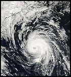
Take a look at the atlantic view of things. You can see how went from a west loaded weak hurricane to this beast of a storm that is now a cat 5. Its an amazing thing to watch really, just amazing...
|
Thunderbird12
Meteorologist
Reged:
Posts: 644
Loc: Oklahoma
|
|
Updated advisory just raised the winds to 130 knots sustained (150 mph). A new forecast has been issued as well, mainly to reflect the increase in intensity.
|


 Threaded


