harmlc.ath.cx
Weather Hobbyist

Reged:
Posts: 54
Loc: Longwood
|
|
Today will be a very telling day as to where is planned to make impact at. Any increase in speed will make the landfall more to the north, so everyone should still pay attention to , up and down the coast of florida. That's why there is a cone of uncertainty, and one shouldn't just pay attention to the line down the middle.
|
ftlaudbob
Storm Chaser

Reged:
Posts: 829
Loc: Valladolid,Mx
|
|
It is alone in it's forcast,so for now I will write it off.The GDFL is the one I watch,and the other models are closer to it.
--------------------
Survived: 10 hurricanes in Rhode Island,Florida and the Yucatan of Mexico .
|
Rdietch
Weather Hobbyist
Reged:
Posts: 89
|
|
BTW where can we get the GDFL early like the and the ? would like to see the 0Z run of it before bed.
|
vineyardsaker
Weather Guru

Reged:
Posts: 152
Loc: New Smyrna Beach, FL
|
|
Are some models know to be generally more reliable then others or does the choice of model depend on the type of storm and circumstances?
--------------------
Charley(eyewall), Ivan, Jeanne, Dennis, Wilma, Irma, Ian (eyewall), Nicole, Helene, Milton
|
danielw
Moderator

Reged:
Posts: 3527
Loc: Hattiesburg,MS (31.3N 89.3W)
|
|
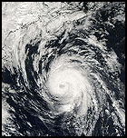
Recon is near the Center. At first glance it appears the tropical storm and maybe even the Hurricane Force wind field has enlarged.
This is probably due to and now having a larger Eye. Therefore a larger windfield.
|
danielw
Moderator

Reged:
Posts: 3527
Loc: Hattiesburg,MS (31.3N 89.3W)
|
|
http://met.psu.edu/tropical/tcgengifs/
http://moe.met.fsu.edu/tcgengifs/
|
harmlc.ath.cx
Weather Hobbyist

Reged:
Posts: 54
Loc: Longwood
|
|
Yea, on the latest satellite loops it appears as if the center has been expanding outwards.
|
Lake Toho - Kissimmee
Storm Tracker

Reged:
Posts: 317
Loc: Kissimmee, Florida on Lake Toh...
|
|
Here pick a model any model. This shows the current model spread and also the most recent . This is current.. for now.. http://img292.imageshack.us/img292/9856/al2420057hd.jpg
--------------------
Dream like you will live forever.. Live like there is no tommorow.. Darwin Rules !!
|
danielw
Moderator

Reged:
Posts: 3527
Loc: Hattiesburg,MS (31.3N 89.3W)
|
|
Look like she still may have Concentric Eyewalls.
Two wind field maximums.
Max flt lvl wind 121kts. Pressure Center near 18.0N?=/ 84.6W
Edited by danielw (Thu Oct 20 2005 01:23 AM)
|
Rdietch
Weather Hobbyist
Reged:
Posts: 89
|
|
Thanks.
The new i see on the site is out and it shows key west! so go figure where this is going to go as it has about the same chance i guess to go where the says as much as the gaps.
|
evergladesangler
Weather Hobbyist
Reged:
Posts: 71
|
|
Quote:
Thanks.
The new i see on the site is out and it shows key west! so go figure where this is going to go as it has about the same chance i guess to go where the says as much as the gaps.
This is interesting because has it just grazing the Yucatan (not unlike the current track) and yet it still end up a Keys event.
When is the next UKMET run?
|
vineyardsaker
Weather Guru

Reged:
Posts: 152
Loc: New Smyrna Beach, FL
|
|
Quote:
Here pick a model any model. This shows the current model spread and also the most recent . This is current.. for now.. http://img292.imageshack.us/img292/9856/al2420057hd.jpg
Where did you get this pic?
|
Storm Hunter
Veteran Storm Chaser

Reged:
Posts: 1370
Loc: Panama City Beach, Fl.
|
|
URNT12 KNHC 200525
VORTEX DATA MESSAGE
A. 20/05:13:00Z
B. 18 deg 00 min N
084 deg 36 min W
C. 700 mb 2209 m
D. NA kt
E. deg nm
F. 142 deg 120 kt
G. 046 deg 034 nm
H. 899 mb
I. 16 C/ 3045 m
J. 18 C/ 3039 m
K. 18 C/ NA
L. CLOSED
M. C4
N. 12345/ 7
O. 0.02 / 1 nm
P. AF308 0924A OB 06
MAX FL WIND 120 KT NE QUAD 05:02:20 Z
--------------------
www.Stormhunter7.com ***see my flight into Hurricane Ike ***
Wx Data: KFLPANAM23 / CW8771
2012== 23/10/9/5 sys/strms/hurr/majh
|
scottsvb
Weather Master
Reged:
Posts: 1184
Loc: fl
|
|
CMC has been off too much,,in general,,so far the best models to date have been the UKMET and and would of said but I didnt like that 12Z run...at least we know its Cancun,,,but does it slide thru it and off the N coast or go just south of there and weaken over the peninsula of the Yucitan before it re-emerges...thats what we want to know over the next 24hrs...too hard to tell right now. I havent seen the UKMET yet but should be out in next 20-30min.
|
danielw
Moderator

Reged:
Posts: 3527
Loc: Hattiesburg,MS (31.3N 89.3W)
|
|
Something strange about that Eye dropsonde. It's missing a number of levels of data.
Not reporting the wind last 150meters either.
|
Storm Hunter
Veteran Storm Chaser

Reged:
Posts: 1370
Loc: Panama City Beach, Fl.
|
|
not sure what to think of new runs....
http://euler.atmos.colostate.edu/~vigh/guidance/atlantic/early1.png
at first glance more spread out?
--------------------
www.Stormhunter7.com ***see my flight into Hurricane Ike ***
Wx Data: KFLPANAM23 / CW8771
2012== 23/10/9/5 sys/strms/hurr/majh
|
Rdietch
Weather Hobbyist
Reged:
Posts: 89
|
|
New UKmet is out also and is about the same as the and the taking it over the keys.
So far you got 3 taking it to the keys and 1 near Tampa.GDFL out soon bet its going to be like the last 3.
Edited by danielw (Thu Oct 20 2005 01:45 AM)
|
Storm Hunter
Veteran Storm Chaser

Reged:
Posts: 1370
Loc: Panama City Beach, Fl.
|
|
yeah saw that.... must of been a bad dropsonde...
UZNT13 KNHC 200525
XXAA 2005/ 99339 70845 11734 99899 28004 ///// 00/// ///// 92///
///// 85498 25405 70198 18200 88999 77999
31313 09608 80513
61616 AF308 0924A OB 07
62626 EYE 0516 AEV 20507 =
XXBB 20058 99339 70845 11734 00899 28004 11850 25405 22721 19617
33705 19400 44697 17400
21212 00899 /////
31313 09608 80513
61616 AF308 0924A OB 07
62626 EYE 0516 AEV 20507 =
where's the rest?
should look like this....
http://www.hurricanehunters.com/tempdrop.htm
--------------------
www.Stormhunter7.com ***see my flight into Hurricane Ike ***
Wx Data: KFLPANAM23 / CW8771
2012== 23/10/9/5 sys/strms/hurr/majh
Edited by Storm Hunter (Thu Oct 20 2005 01:39 AM)
|
danielw
Moderator

Reged:
Posts: 3527
Loc: Hattiesburg,MS (31.3N 89.3W)
|
|
I understand the levels above 850mb not being there...pressure too low.
But the lat/long for the 'splash' isn't there either.
Oh well. They got the data.
|
Storm Hunter
Veteran Storm Chaser

Reged:
Posts: 1370
Loc: Panama City Beach, Fl.
|
|
REPEATING THE 2 AM EDT POSITION...18.1 N... 84.7 W. MOVEMENT
BETWEEN...WEST AND WEST-NORTHWEST NEAR 8 MPH. MAXIMUM SUSTAINED
WINDS...155 MPH. MINIMUM CENTRAL PRESSURE...899 MB.
--------------------
www.Stormhunter7.com ***see my flight into Hurricane Ike ***
Wx Data: KFLPANAM23 / CW8771
2012== 23/10/9/5 sys/strms/hurr/majh
|


 Threaded


