Wxwatcher2
Storm Tracker

Reged:
Posts: 337
Loc:
|
|
Quote:
I would love to believe that.But given the models,we have to get ready for the worse.The GDFL is the one I trust,and that does take it over my area.People are very scared here,even the long time locals.
The media has made us increasingly afraid of hurricanes especially this year with the Mississippi coast and New Orleans. The old time residents should know better than to panic.
Prepare as best you can and if you feel unsafe in your home, evacuate to a shelter or further North.
It's a couple of days out but it's looking more and more like a SW Florida event cutting across the state near West Palm area.
|
Lake Toho - Kissimmee
Storm Tracker

Reged:
Posts: 317
Loc: Kissimmee, Florida on Lake Toh...
|
|
https://www.fnmoc.navy.mil/mywxmap/logout.do?requestId=1126908274163.1786.1
Click on public records and then pic tropical Atlantic. Then have fun and play.
--------------------
Dream like you will live forever.. Live like there is no tommorow.. Darwin Rules !!
|
Storm Hunter
Veteran Storm Chaser

Reged:
Posts: 1370
Loc: Panama City Beach, Fl.
|
|
URNT11 KNHC 200413
97779 04104 50214 83010 76200 04017 6678/ /5758
RMK AF308 0924A OB 04
looks like recon was to the NE of center.... and just south of tip of cuba
plane was at:
21.4n - 83.0w at 0410z
--------------------
www.Stormhunter7.com ***see my flight into Hurricane Ike ***
Wx Data: KFLPANAM23 / CW8771
2012== 23/10/9/5 sys/strms/hurr/majh
Edited by Storm Hunter (Thu Oct 20 2005 12:42 AM)
|
evergladesangler
Weather Hobbyist
Reged:
Posts: 71
|
|
Quote:
https://www.fnmoc.navy.mil/mywxmap/logout.do?requestId=1126908274163.1786.1
Click on public records and then pic tropical Atlantic. Then have fun and play.
Am I reading it right that is now showing a Yucatan landfall and then reemergence north of Yucatan in the Gulf? What happens after that as it moves east?
|
ftlaudbob
Storm Chaser

Reged:
Posts: 829
Loc: Valladolid,Mx
|
|
If it keeps on it's current path and forcast strength,what do you guys think will be the impact on my area?
--------------------
Survived: 10 hurricanes in Rhode Island,Florida and the Yucatan of Mexico .
|
Lake Toho - Kissimmee
Storm Tracker

Reged:
Posts: 317
Loc: Kissimmee, Florida on Lake Toh...
|
|
I am using a very long stethascope to hear the elephants to ensure that I am not bending over. 00Z moved north, to just north of Sarasota, just South of Tampa.
OK OK Enough Model Talk.. I am all oout of models for now anyways.. Who's got the UKMET ?
--------------------
Dream like you will live forever.. Live like there is no tommorow.. Darwin Rules !!
|
Big Red Machine
Storm Tracker
Reged:
Posts: 223
Loc: Polk City, FL
|
|
GFS and connected models are really out to lunch now. May well stand for Good For Sh**....
Turning my attention to another models then...
NOGAPS has been slowly moving northward. This run looks to take into Bradenton/just south of Tampa. Could catch some folks with their pants down if this verifies
Edit: (Just saw my post pretty much echoes Toho above me... sorry about that... slow typer) 
Edited by Big Red Machine (Thu Oct 20 2005 12:38 AM)
|
harmlc.ath.cx
Weather Hobbyist

Reged:
Posts: 54
Loc: Longwood
|
|
It dosn't look good for Ft.lauderdale on it's current track, but it's bound to change. You'd be getting the northern quadrant, and pretty much the core wind fields. The only good news is it would be already on land, and moving fast. But these models area bound to change in the next 3-4 days.
|
Colleen A.
Moderator

Reged:
Posts: 1432
Loc: Florida
|
|
I have to say I agree with Daniel...this IS a hurricane after all, and we know that we will see changes in tracks, intensity, so forth over the next few days. You cannot look at every jog to determine what the true direction is...look for trends.
Ftlaudbob: there is no reason to panic if you have your preparations made. If you feel as though you need to leave, then by all means do so. Bringing it up here again and again and again is not going to change the outcome of this storm. You may get hit, you may not get hit. Same thing here with me, and I'm on the WEST COAST of Florida. I am not in a panic mode and I will not be because I already KNOW what I will do if my area is threatened. I've known since the beginning of hurricane season.
If you haven't figured it out by now, then either you don't heed the warnings posted here and by your local officials, or you just want to keep riding the "I don't know what to do" train until it runs out of deisel fuel. You have been told over and over what to do. So please do it...if you don't do it, then please stop pulling the fire alarm button.
Get a hold of yourself. For the sake and sanity of all of us here.
--------------------
You know you're a hurricane freak when you wake up in the morning and hit "REFRESH" on CFHC instead of the Snooze Button.
|
vineyardsaker
Weather Guru

Reged:
Posts: 152
Loc: New Smyrna Beach, FL
|
|
Quote:
For Central Florida, chances remain pretty low that will have a direct impact. It all depends on if picks up forward speed. If she starts increasing her speed and manages to clip the eastern Yucatan pennisula before being turned to the northeast, she will gain a higher latitude and come in further north on the pennisula. However, I am still not sold that it would be Central Florida. In my mind, the furthest north it can go is Sarasota.
By what time do you think we might have some degree of confidence in predicting what will happen to central Florida? Tomorrow (Thu.) evening?
--------------------
Charley(eyewall), Ivan, Jeanne, Dennis, Wilma, Irma, Ian (eyewall), Nicole, Helene, Milton
|
harmlc.ath.cx
Weather Hobbyist

Reged:
Posts: 54
Loc: Longwood
|
|
We won't know for certain until it makes its turn to the northeast.
|
Rdietch
Weather Hobbyist
Reged:
Posts: 89
|
|
can you guys link the ?
|
zacker20
Weather Watcher
Reged:
Posts: 27
|
|
Quote:
By what time do you think we might have some degree of confidence in predicting what will happen to central Florida? Tomorrow (Thu.) evening?
Yes, once it begins to make that turn to the northeast, we will have a very good idea of where landfall will occur. That turn to the northeast is expected on Friday evening, so there is still some time to monitor it.
Just make mental preparations now. No need to get ready to evacuate. Things are looking good for Central Florida and right now all you can do is wait and see if it makes a drastic move (because a landfall in Central Florida would be pretty drastic as of right now). There's simply nothing else to do. Go about your business, but also keep in mind that there is a rather dangerous hurricane heading towards the pennisula and stay tuned to this website and the .
|
evergladesangler
Weather Hobbyist
Reged:
Posts: 71
|
|
Quote:
can you guys link the ?
Try this:
http://tinyurl.com/dhzf2
|
Storm Hunter
Veteran Storm Chaser

Reged:
Posts: 1370
Loc: Panama City Beach, Fl.
|
|
URNT11 KNHC 200443
97779 04400 50193 83219 30800 13065 08089 /3091
RMK AF308 0924A OB 05
plane was at 19.3n 83.2w at 0440z
alt down to 10105ft.... from 25000ft... on the way in!!
winds at flight level: 65kts? from 130 degrees.
corrected windspeed~danielw
--------------------
www.Stormhunter7.com ***see my flight into Hurricane Ike ***
Wx Data: KFLPANAM23 / CW8771
2012== 23/10/9/5 sys/strms/hurr/majh
Edited by danielw (Thu Oct 20 2005 01:00 AM)
|
harmlc.ath.cx
Weather Hobbyist

Reged:
Posts: 54
Loc: Longwood
|
|
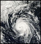
Here's a pretty good picture.
http://www.nrlmry.navy.mil/tc_pages/tc_home.html
edited to remove 5 hour old image and replace it with link to conserve space~danielw
Edited by danielw (Thu Oct 20 2005 01:06 AM)
|
Lake Toho - Kissimmee
Storm Tracker

Reged:
Posts: 317
Loc: Kissimmee, Florida on Lake Toh...
|
|
Check your inbox I sent it too you..
--------------------
Dream like you will live forever.. Live like there is no tommorow.. Darwin Rules !!
|
ftlaudbob
Storm Chaser

Reged:
Posts: 829
Loc: Valladolid,Mx
|
|
I guess we are all under stress,but more so for south Florida.Tampa looks less and less liklely.
--------------------
Survived: 10 hurricanes in Rhode Island,Florida and the Yucatan of Mexico .
|
vineyardsaker
Weather Guru

Reged:
Posts: 152
Loc: New Smyrna Beach, FL
|
|
Thanks for this answer and for all the info you guys provide on this website!
We are rather nervous here as Chaley left some very bad memories for many around here and ther are at least two models (A98E and LBAR) which still are pointing at us. Add to this that nobody is sure how strong will be at landfall AND that I hear that it might cross the penensula so fast that it would not weaken much, if at all, and you will see why we remain rather concerned around here even though, unlike last year, we were spared so far this year.
Many thanks again to all & good luck!
--------------------
Charley(eyewall), Ivan, Jeanne, Dennis, Wilma, Irma, Ian (eyewall), Nicole, Helene, Milton
|
Big Red Machine
Storm Tracker
Reged:
Posts: 223
Loc: Polk City, FL
|
|
Bob, take a look at the latest . You may want to update that thought.
00z makes a hit just south of Tampa.
Look, we are all concerned for you in S. FL, but please do not let your abundance of concern for yourself and your city overshadow other opinions.
|


 Threaded


