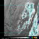
An EastPac Invest, 95E, that crossed over 140W into the Central Pacific last night is now making a bee-line towards the Big Island of Hawaii.
Although no longer classified as an invest, and no TC development is expected of it, thankfully, it may very well bring some much needed rains to the parched Big Island.
Although it's balmy summertime here in the islands where we do get frequent tradewind showers, especially during the night and early mornings, it's been a *very* dry winter in the Islands, thanks mostly to the now-departed moderate El Nino pattern that we were in.
So any 'generous' showers and rain would be most welcome. And the northern fringe of ex-Invest 95E is expected to bring some relief to mainly windward and Kau (SE) facing slopes of the Big Island.
Additionally, a southwesterly jetstream, which is on the eastern flanks of a NE / SW oriented upper level trough over the Islands, may very well interact with the incoming low-level moisture to cause some deep convection to develop over the Islands as the disturbance continues it's WNW passage, just south of, or over the Island chain.
One can even see the moisture field currently building with even a few towering-Cu and Cb's now flaring up as it approaches the Hawaiian Islands, as shown quite nicely in this link, well worth a view:
http://www.prh.noaa.gov/hnl/satellite/Hawaii_IR_loop.gif
Hmmm ... Interesting. This is, perhaps, the most 'interesting' weather we've had in months. Sure hope we get some significant rain from this event. It would truly be a blessing for the folks that rely on water-catchment systems on the parched Big Island, especially. 
- Norm
|


 Threaded


