Black Pearl
Weather Watcher

Reged:
Posts: 32
Loc: Mobile Bay
|
|
Quote:
THERE HAS BEEN LITTLE CHANGE TO THE FORECAST PHILOSOPHY...ALTHOUGH THE CONFIDENCE HAS DECREASED DUE TO A SPREADING OF THE GUIDANCE ENVELOPE.
It looks like the models have basically split with the official forecast down the middle. 
Models
|
shewtinstar
Verified CFHC User
Reged:
Posts: 23
Loc: Jacksonville, Fl
|
|
I am very far from being an expert on these things, but it sure looks to me like Fay is dying out.
|
Hugh
Senior Storm Chaser
Reged:
Posts: 1060
Loc: Okaloosa County, Florida
|
|
Quote:
It looks like the models have basically split with the official forecast down the middle.
When the models have a wide divergence, the generally has little choice but to either pick one of the tracks, or split the difference (go with the consensus). That's why you have to look at the cone, rather than the actual forecast lines.
--------------------
Hugh
Eloise (1975) - Elena and several other near misses (1985) - Erin & Opal (1995) - Ivan (2004)
|
JMII
Weather Master

Reged:
Posts: 546
Loc: Cape Coral & Margate, FL
|
|
Quote:
I am very far from being an expert on these things, but it sure looks to me like Fay is dying out.
Its taken a beating for sure, pretty much cut off from its warm ocean energy source by Cuba. Personally I don't believe the 50mph wind estimate at this time, I doubt its blowing over 40 at the center (provided you could even find it!).
Once Fay moves off Cuba its going to start to get squeezed between the low (west of it) and the front (to the north). I just don't see how it can intensify given those conditions. I do see more of turn to the east today versus yesterday so cone appears to be a good average of what could (should?) happen. I think the possibility of Panhandle landing is getting more remote, between Naples and Tampa seems like a better bet. I'd agree with current model, after landfall the track will head east with storm exiting between Daytona and Jacksonville.
Cat 1 at landfall is about it, but given its condition now even that seems like an over estimate. Everything depends on the arch of this turn to the north, if she swings wide she can gain strength, if she cuts the corner tight (like I've been thinking all along) she'll be in Key West and already sucking up drier air off the mainland which will zap any development as she comes ashore about the same place did.
However the sloppyness of this system makes it hard to judge. The center could hop Cuba early or drag right thru the middle of country, either way the vertical structure of Fay as a whole will be ruined so it should remain weak.
The standard disclaimer applies: I'm not a professional, just throwing my dart on the board for comparison.
--------------------
South FL Native... experienced many tropical systems, put up the panels for:
David 79 - Floyd 87 - Andrew 92 - Georges 98 - Frances 04 - Wilma 05 - Matthew 16 - Irma 17
Lost our St James City rental property to Ian 22
|
MichaelA
Weather Analyst

Reged:
Posts: 952
Loc: Pinellas Park, FL
|
|
Looking at the water vapor loops this morning/afternoon, I'm beginning to lean toward a more NE or NNE track on Tuesday/Wednesday if the trough axis just south of Louisiana continues to dig and move eastward.
--------------------
Michael
PWS
|
Captain Jed
Registered User
Reged:
Posts: 7
Loc: Tampa Bay
|
|
Quote:
I am very far from being an expert on these things, but it sure looks to me like Fay is dying out.
agree.Fizzle/drizzle.To all Tampa wishcasters,better luck next time! 
|
Robert
Weather Analyst

Reged:
Posts: 366
Loc: Southeast, FL
|
|
Hmm It looks like a depresion if you ask me. Fay is WEAK The LLCC is exposed to west of the tiny little blob of convection south of cuba she was under. Her circualtion is tight but small very small. It appears now she is getting away from jaimiaca and what was all that convection and mess south her all day yesterday and before is disapaiting breaking off and is heading south, off west of jaimiaca. The Circualtion seems to haved jogged west and is now crossing the 80th parralel in slightly more open water with the south west more open for breathing and the fact the center is more offshore of cuba, a western jog might be enough to get a better cluster of thunderstorm to fire. the only thing hindering this is that the center is pasing near a mountian with a deecent slope probally drawing cooler drier air from higher altidude being injected in the surface stream. this might be the cause for the center becoming exposed, but im not sure. I belive this evening will bring a big blow of convection over the center before moving inland over night and, well we will see what he have left in the morning.
|
shewtinstar
Verified CFHC User
Reged:
Posts: 23
Loc: Jacksonville, Fl
|
|
Quote:
Quote:
I am very far from being an expert on these things, but it sure looks to me like Fay is dying out.
agree.Fizzle/drizzle.To all Tampa wishcasters,better luck next time!
And I was so looking forward to a day off work.
|
TheOtherRick
Weather Watcher
Reged:
Posts: 41
Loc:
|
|
Wait a minute, the 2pm location is radically to the west of the prediction, and picking up speed. Double the disagreement with the prediction of any other point during the life of the storm.
Not getting closer to Cuba, but twice the distance from it, on top of all that warm water.
At the current angle, it would miss Cuba and shoot the gap into the Gulf.
No doubt backroom noise, randomness and uncertainty is a lot of it, but this stands out like a sore thumb.
http://flhurricane.com/googlemap.php?2008s6#
|
Robert
Weather Analyst
Reged:
Posts: 366
Loc: Southeast, FL
|
|
Has anyone considerd the bam and its west turn bias the past day or so its been taungted about scince this got going. The longer this stay south and west the beteer its chance of being left behind to speak. being pulled north but not really getting absorbed by the trough and then just being droped like a doller falling out your pocket , then catching the ridge to?
|
Hugh
Senior Storm Chaser
Reged:
Posts: 1060
Loc: Okaloosa County, Florida
|
|
Well, Bevin did it in the 5pm discussion.... comparing the current forecast track of Fay to that of .
Of course, this was after casting a huge doubt in the forecast track given the wide spread in models (finally, they mention the wide spread... good job!)... Overall, the current trend means no one can really feel at ease just yet.
--------------------
Hugh
Eloise (1975) - Elena and several other near misses (1985) - Erin & Opal (1995) - Ivan (2004)
|
StrmTrckrMiami
Weather Guru

Reged:
Posts: 148
Loc: Manchester, NH
|
|
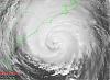
South Florida (Lee Charlotte and Hendry Counties) Has Feeder Bands from Fay (or what I believe to be feeder bands from her)
Check out this link and my attached photos. The clouds In the photos are active lightning clouds.
http://www.winknews.com/weather/radar
And now for the photos:


--------------------
Tracking Storms Since 2004
Miami, Cocoa, Fort Myers and Jacksonville
Currently Reside in New England
|
LDH892
Meteorologist
Reged:
Posts: 13
Loc: Carolinas
|
|
StrmTrckrMiami - the thunderstorm activity you're seeing is not associated with Fay. Fay is more than 400 miles away. The storms are part of the overall e-w synoptic flow, but IMO they are in not feeder-bands into the tropical cyclone.
|
StrmTrckrMiami
Weather Guru
Reged:
Posts: 148
Loc: Manchester, NH
|
|
On Satellite it looks as though they are the feeder bands,.
http://www.winknews.com/
Check out the one that shows Fay and the one that shows florida..
--------------------
Tracking Storms Since 2004
Miami, Cocoa, Fort Myers and Jacksonville
Currently Reside in New England
|
MikeC
Admin
Reged:
Posts: 4673
Loc: Orlando, FL
|
|
The very latest shifted East again. I need to stop looking at the models now.
|
StrmTrckrMiami
Weather Guru
Reged:
Posts: 148
Loc: Manchester, NH
|
|
Mike,
The models dont seem to know what they are doing for some reason.
--------------------
Tracking Storms Since 2004
Miami, Cocoa, Fort Myers and Jacksonville
Currently Reside in New England
|
Hugh
Senior Storm Chaser
Reged:
Posts: 1060
Loc: Okaloosa County, Florida
|
|
Quote:
The very latest shifted East again. I need to stop looking at the models now.
Last I saw was an eastern outlier already.... BAMM is really odd now.... calling for landfall in Tampa, and then turning around and heading for Pensacola.
Who's feeding the data into the computers, a sicko? 
--------------------
Hugh
Eloise (1975) - Elena and several other near misses (1985) - Erin & Opal (1995) - Ivan (2004)
|
LDH892
Meteorologist
Reged:
Posts: 13
Loc: Carolinas
|
|
StrmTrckrMiami - I looked at the radar loop of the storms in your area earlier, and as I said above they are not feeder-bands. Feeder-bands are more developed linearly and are typically directly linked to pull moisture into the cyclone. Do a google search of feeder bands to find out more, or you can visit this site that I just found - link hope this helps.
|
Addicted2Cane
Verified CFHC User
Reged:
Posts: 13
Loc:
|
|
What?
--------------------
Where is the wind and rain...I NEED to sleep!!
|
JMII
Weather Master
Reged:
Posts: 546
Loc: Cape Coral & Margate, FL
|
|
Quote:
Who's feeding the data into the computers, a sicko?
Garbage in / Garbage out  They can't get a fix on the center thus the models keep jumping around. They can't get a fix on the center thus the models keep jumping around.
Instead of looking at the storm itself I keep looking at the conditions in its general path. IE: what's going in NW FL, where is the High over the Atlantic, what about the low-level spin in the Gulf. Storms always take the path of least resistance, see where ever the clear "road" is thats were she'll go. Of course if you can't tell where she is currently that makes this whole process rather silly and pointless.
The models have moved west but I still see a general flow to the east. I just don't see how this storm can get that far up the state before being pushed aside by westerly flow shown in the water vapor loop: http://www.goes.noaa.gov/HURRLOOPS/huwvloop.html However the problem I see down the road is that since the storm has slowed down (again) it might just miss the big dip in the upper level over TN and sneak in behind it. The low pressure ahead Fay in the Gulf is dropping further south so its effects are being minimized with each passing hour, thus maybe she'll slide even further west, I wonder if this is what the models are grabbing onto.
Then again these effects are mostly pronounced on more vertically stacked and developed storms. The weaker Fay stays the harder it is to judge just what will effect her the most.
--------------------
South FL Native... experienced many tropical systems, put up the panels for:
David 79 - Floyd 87 - Andrew 92 - Georges 98 - Frances 04 - Wilma 05 - Matthew 16 - Irma 17
Lost our St James City rental property to Ian 22
|


 Threaded


