pcola
Storm Tracker

Reged:
Posts: 344
Loc: pensacola/gulf breeze
|
|
you might want to change that to the Florida Peninsula or east coast, don't think the panhandle is out of the woods yet, with the hwrf model hitting there and a slight turn late in the and ....it may all come down to the speed of the storm and where it is when a break in the ridge occurs
--------------------
Erin 95 , Opal 95, Ivan 04, Dennis 05, and that's enough!!!!
|
mcgowanmc
Weather Hobbyist
Reged:
Posts: 96
Loc: NW ARKANSAS
|
|
Quote:
Yeah you can't get much more straightforward than this from the latest forecast discussion;
HOWEVER...I AM A LITTLE MORE CONFIDENT THAT IN FIVE DAYS...THERE
WILL BE A LARGE HURRICANE IN THE CENTRAL GULF OF MEXICO.
The "central" line of the track now points almost directly at Houston, we'll see how this plays out. We should have additional recon data at 1am CDT that will tell us the more accurate strength and atmospheric conditions.
OMG
From Crownweather this AM:
"The forecast track for the next 36 to 48 hours is a difficult one because forecasting a major hurricane make landfall into Cuba from the east-northeast just isn't right. It is such a rare track that I cannot find an example of a major hurricane doing this. Therefore, I am very reluctantly forecasting a track that is close to the and HWRF model tracks and am forecasting Ike to come ashore on the north coast of Cuba near La Puerto and Manati late tonight as a very powerful Category 4 hurricane. Once ashore, Ike is forecast to track about 25 miles inland from the north coast of Cuba on Monday into Monday night. Ike should then track off of the north coast of Cuba about 60 miles or so east of Havana late Monday night or early Tuesday morning. This jaunt through northern Cuba may knock Ike down from Category 4 strength to as much as Category 1 strength."
This is or ReDux.
And NOLA can't afford to evac again. BR is still on it's knees.
The oil industry will take 6 months to recover.
Port Everglades is the regional seaport for nine petroleum companies, which sypply gasoline, jet fuel, fuel oil, diesel fuel, propane, aviation gasoline and asphalt to 12 South Florida counties and all three local international airports.
Broward County - Port Everglades
A: Seventy-five percent of the refined gasoline delivered to Port Everglades on a daily basis comes from refineries in Louisiana, Texas and Mississippi. ...
www.broward.org/port//petroleum_faq.htm
Good Luck, All of Us
|
Hugh
Senior Storm Chaser
Reged:
Posts: 1060
Loc: Okaloosa County, Florida
|
|
Quote:
you might want to change that to the Florida Peninsula or east coast, don't think the panhandle is out of the woods yet, with the hwrf model hitting there and a slight turn late in the and ....it may all come down to the speed of the storm and where it is when a break in the ridge occurs
Absolutely true. Plus, where and how long it goes over Cuba will be a factor. The models continue to wobble, it's almost as if they stay on a certain track long enough for the to believe it, and then they shift. Powerful hurricanes are also more likely to move poleward, which tends to make me reluctant to believe a Houston landfall, but it's just too early to say for sure.
--------------------
Hugh
Eloise (1975) - Elena and several other near misses (1985) - Erin & Opal (1995) - Ivan (2004)
|
Evan Johnson
Weather Guru

Reged:
Posts: 143
Loc: Loxahatchee, FL
|
|
now you are tapping a entirely different realm. i cant buy into that hype. refineries and gas stations have reserves as well as the state. just like any other state, in the event that a storm is projected and or hits their main supplier, they either go to their secondary supplier or tap off their reserve. maybe our gas prices will go up a bit but thats about all. as it is most areas in palm beach county where i live are 20 cents above national average anyway so it doesnt phase me.
|
Evan Johnson
Weather Guru

Reged:
Posts: 143
Loc: Loxahatchee, FL
|
|
maybe this will help everyone better understand the current wind steering currents, how strong/weak they are.
http://cimss.ssec.wisc.edu/tropic/real-time/atlantic/winds/wg8dlm1.GIF
hope this helps.
|
jf
Verified CFHC User
Reged:
Posts: 18
|
|
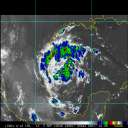
It appears as though the cloud shield from Ike is expanding to the N while the main storm is moving W at a slightly slower speed. It is possible that Ike could bounce off the mountains in Cuba and wobble to the N or NW. I'm not sure why the cloud shield is expanding to the N but I'm sure someone could explain why.
|
Evan Johnson
Weather Guru

Reged:
Posts: 143
Loc: Loxahatchee, FL
|
|
the fact the storm may be expanding on its north side may have to do with the fact that the current wind steering currents are weakining. there is less pressure on the storm to stay south. IE 2 days ago there was practically no north side of the storm because of the strong frontal boundry pancake'ing it steering it west. the waters it is in now have a weaker steering wind flow current. thats my best guess.
Edited by Evan McCone (Sun Sep 07 2008 09:13 AM)
|
danielw
Moderator

Reged:
Posts: 3527
Loc: Hattiesburg,MS (31.3N 89.3W)
|
|
Question is probably better answered by a Met.
My thinking is the outer pressure is weakening and allowing the storm envelope to expand.
Also known as the ridge moving or breaking down. Could be a good thing or it might be a bad thing. Only time will tell.
Models have updated and now have four out of twelve making landfall between Panama City Beach,FL and Vermillion Bay,LA.
https://my.sfwmd.gov/sfwmd/common/images/weather/plots/storm_09.gif
|
hurricane expert
Really Not an Expert
Reged:
Posts: 105
Loc: florida
|
|
Its still possible first of all our storm is to the east of us until we see this thing farther away its always good to be prepared. One reason i dont think were out of this as of yet is cause of this trough coming down the mid plains check this out in 48 hours http://www.accuweather.com/maps-galileo....face&fday=5
depending on this is where i think ike is going to go ?
|
mcgowanmc
Weather Hobbyist
Reged:
Posts: 96
Loc: NW ARKANSAS
|
|
[quote
Models have updated and now have four out of twelve making landfall between Panama City Beach,FL and Vermillion Bay,LA.
https://my.sfwmd.gov/sfwmd/common/images/weather/plots/storm_09.gif
Now add in the "Ghost Tracks" of Edouard, Fay, and Gustav.
And the fact that NO did not get that much precip from Gustav.
That would rule out Vermillion (Please God says BR). And Panama would be a maybe.
But it's getting "late" into the season and the coriolis effect should negate the continued
"Rita" track.
I like Mobile and West though. In light of both the and HWRF models have shifted a little northward,
somewhere between PilotTown and Pascagoula. IMHO
|
pcola
Storm Tracker

Reged:
Posts: 344
Loc: pensacola/gulf breeze
|
|
models are still way too inconsistent for an accurate 5 day...GFS went from Cedar Key FL yesterday morning to Corpus Christi TX last night to central LA today....the changes per run are over 200 miles...we still have another day before i think an accurate Gulf path is determined
--------------------
Erin 95 , Opal 95, Ivan 04, Dennis 05, and that's enough!!!!
|
mcgowanmc
Weather Hobbyist
Reged:
Posts: 96
Loc: NW ARKANSAS
|
|
Quote:
What's your guess on the current threat level for New Orleans? Do you know if they are already planning for yet another evacuation? Has Nagin made any statements?
Like every other program for Hurricane Preparedness, the people are not getting the info.
Watch what happens when Nagin gives the evac order. Not good.
Edited by mcgowanmc (Sun Sep 07 2008 09:56 AM)
|
mcgowanmc
Weather Hobbyist
Reged:
Posts: 96
Loc: NW ARKANSAS
|
|
Quote:
models are still way too inconsistent for an accurate 5 day...GFS went from Cedar Key FL yesterday morning to Corpus Christi TX last night to central LA today....the changes per run are over 200 miles...we still have another day before i think an accurate Gulf path is determined
That's true enough, but every model now shows a Cat 3 in the GOM by Friday AM . And these models have been accurate enough
this year. The instant Ike takes it's WNW track, everyone from Panama City to Vermilion Bay will have
to begin prep. And who can afford to?
Ex-Mississippi/Alabama will have to pull every power truck out of Louisiana.
By this Evening we should know the angle Ike will hit Cuba.
That'll tell us alot.
Sincerely,
James
|
hogrunr
Weather Guru

Reged:
Posts: 153
Loc: Spring, TX
|
|
Once landfall is withing 48-72 hours, the error will be drastically smaller than 200 miles, so it will be a much more focused evacuation. there are still about 35 other states that have power trucks to send down, so while Mississippi may have to pull back their own trucks (if Ike hits in that area that is) there will be plenty of others just waiting to get in on the money to be made from this.
The same situation waits for TX, they will have to pull their resources out of LA if it hits in TX.
|
jf
Verified CFHC User
Reged:
Posts: 18
|
|
Quote:
Question is probably better answered by a Met.
My thinking is the outer pressure is weakening and allowing the storm envelope to expand.
Also known as the ridge moving or breaking down. Could be a good thing or it might be a bad thing. Only time will tell.
Models have updated and now have four out of twelve making landfall between Panama City Beach,FL and Vermillion Bay,LA.
https://my.sfwmd.gov/sfwmd/common/images/weather/plots/storm_09.gif
I see from recent Sat images that Ike has wobbled to the NW as it approached the Island of Inagua.Does the recent expansion of the storm envelope to the North mean the storm could be moving into the least hostil environment.? What conditions would need exist to confirm a shift of a storm as strong as IKE.?
|
willa
Unregistered
|
|
So this is no longer a central florida/south florida event?
|
ftlaudbob
Storm Chaser

Reged:
Posts: 829
Loc: Valladolid,Mx
|
|
Is there any site where I can find last Thursday's forecast track.I believe it is currently still on THAT track.I think it had it going along the north coast of Cuba.
--------------------
Survived: 10 hurricanes in Rhode Island,Florida and the Yucatan of Mexico .
|
Ben F.
Registered User
Reged:
Posts: 2
Loc: Palm Beach Gardens, FL
|
|
Central and South Florida is out of the cone. There is no chance of it coming here.
|
willa
Unregistered
|
|
They usually have it in the archives. Interesting thing is. Only 1 storm ever has not hit florida that was within 300 miles of ike right now. This is a once in a lifetime event that it won't hit florida.All that tells me is, the chances of central florida like tampa area has a very slim to none chance to ever be hit directly by a hurricane.
|
jf
Verified CFHC User
Reged:
Posts: 18
|
|
The website has an archive section
|


 Threaded


