Current Radar or Satellite Image

Flhurricane.com - Central Florida Hurricane Center - Tracking Storms since 1995Hurricanes Without the Hype! Since 1995


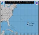
Rafael continues to decouple over the Gulf. Meanwhile we are keeping a watch on Invest 98L around the Bahamas and potentially a new low forming in the Caribbean.
Days since last H. Landfall - US: Any 31 (Milton) , Major: 31 (Milton) Florida - Any: 31 (Milton) Major: 31 (Milton)
26.3N 91.9W
Wind: 40MPH
Pres: 1003mb
Moving:
Nnw at 3 mph
Click for Storm Spotlight
Invest 98LClick for Invest Information from CIMSS
COMMUNICATION
STORM DATA
CONTENT
FOLLOW US


General Discussion >> Site Updates, Suggestions and Questions

Pages: 1
CoconutCandy
User


Reged:
Posts: 245
Loc: Beautiful Honolulu Hawaii
Please help. LINK to "Storm Spotlight" Page ??
      #86969 - Fri Sep 25 2009 06:41 PM

I just discovered this page on CFHC ...

http://flhurricane.com/cyclone/stormspotlight.php?year=2009&storm=8

... from looking at "Who's Online" and see what others' were looking at.

Great page. But please tell me HOW I can find it (a link, etc.) from the MAIN page ?!?

Amazing that, after 3 years posting here, I STILL haven't figured out all the ins and outs and exactly what pages (info) are available for viewing.

Thanks if you could please shed some insight.


Post Extras: Print Post   Remind Me!   Notify Moderator  
Ed DunhamAdministrator
Former Meteorologist & CFHC Forum Moderator (Ed Passed Away on May 14, 2017)


Reged:
Posts: 2565
Loc: Melbourne, FL
Re: Please help. LINK to "Storm Spotlight" Page ?? [Re: CoconutCandy]
      #86974 - Sat Sep 26 2009 07:42 AM

Just click on the 'tracking map' to the left, under Current Storms.
ED


Post Extras: Print Post   Remind Me!   Notify Moderator  
CoconutCandy
User


Reged:
Posts: 245
Loc: Beautiful Honolulu Hawaii
LINK to the "Storm Spotlight" Page [Re: Ed Dunham]
      #86975 - Sat Sep 26 2009 08:00 AM

Thanks Ed. It just never occured to me to click on the map itself. Maybe tiny text below the map that says "Click the Map for More Info" (or something similar), like the 'mph' just above the map. Then folks like me (who didn't know) will realize the map is clickable and yields more info regarding the current storm. Food for thought.

Post Extras: Print Post   Remind Me!   Notify Moderator  
Pages: 1


Extra information
0 registered and 6 anonymous users are browsing this forum.

Moderator:  

Print Topic

Forum Permissions
      You cannot start new topics
      You cannot reply to topics
      HTML is disabled
      UBBCode is enabled

Rating:
Topic views: 4184

Rate this topic

Jump to

Note: This is NOT an official page. It is run by weather hobbyists and should not be used as a replacement for official sources. 
CFHC's main servers are currently located at
Hostdime.com in Orlando, FL.
Image Server Network thanks to Mike Potts and Amazon Web Services. If you have static file hosting space that allows dns aliasing contact us to help out! Some Maps Provided by:
Great thanks to all who donated and everyone who uses the site as well. Site designed for 800x600+ resolution
When in doubt, take the word of the National Hurricane Center