cieldumort
Moderator

Reged:
Posts: 2519
Loc: Austin, Tx
|
|

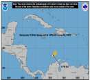
A tropical wave and as associated broad area of low pressure is being tracked as Invest 98L. This feature is located several hundred miles east of the Windward Islands, with movement to the west-northwest at around 15 MPH.
Shower and thunderstorm activity with 98L remains numerous, but largely unorganized as of today, Oct 10, but it is becoming increasingly possible that they will start to come together in a meaningful way within the next few days, and gives 98L a 30% chance of becoming a tropical cyclone within the next 48 hours.
This is where to put your mid to long range best guesses on potential for further development, intensity, and forecast track. Longer range model output discussions are also appropriate here.
Title updated to reflect upgrade to tropical storm.
Edited by cieldumort (Fri Oct 12 2012 09:59 PM)
|
LoisCane
Veteran Storm Chaser

Reged:
Posts: 1237
Loc: South Florida
|
|
Thanks for being here... a bit confused... looked better the other day and still seems far from a sure thing. But, the models like it and yet the models have been at odds with what it will do.l
A very fluid, developing situation..
--------------------
http://hurricaneharbor.blogspot.com/
|
cieldumort
Moderator

Reged:
Posts: 2519
Loc: Austin, Tx
|
|
A combination of radar, satellite, and recon flights have determined that vigorous Invest 98L has closed off a circulation at the surface, and has thus been upgraded to Tropical Storm Rafael.
Rafael is expected to bring Puerto Rico and the Lesser Antilles very heavy rains with pockets of tropical storm force winds before gradually exiting the area early next week. From there, models strongly suggest that Bermuda may be in its sights by mid-week, and perhaps even Newfoundland by next weekend.
It is worth noting that while there have been a few model runs showing Rafael becoming a formidable hurricane, its core is quite large, as is its overall circulation, and intensification into a hurricane, while very possible, may be slow to occur, should it occur.
|
|


 Threaded


