
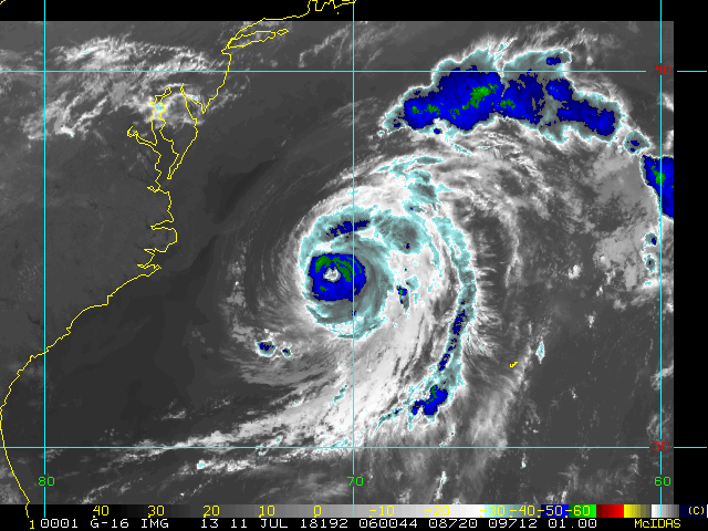
An active month of July continues, with recon now finding Chris a hurricane. Fortunately, nearly all reliable guidance takes Hurricane Chris north-northeast to northeast away from the U.S., but the cyclone could continue to produce some serious rip current risks along the eastern seaboard.
Another Low to the northeast of Chris is weak, and significant development is not expected, although it could have some influence on the path Chris takes.
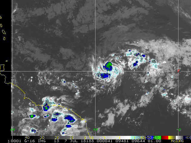
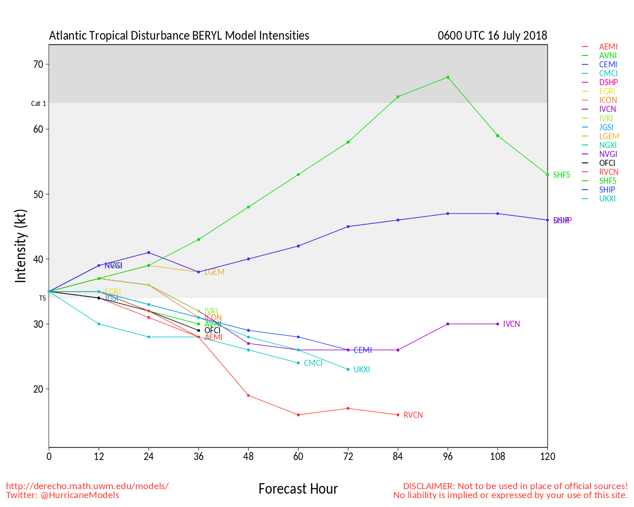
Southeast of Chris, the low pressure remains of former Hurricane Beryl continue struggling, but a new mid-level center may be trying to form along the northern portion of this trough. Interests in the region should continue to monitor this disturbance closely, and stay tuned to the National Hurricane Center for updates. odds of 20% within 48 hours/50% within 5 days, and these odds could be going up.
Finally, way, way, way out in the Tropical Atlantic, an active portion of the is worth keeping an eye on, as despite Sea Surface Temps running well below average in the Tropical Atlantic so far this seasaon, African Easterly Waves have been busier and friskier than usual.
For Chris model talk and more check out the Hurricane Chris Lounge
For more Beryl model talk, go beyond the cone with us in the Beryl Lounge.
Mid-Atlantic/Carolina Links
Southeast Composite Radar Loop
(Latest Static)
Charleston, SC Radar Radar Loop
(Latest Static)
Wilmington, NC Radar Radar Loop
(Latest Static)
Morehead City, NC Radar Radar Loop
(Latest Static)
Norfolk/Wakefield, VA Radar Radar Loop
(Latest Static)
Area Forecast Discussions:
Charleston, SC -
Wilmington, NC -
Morehead City, NC -
Norfolk/Virginia Beach/Hampton Roads, VA
Power Outage Maps:
South Carolina Power Outage Map
North Carolina Power Outage Map
Virginia Power Outage Map
Canadian Hurricane Centre
Beryl Event Related Links
SFWMD Model Plot (Animated Model Plot) SFWMD Hurricane Page
[https://flhurricane.com/floatanimator.php?year=2018&storm=2 Flhurricane Satellite Floater Animation of Beryl
GOES Floater
Animated Model Plot of Beryl
Clark Evans Track Model Plot of Beryl
(Animated!) Model Plots in Google Earth - In Google Maps
Clark Evans Intensity Model Plot of Beryl (Animated!)
Clark Evans Track Plot of Beryl
Other Model Charts from Clark
Clark Evans Top 10 Analog Storms for Beryl
More model runs on from RAL/Jonathan Vigh's page
NRL Info on Beryl -- RAMMB Info
COD Atlantic Satellite View
Chris Event Related Links
SFWMD Model Plot (Animated Model Plot) SFWMD Hurricane Page
[https://flhurricane.com/floatanimator.php?year=2018&storm=3 Flhurricane Satellite Floater Animation of Chris
GOES Floater
Animated Model Plot of Chris
Clark Evans Track Model Plot of Chris
(Animated!) Model Plots in Google Earth - In Google Maps
Clark Evans Intensity Model Plot of Chris (Animated!)
Clark Evans Track Plot of Chris
Other Model Charts from Clark
Clark Evans Top 10 Analog Storms for Chris
More model runs on from RAL/Jonathan Vigh's page
NRL Info on Chris -- RAMMB Info
COD Atlantic Satellite View
Eastern NC/OBX/Hampton Roads Media:
North Carolina Power Outage Map
Star News Online (Wilmington)
Outer Banks Sentinel
Hampton Roads Pilot
WWAY TV 3 Wilmington, NC (ABC)
WECT TV 6 Wilmington, NC (NBC)
Fox Wilmington (FOX)
WILM TV 10 Wilmington, NC (CBS)
WITN 7 - Eastern North Carolina TV (NBC)
WCTI 12 - Eastern North Carolina (ABC)
WNCT TV 9 - Eastern North Carolina (CBS)
Wavy 10 (NBC) - Hampton Roads/VA Beach, VA TV
WTKR 3 (CBS) - Hampton Roads/VA Beach, VA
WVEC 13 (ABC) - Hampton Roads/VA Beach, VA
Edited by cieldumort (Sat Jul 14 2018 02:39 PM)