2PM AST Update 12 Aug 2018
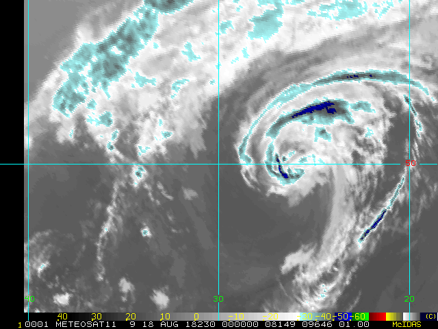
As expected, a non-tropical low has formed in the north-central Atlantic and is showing some signs of being able to transition into a sub-trop or tropical cyclone. This system is now being tracked as an Invest, 98L, but is no threat to the Americas while it meanders over the subtropical Atlantic.
Elsewhere, the weak disturbance between the Caribbean and Africa has been decimated and is now given a near-zero chance of developing.
Ciel
Original Entry

The climatological heart of the Atlantic Hurricane Season is now just about a week away, generally thought of as mid-August trough mid-October, and while 2018 is expected by most specialists to end up with far fewer named storms, hurricanes and majors than last year, "it only takes one." Now, while it is still quiet, is a great time to do hurricane preparedness, so when the peak does come, and if a significant storm approaches, there will be less to worry about.

And all is not quiet. As of today, August 10, is now focusing on two features. One, an expected development of a non-tropical low out in the central Atlantic that could acquire sub-tropical or tropical status much like pre-Debby did. This feature should not be a threat to the Americas. The other, a disturbance located about midway between Africa and the Lesser Antilles, could slowly develop next week as it travels west-northwest towards the Caribbean.
Edited by MikeC (Sat Aug 18 2018 07:28 AM)


 Threaded


