MikeC
Admin
Reged:
Posts: 4635
Loc: Orlando, FL
|
|
7PM EDT Update 4 September 2018
Gordon is now a high-end Tropical Storm with maximum sustained winds in a few spots of about 70MPH. Recon is heading back in to see if any additional changes in intensity have occurred.
The cyclone may tighten up right before and/or into and/or just after landfall. This is to say, Gordon may become a more fully hurricane type of tropical cyclone at any time over the next six hours or so. A T.C. ramping up a full category into landfall is hardly unprecedented, and those in the Hurricane Warning should take it seriously, preparing for the worst, hoping for the best. Preparations should now be rushed to completion in the Hurricane Warning area.
As it is, clean doppler velocity scans at around 10,000' this this afternoon have been upwards of 90 MPH, and it is possible that Gordon will begin efficiently transferring these rates to the surface, at least in gusts. Wind gusts this high can cause significant damage to roofs, topple trees, snap power lines, roll trailers, etc.
During and after landfall, dangerous storm surge of up to three or four feet is expected. Surge this high can easily lift very heavy automobiles and send them uncontrollably up-current.
After landfall, Gordon's forward movement is forecast to slow down markedly, and both flash flooding and still some wind damage is likely well inland. Be prepared for power outages that may take some time to come back online. At least three days non-perishable food and many gallons of drinkable water per person always a good idea.
At least a couple of tornadoes are likely. Tropical cyclone tornadoes often strike with little or no warning. These tend to be EF 0s and 1s. But not always.
NHC: Quote:
SUMMARY OF WATCHES AND WARNINGS IN EFFECT:
A Storm Surge Warning is in effect for...
* Shell Beach to Dauphin Island
A Storm Surge Watch is in effect for...
* West of Shell Beach to the Mouth of the Mississippi River
* East of Dauphin Island to Navarre
A Hurricane Warning is in effect for...
* Mouth of the Pearl River to the Alabama-Florida Border
A Tropical Storm Warning is in effect for...
* West of the Mouth of the Pearl River to the Mouth of the
Mississippi River, including Lake Pontchartrain
* Alabama-Florida Border to Okaloosa-Walton County Line
-Ciel
7AM EDT Update 4 September 2018
Tropical Storm Gordon has held steady overnight and is making its run toward the Mississippi Gulf coast, most of the wind and convection associated with Gordon is on the east (sometimes well to the east) of the center of circulation, which has been exposed at times overnight.
Recorn recently found pressures of around 1001mb, so it still continues to gradually strengthen and probably has enough time to become a category 1 hurricane before landfall, thus hurricane warnings are up for the area. Impacts will likely be similar to Nate from last year. Small storms like Gordon, are susceptible to rapid intensity changes (both up and down), the upper level low weakening the southwest quadrant is moving away from Gordon this morning, so it is still worth watching. Those in the warning areas should prepare for a category 2 hurricane, and hope for less, but listen to local media and officials for your immediate area.
11AM EDT Update 3 September 2018
Hurricane Watches are now up along the northern Gulf coast for Gordon, from the Mouth of the Pearl River to the Alabama-Florida Border.
Gordon has continued to organize this morning ahead of schedule, but remains a Tropical Storm at the moment, with some strong wind reports from the Keys this morning. Recon is entering the system now to check it out.
Original Update
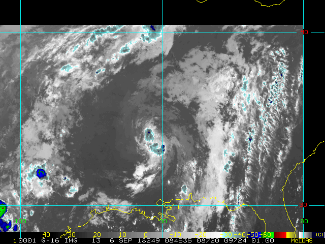
Tropical Storm Warnings are up for the Florida Keys and portions of S. Florida also in the North Gulf from AL/FL to Morgan City, LA as Tropical Storm Gordon forms near the Florida Keys this morning.
A 45MPH Tropcial Storm was what it was forecast to be in 36 hours from now at the 5AM Advisory. It's ahead of schedule.
The upgraded based on some surface observations and radar, they will probably hold off any big forecast changes until the recon aircraft gets out to investigate it later today.
Edited by cieldumort (Tue Sep 04 2018 07:05 PM)
|
MikeC
Admin
Reged:
Posts: 4635
Loc: Orlando, FL
|
|
A recent storm report from NWS Key West showed 65mph sustained winds at Carysport Reef.
|
doug
Weather Analyst
Reged:
Posts: 1006
Loc: parrish,fl
|
|
Radar suggests the track is a bit east of the projected as exhibited on ahe SWFMD site
--------------------
doug
|
MikeC
Admin
Reged:
Posts: 4635
Loc: Orlando, FL
|
|
Let us know what you are seeing locally at http://flhurricane.com/cyclone/showflat.php?Cat=0&Number=99463&page=1&vc=1#Post994632
Recon is showing it continue to rapidly organize this morning, the 12Z is all but worthless since it does not match whats going on right now.
|
doug
Weather Analyst
Reged:
Posts: 1006
Loc: parrish,fl
|
|
A little hint of an eye has appeared on the My Radar app on my IPad...could be an artifact
--------------------
doug
|
Joeyfl
Weather Guru

Reged:
Posts: 133
Loc: St.Pete,FL
|
|
Definitely has taken bit of a NNW jog past few hours, now center just west of Marco Island. Be interesting to see how long this movement continues before it resumes NW path.
|
doug
Weather Analyst
Reged:
Posts: 1006
Loc: parrish,fl
|
|
I think it is closer to NW as it is not parallel to the coastline which is essentially NNW. It certainly is not WNW. Can it gain intensity quickly over the really warm water? That’s what I will be watching now
--------------------
doug
|
Bloodstar
Moderator

Reged:
Posts: 467
Loc: Tucson, AZ
|
|
Quote:
A little hint of an eye has appeared on the My Radar app on my IPad...could be an artifact
See the same thing, but it must be an artifact, or a transient center clearing. Pressures are too high and winds are too low to support any real inner core of winds.
At least that's my on the feature
--------------------
M. S. Earth and Atmospheric Sciences, Georgia Tech - May 2020
NOAA MADIS/HADS Programmer
U. Arizona PhD Student
|
doug
Weather Analyst
Reged:
Posts: 1006
Loc: parrish,fl
|
|
I see quite a bit of shear in the radar presentation north an west of the low center not so much to the east and southeast
--------------------
doug
|
cieldumort
Moderator

Reged:
Posts: 2497
Loc: Austin, Tx
|
|
Quote:
Quote:
A little hint of an eye has appeared on the My Radar app on my IPad...could be an artifact
See the same thing, but it must be an artifact, or a transient center clearing. Pressures are too high and winds are too low to support any real inner core of winds.
At least that's my on the feature
The ambient SLPs are relatively high. 1004mb is thereby low on a relative basis. The last recon pass through Gordon found 4mb drop in just 3 hours. The eyewall has shown multiple clean velocity scans well into upper-end tropical storm force, but off and on, or if you like, consistently inconsistent - but also consistent with the 65 MPH (56 KT) sustained wind from the Mesonet site NWS Key West reported earlier this morning.
IMHO, it is more likely than not that this is the development of an inner core and incipient eye (Would put the odds of this above 95%). However, that said, Gordon is a small/mid-sized TC with a very small inner core, and will likely be subject to rapid fluctuations (up and down) of intensity.
The track ahead is actually one of generally favorable shear and hearty SSTs, so an overall strengthening trend possibly with episodes of R.I. looks on target. Cat 1/2 hurricane at landfall seems to me very plausible - less or even slightly higher - depending.
*Edited to correct for pressure drop. (4mb not 6mb - finalized in the second vortex message).
Edited by cieldumort (Mon Sep 03 2018 03:27 PM)
|
doug
Weather Analyst
Reged:
Posts: 1006
Loc: parrish,fl
|
|
The WV loop seems to demonstrate an override of dryer air from the NW which has inhibited development north and west.
--------------------
doug
|
MikeC
Admin
Reged:
Posts: 4635
Loc: Orlando, FL
|
|
Gordon is moving a bit to fast, looks like the existing center is starting to be exposed (and shifting west overall). The Upper Level low to the SW is keeping that side of it from going, while the east is blowing up big convection. Pretty messy setup, I think strengthening has halted for now (it may likely weaken for the 11PM) There's a chance the center may reform to the east, it may get interesting again midday tomorrow.
|
cieldumort
Moderator

Reged:
Posts: 2497
Loc: Austin, Tx
|
|

Third pass through has found pressure leveling out at around 1005, but winds increasing - now a more conclusive argument for 50KT and possibly 55KT at 11.
The shear, dry air, and rapid movement others have noted appear to be the only thing keeping Gordon from ramping up fast, but so far, they do not appear to be weakening the tropical cyclone. Caveat being Gordon's small inner core is certainly putting at risk along the track should at any time conditions become less hospitable, for a significant drop in intensity.
CIMSS analyzes shear of 25 knots just to the circulation's north, but so far, this is nowhere near the core. More importantly, that shear will probably ease up should, as expected, deeper convection blow up over a wider area, bolstering the upper-level high aloft (and thus fending off that shear, or even weakening the shearing ULL altogether).
|
cieldumort
Moderator

Reged:
Posts: 2497
Loc: Austin, Tx
|
|
Looks like Gordon has ingested a bit of dry air within the past hour - that relentless higher-than-forecast shear others have noted above taking a toll, no doubt. Very close to hurricane, but probably in the books as high-end T.S. Clean radar velocities of up to 80 MPH at 1,500' may easily still produce a hurricane-force gust here and there - just not as possible for sustained. The eyewall has been fanning out. Good sign for those in the inner core of Gordon's immediate direct path, but issues to come. Water rising rapidly now in places, etc.
|
cieldumort
Moderator

Reged:
Posts: 2497
Loc: Austin, Tx
|
|
Spoke too soon last time. Gordon is still deepening into landfall with winds increasing - at least just above the surface - might happen to get a note in real time, but at a minimum, absolutely now a candidate for post-season reanalysis.
For those in Gordon, best to treat this like a landfalling Cat 1, regardless. Solid data to back that up, too.
|


 Threaded

