Current Radar or Satellite Image

Flhurricane.com - Central Florida Hurricane Center - Tracking Storms since 1995Hurricanes Without the Hype! Since 1995


The 2024 season is officially over after a brutal number of landfals, a stunning rampup in the back-half and a record-early Cat 5.
Days since last H. Landfall - US: Any 62 (Milton) , Major: 62 (Milton) Florida - Any: 62 (Milton) Major: 62 (Milton)


Archives 2010s >> 2018 News Talkbacks

Pages: 1
MikeCAdministrator
Admin


Reged:
Posts: 4635
Loc: Orlando, FL
The Atlantic after Michael
      #99829 - Sun Oct 14 2018 04:49 PM

12PM EDT Update 24 October 2018
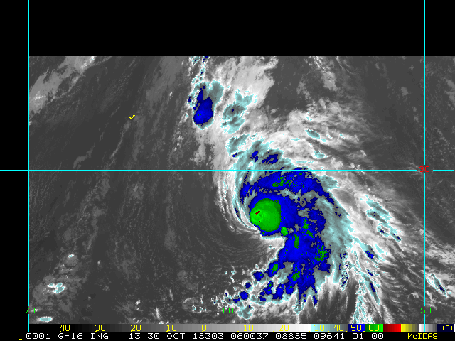
We are keeping an eye on a broad area of low pressure located 900+ miles east of the northern Leeward Islands. The feature, tagged 95L, is expected by NHC to develop, but is not expected to threaten land.

Elsewhere, Super Typhoon Yutu with winds of at least 180 MPH is making landfall near Guam:
Quote:

43 minutes ago
...EYE OF SUPER TYPHOON YUTU OVER TINIAN AND SAIPAN...

.NEW INFORMATION...

THE EYE OF SUPER TYPHOON YUTU NOW OVER TINIAN AND SOUTHERN SAIPAN.THE CURRENT POSITION OF YUTU HAS THE EYE OVER TINIAN AND SOUTHERN SAIPAN WITH MAX WINDS IN THE EYE WALL 180 MPH OR STRONGER...A DANGEROUS CATEGORY 5 SUPER TYPHOON. THESE WINDS WILL CONTINUE TO AFFECT TINIAN AND SAIPAN FOR THE NEXT FEW HOURS. ALL RESIDENTS SHOULD CONTINUE TO MONITOR SUBSEQUENT FORECASTS AND ADVISORIES FOR ANY CHANGES THAT MIGHT IMPACT YOUR ISLAND. EITHER LOCAL MEDIA OR THE NWS GUAM WEBSITE AT www.WEATHER.GOV/GUM/ ARE GOOD CHOICES.


Last, moisture from former Cat 5 EPAC Willa is streaming into the southern Gulf states. A remnant of Willa may help form a coastal Low over the coming days and run up the south to southeast to eastern seaboard.
- Ciel

Original Entry
Hurricane Michael will be one remembered for years to come for this decade for Florida. Although Irma, Matthew and Hermine (The other 3 hurricanes, and only ones from the decade) will be remembered, the raw violent nature of Michael will put that at the top, along with its impacts well inland. Post analysis may bring it up to Category 5 after all is said and done. Callaway, Tyndall, Mexico Beach, Cape San Blas and Panama City within Gulf and Bay counties are forever changed, as many areas around ti were also.

Our twitter feed is full of examples and response to it.

Beyond that Leslie made landfall in Portugal and brought damage to there, very unexpectedly.


Two low-chance areas are being watched, a 20% area in the West Caribbean (94L) and another area in the Central Atlantic with 10%. Neither have much model support, but there is a possibility for one or two more systems this season before all is said and done.

Links for 95L may need to update - use with caution


Post Extras: Print Post   Remind Me!   Notify Moderator  
Pages: 1


Extra information
0 registered and 8 anonymous users are browsing this forum.

Moderator:  

Print Topic

Forum Permissions
      You cannot start new topics
      You cannot reply to topics
      HTML is disabled
      UBBCode is enabled

Rating:
Topic views: 6791

Rate this topic

Jump to

Note: This is NOT an official page. It is run by weather hobbyists and should not be used as a replacement for official sources. 
CFHC's main servers are currently located at
Hostdime.com in Orlando, FL.
Image Server Network thanks to Mike Potts and Amazon Web Services. If you have static file hosting space that allows dns aliasing contact us to help out! Some Maps Provided by:
Great thanks to all who donated and everyone who uses the site as well. Site designed for 800x600+ resolution
When in doubt, take the word of the National Hurricane Center