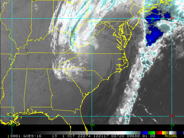
Now a hybrid Hurricane Ian, the cyclone is restrengthening over the very warm waters off the southeast coast along the Gulf Stream, and is now back up to 85 MPH at the time of this post, and still strengthening. Storms like Ian tend to over-perform many models and indeed official forecasts, so residents in Ian's path should prepare for a full Category higher than forecast. That is also always a good thing to do, no matter the storm.
Ian or its remnants may make landfall, move inland, and then reemerge over the the Gulf Stream in a few days, but hopefully by that time up and away. For good.
Elsewhere, conditions across the Atlantic continue generally favorable for additional development. The "it only takes one" doesn't also necessarily mean, "and done."
For in-depth model analysis and a place for more speculative discussions, join us in the Ian Forecast Lounge
September 2022 has now generated more Accumulated Cyclone Energy (ACE) than either September 2020 or September 2021. It has now produced the 11th most September ACE since 1980. ACE is integrated metric accounting for storm frequency, intensity, and duration. #Hurricane#Ianpic.twitter.com/Wf6vaWo7ZI


 Threaded


