Current Radar or Satellite Image

Flhurricane.com - Central Florida Hurricane Center - Tracking Storms since 199531 Years of Hurricanes Without the Hype - Since 1995


Hurricane Fausto heads towards the Hawaiian Islands and Wataches may go up by early next week. Atlantic is quiet again.
Days since last Hurricane Landfall — US Any: 655 (Milton), US Major: 655 (Milton), FL Any: 655 (Milton), FL Major: 655 (Milton)
FlHurricane Atlantic Tropical Cyclone Tracking 🌀 Since 1995
None
HypeScale:
4.00
0510
Communication
Storm Data
Content
Follow & Connect


Archives 2020s >> 2024 Forecast Lounge

Jump to first unread post. Pages: 1
cieldumortModerator
Moderator


Reged:
Posts: 2738
Loc: Austin, Tx
Gordon Lounge
      #115124 - Mon Sep 09 2024 12:20 PM


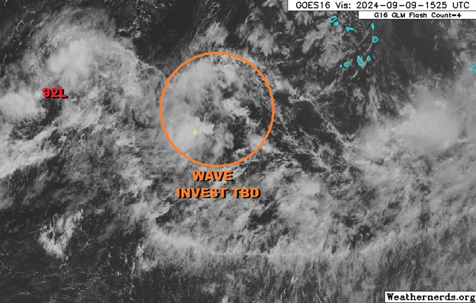
A stout trof located to the east-southeast of Invest 92L is showing some initial signs of organization today and as it has strong model support for development and what appears to be an upswing in favorable conditions with potential to become a significant long-track Cabo Verde type tropical cyclone, we are starting a Lounge on it at this time. This feature is not yet Invest-tagged, but will likely be so soon if trends continue.


The trof with the wave set to interact with and take over it is now being tracked as one Invest, tagged 93L, and the title has been updated accordingly.

2024-09-11 12:00 15.8 -27.9 30 SEVEN
2024-09-13 12:00 19.2 -38.3 35 GORDON

Ciel

Edited by cieldumort (Fri Sep 13 2024 01:14 PM)


Post Extras: Print Post   Remind Me!   Notify Moderator  
cieldumortModerator
Moderator


Reged:
Posts: 2738
Loc: Austin, Tx
Re: E ATL Trof [Re: cieldumort]
      #115127 - Mon Sep 09 2024 03:19 PM


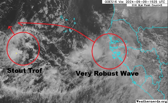
To add more clarity and context to the Trof in the far eastern Atlantic that is now up to 70% NHC development odds (within 7 days).

The NHC forecast, as do many models, expects the very robust wave now rolling off of western Africa to track wnw faster than the trof further west does, and for it to grab it and develop together. This is very possible, but also given how robust both are already, it is somewhat possible each develops on their own, with the trof less likely to become a fish spinner in that case, and the wave more likely to hook north prior to getting very far west. Should the two merge in order to develop, modeling shows a number of possible future solutions that are either fish spinny or potentially sneaking further west.


Post Extras: Print Post   Remind Me!   Notify Moderator  
Pages: 1


Extra information
0 registered and 1 anonymous users are browsing this forum.

Moderator:  CFHC, MikeC, Ed Dunham, Colleen A., Atricks, danielw, Clark, Christine H, RedingtonBeachGuy, SkeetoBite, Bloodstar, tpratch, typhoon_tip, cieldumort, Jackie M, Wigeon, Hank Buck 

Print Topic

Forum Permissions
      You cannot start new topics
      You cannot reply to topics
      HTML is disabled
      UBBCode is enabled

Rating:
Topic views: 3238

Rate this topic

Jump to