cieldumort
Moderator

Reged:
Posts: 2948
Loc: Austin, Tx
|
|
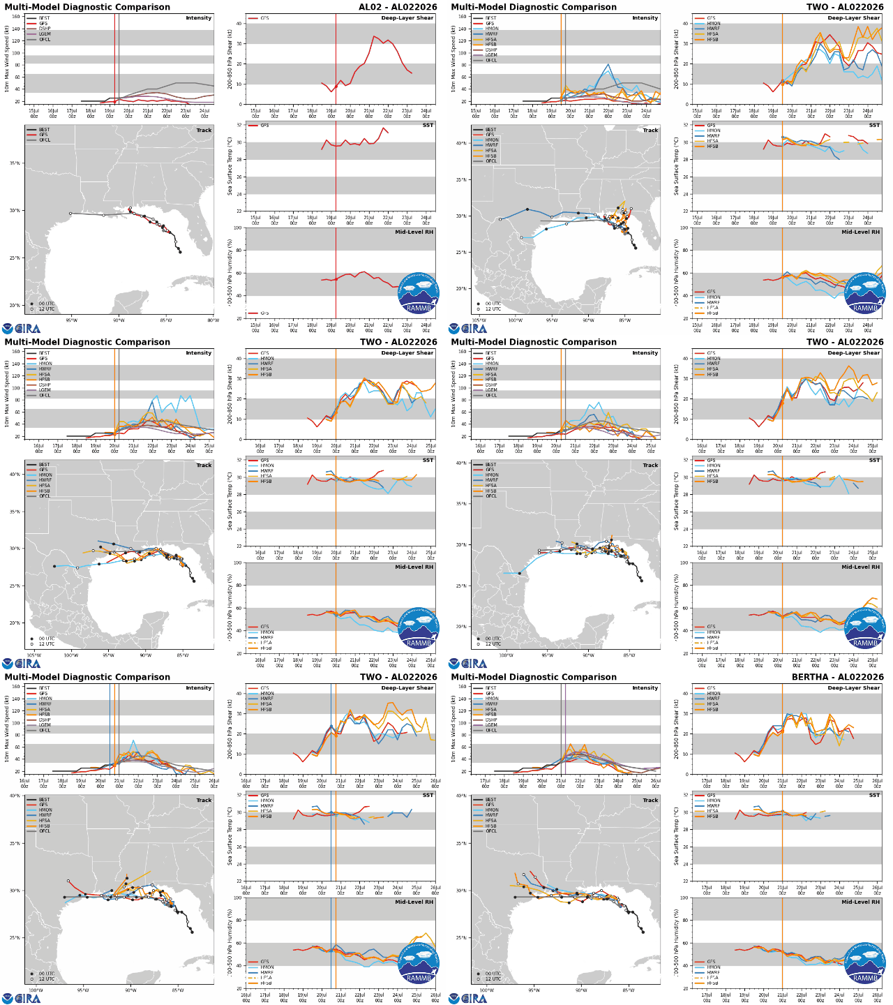
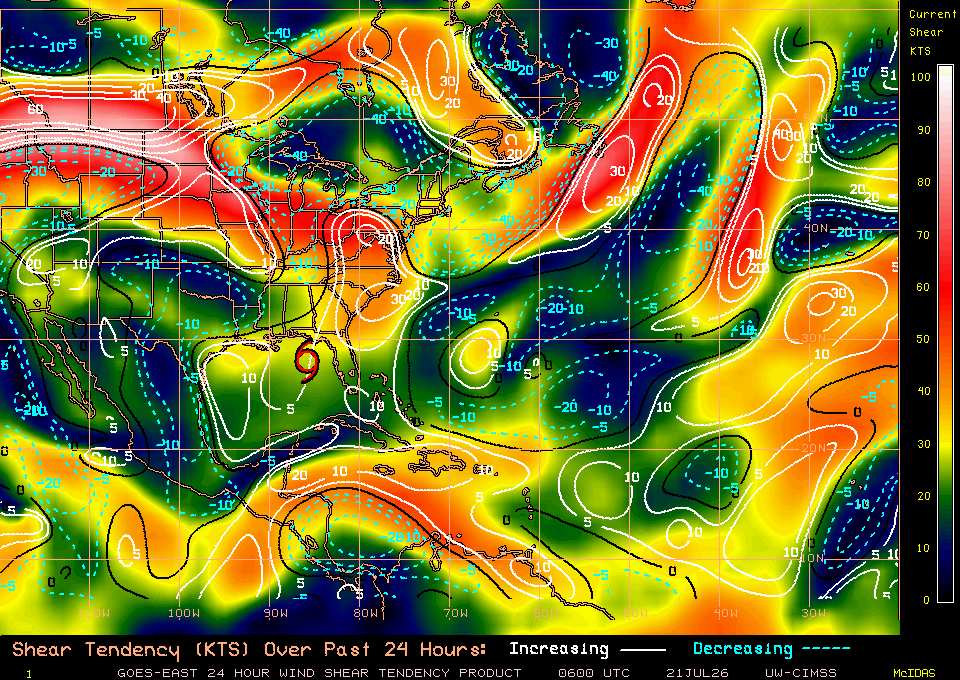
Shear is back to getting the best of Bertha's valiant attempt to strengthen even more overnight, and is largely forecast to only increase for several days.
|
cieldumort
Moderator
Reged:
Posts: 2948
Loc: Austin, Tx
|
|
|
CFHC

Reged:
Posts: 217
Loc: East Central Florida
|
|
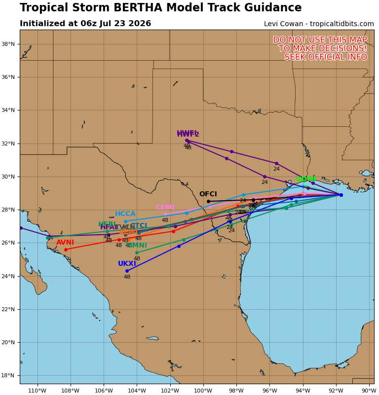
Bertha has likely peaked today, shear is unrelenting, most of the ensembles have it over Louisiana, and it still appears the most likely, south side is still pulsing with activity. A non nino year bertha would be formidible.
|
cieldumort
Moderator
Reged:
Posts: 2948
Loc: Austin, Tx
|
|
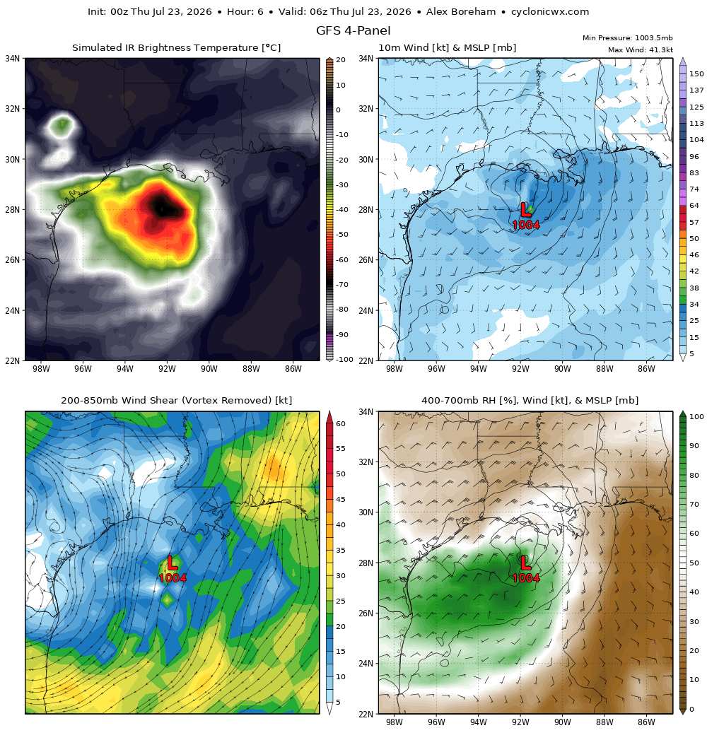
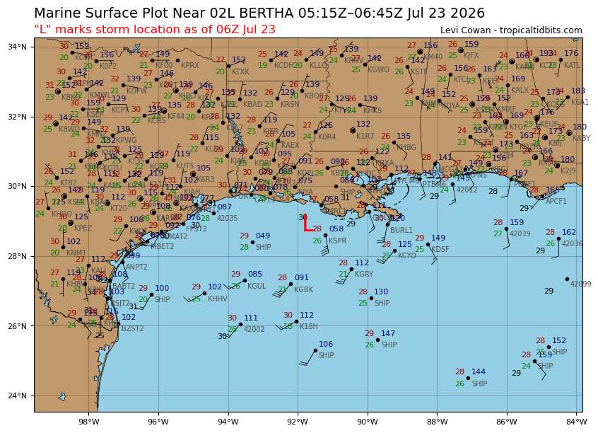
23/0z may have forecast a fairly accurate initial state for Bertha as of 06Z Thursday. Something to keep in mind when considering the for the remainder of Bertha's run.
|
cieldumort
Moderator
Reged:
Posts: 2948
Loc: Austin, Tx
|
|
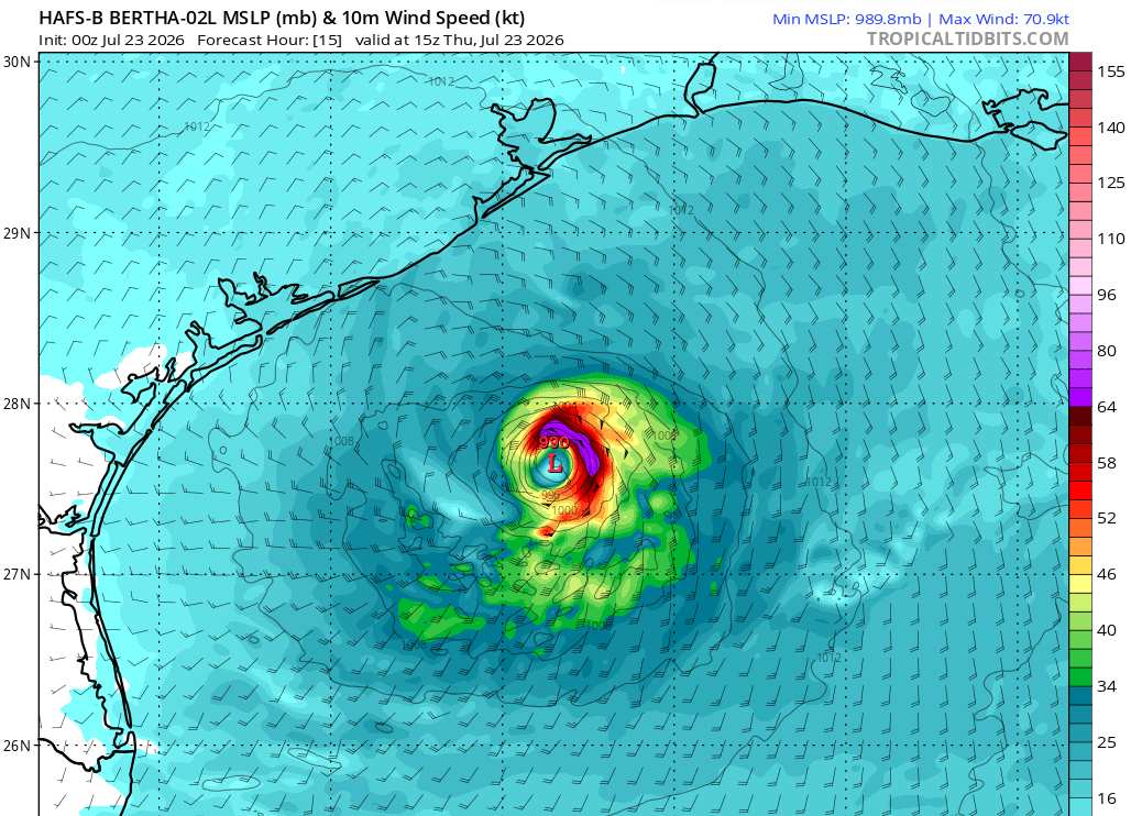
In light of Bertha's current state and the weather being produced in the Gulf south of Louisiana and east of Texas overnight, the runs that bring Bertha up to a hurricane-force storm shown here now seem entirely plausible.
Hurricane-force winds already occurred earlier tonight within Bertha's MCV (though not necessarily representative of a surface low ~ we simply have no recon in there at this time).
HAFS-A
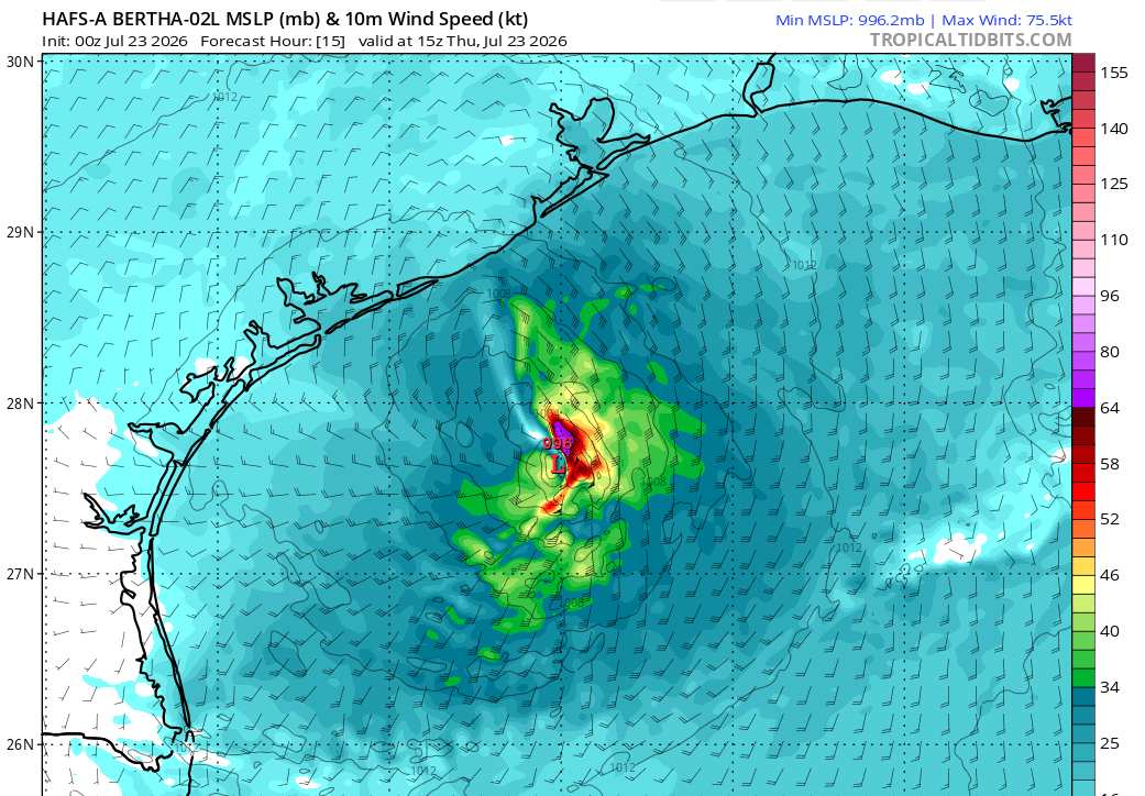
HAFS-B
|
cieldumort
Moderator
Reged:
Posts: 2948
Loc: Austin, Tx
|
|
|
cieldumort
Moderator
Reged:
Posts: 2948
Loc: Austin, Tx
|
|
|



 Previous
 Index
Index
 Next
Next
 Threaded


 [Re:
[Re:  Edit
Edit
 Reply
Reply
 Quote
Quote


