cieldumort
Moderator

Reged:
Posts: 2727
Loc: Austin, Tx
|
|
1:30AM CDT 21 July, 2026 Update
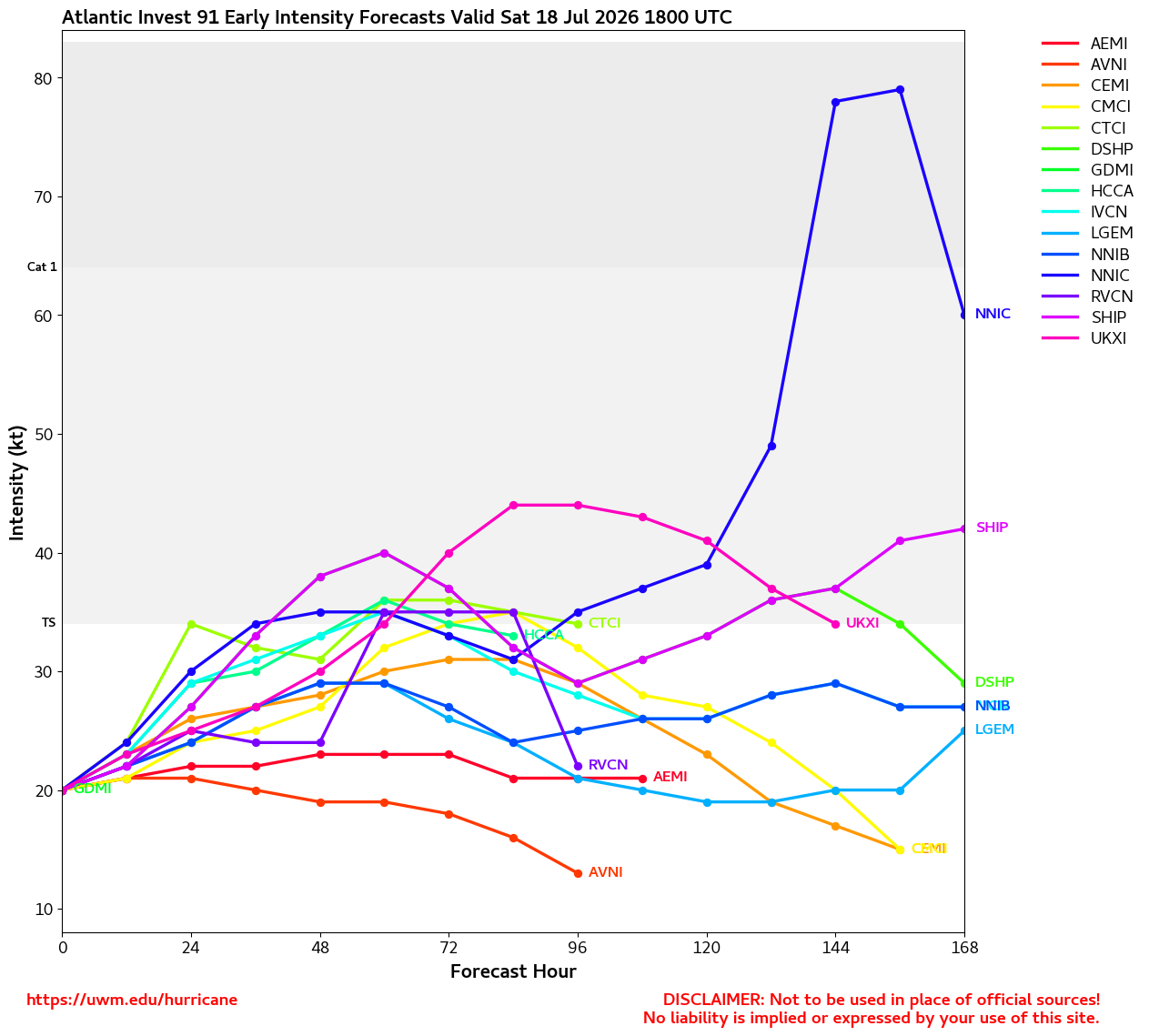
Bertha continues intensifying. A few models are back to suggesting potential for a hurricane near or just south of Louisiana and these runs are now plausible, although still not the official forecast and especially tenuous given the expected increasing shear.
Ciel
10PM CDT 20 July, 2026 Update
Now Tropical Storm Bertha continues to intensify tonight as the center has finally nestled underneath the deepest convection that is firing in the southern half of the circulation. With the center finding ways to stay even a little bit south, this keeps open the window for the cyclone to survive past Louisiana and perhaps go all the way to Texas.
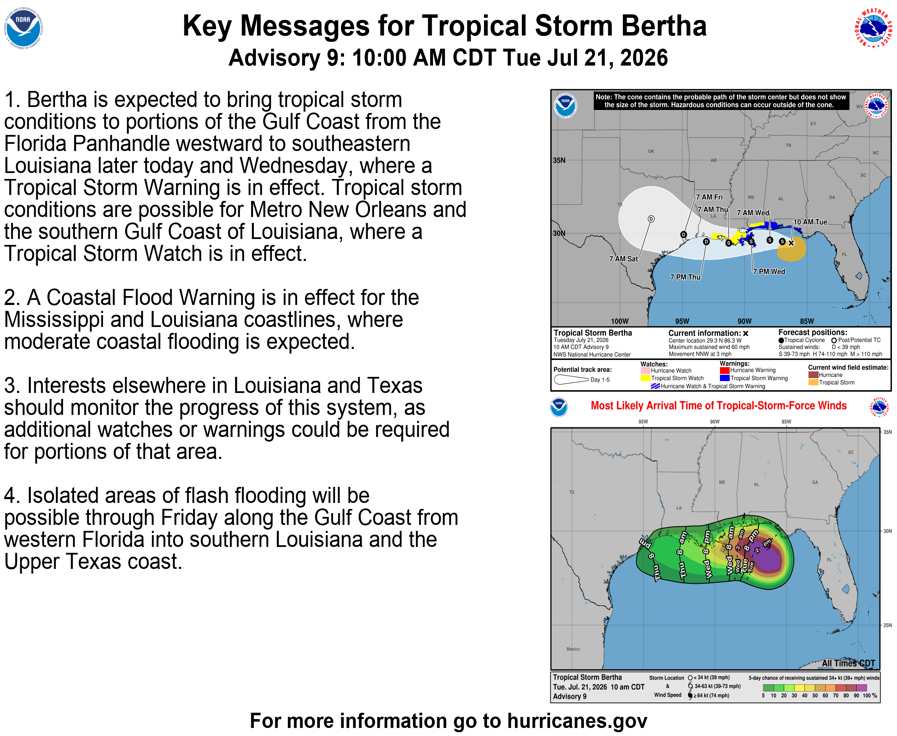
In the meantime, Tropical Storm conditions are now occurring offshore and increasingly likely to occur along portions of the northern Gulf coast. With that, Tropical Storm Warnings are now being issued.
Ciel
12PM EDT 20 July, 2026 Update
Tropical Depression Two: The struggle is real. Northeasterly shear has overtaken dry air as the leading cause of the depression's inability to get named. Models have dramatically peddled back on their bullish outlooks and most now favor a low/mid-range tropical storm tracking into Louisiana or thereabouts, followed by an eventual demise over land.
There is a modest but decreasing chance that the cyclone remains more offshore and can avail itself of the very warm gulf waters, so a stronger system that makes it further west is still a possibility, but no longer the probability. More details on this can be found in the Lounge.
Ciel
11AM EDT 19 July, 2026 Update
Invest 91L has become Tropical Depression Two and Advisories have begun.
Ciel
3:00AM EDT 19 July, 2026 Update
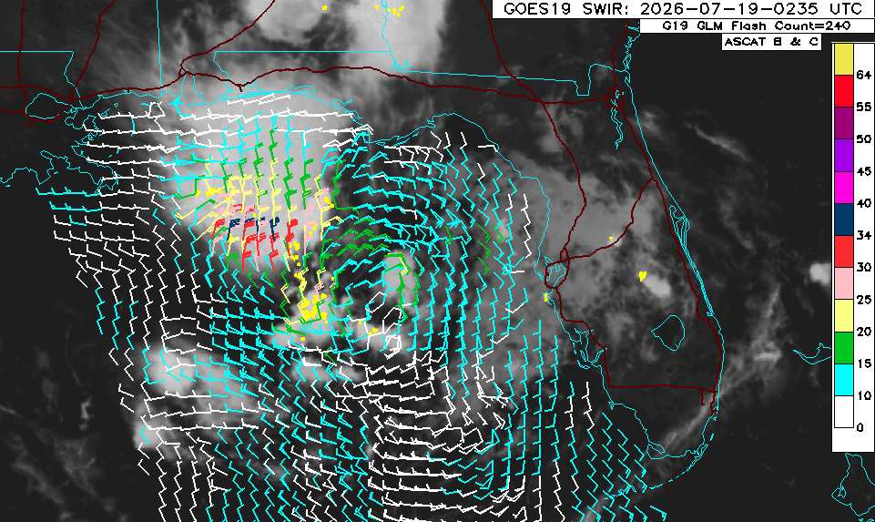
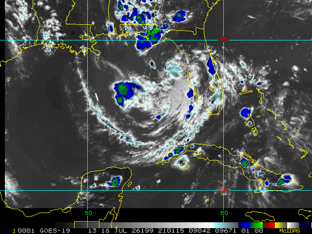
Tonight, Invest 91L now has somewhat of a surface circulation and also pressures at the surface are falling. However, the system lacks sufficient and organized deep convection as it is battling dry air and shear from an upper-level low impinging from the north. Nonetheless, it has more than a few avenues for tropical cyclone genesis to occur over the next 6-72 hours, and is more likely than not to develop. The next name on the list in 2026 is Bertha.
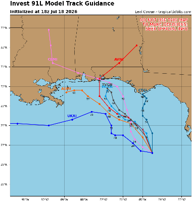
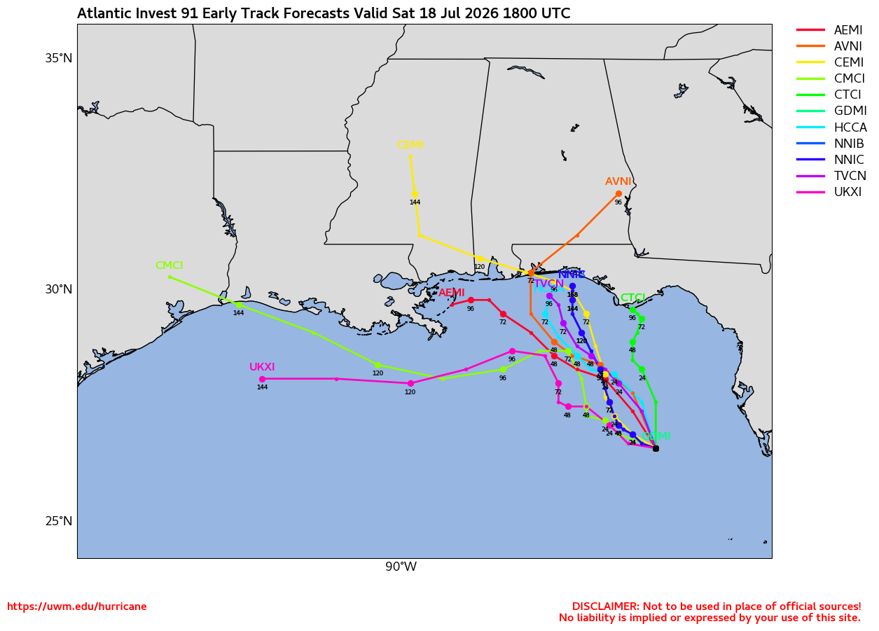
As far as track is concerned, earlier and stronger development could favor continued jogs ~ if not an outright persistent course ~ to the west. This could ultimately put Texas and/or northeastern Mexico on play. A somewhat delayed and/or weaker development would probably tend to favor a track heading as far east as Florida's Big Bend to as far west as the upper Texas gulf coast.
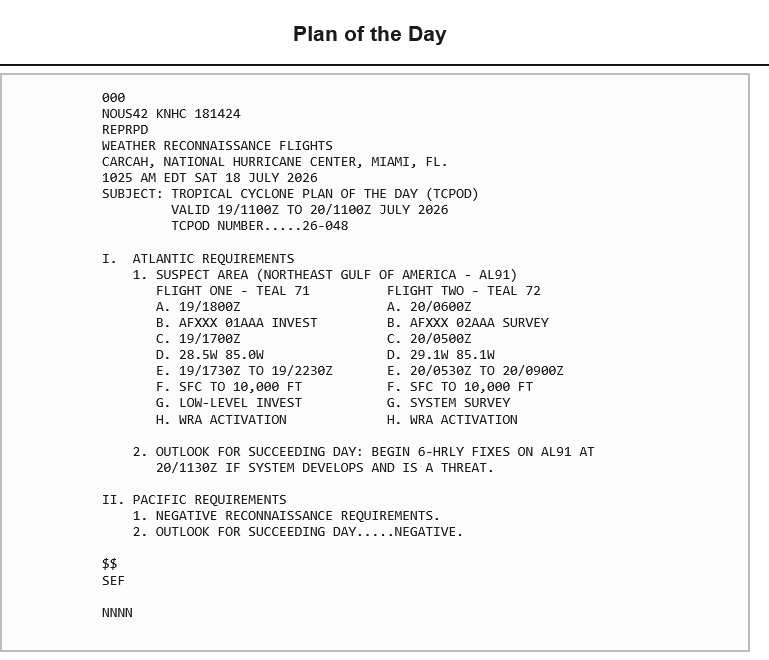
Recon will help and is scheduled to start heading in later today.
Ciel
12:45PM EDT 18 July, 2026 Update
The Area of Interest we have been tracking in the Gulf has been Invest tagged, and is now being monitored as Invest 91L. Recon has been tasked to begin flying in on Sunday. There are some indications that the environment for development may now be going up, perhaps even quite a bit overnight tonight, and so they may encounter a closed surface low when they get in there tomorrow.
Modeling has been a little vague, but with a more coherent system coming together and especially with recon scheduled to go in, should start being more reliable soon. Interests all along and in the Gulf may want to follow along with us on this one. Lots more modeling data, analysis and speculation can be found in the Lounge.
-Ciel
Original Update
We are now closely monitoring two systems that while still officially listed as having "slight" chances for development, are already producing heavy weather.
The first, and closest to home, is an area of closed low pressure aloft that is building down towards the surface, not yet Invest-tagged,
but we already have a Forecast Lounge up on this one:
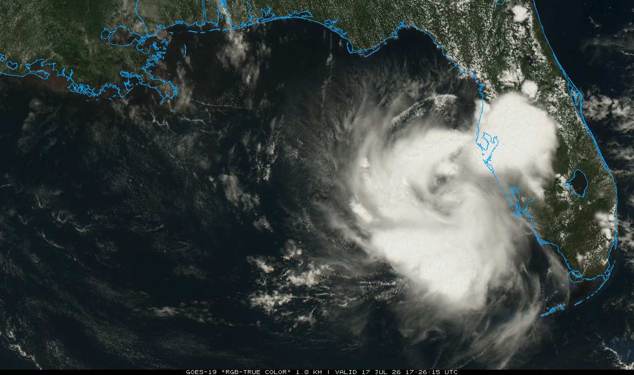
Eastern Gulf Low Forecast Lounge (INVEST 91L)
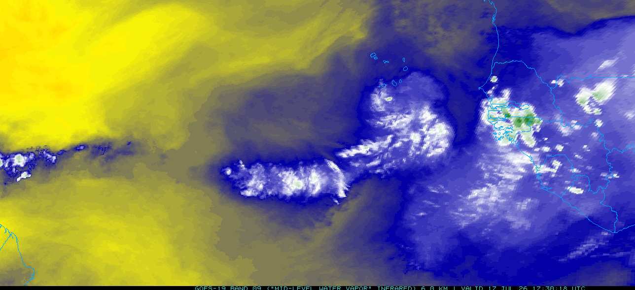
The second is a stout tropical wave now located south of the Cabo Verde Islands in the far eastern Atlantic, but encountering cooler waters and stable air.
|
cieldumort
Moderator
Reged:
Posts: 2727
Loc: Austin, Tx
|
|
|
cieldumort
Moderator
Reged:
Posts: 2727
Loc: Austin, Tx
|
|
|
|




 Previous
 Index
Index
 Next
Next
 Threaded

 Edit
Edit
 Reply
Reply
 Quote
Quote