MikeC
Admin
Reged:
Posts: 4839
Loc: Orlando, FL
|
|
4PM ET (10AM HT) 15 August, 2026 Update
Lala has become a hurricane and is also now seemingly pulling a bit right (north) of prior track, as many of the more bullish hurricane models expected. This will bring more of the most dangerous weather to the Big Island for many hours to come, and preparations to protect life and property should already be completed, ideally.
Ciel
1PM ET (7AM HT) 15 August, 2026 Update
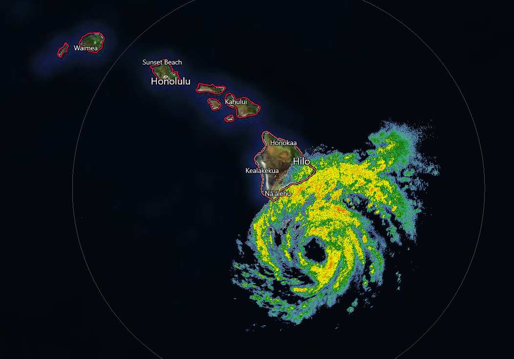
Recon has left Hawaii, following protocol given safety and logistic considerations. However, based on radar, satellite and microwave analysis, Lala will likely soon be a hurricane, already with a ragged eye apparent.
Track has been a little left (south) of forecast and many models (esp the hurricane models). A track that avoids landfall could preclude history books, but actually lessen the possible disruption of the center tracking over the very high mountains of the Big Island.
Regardless of exact track, this is a very dangerous tropical cyclone that will undoubtedly dump tons of rain resulting in flooding and mudslides. Preps to protect life and property should be rushed to completion.
Ciel
1:30PM ET 14 August, 2026 Update
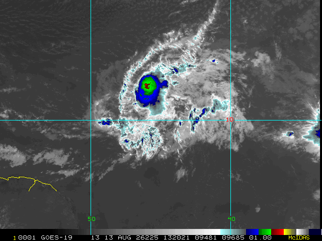
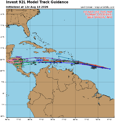
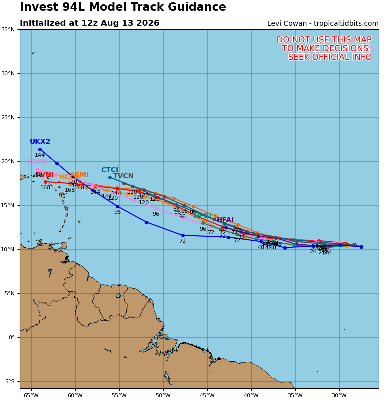
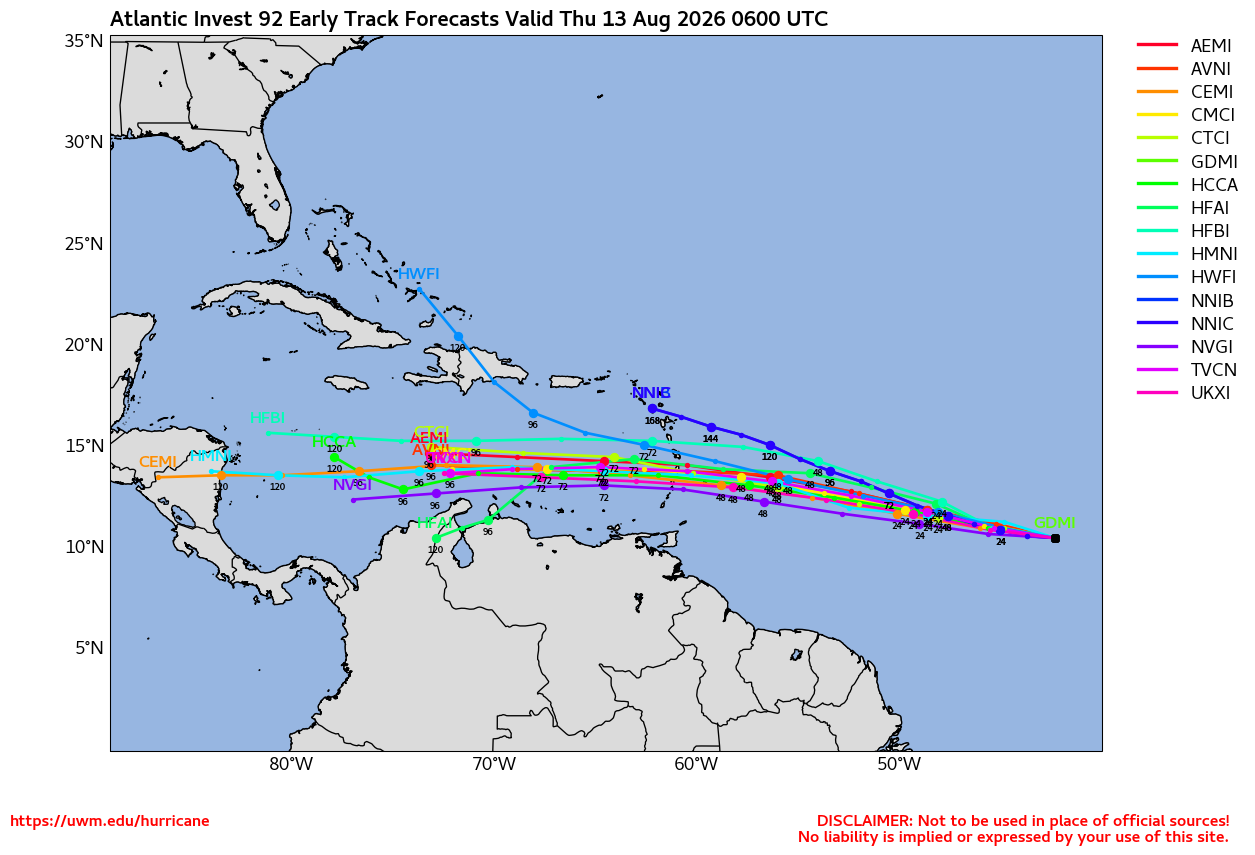
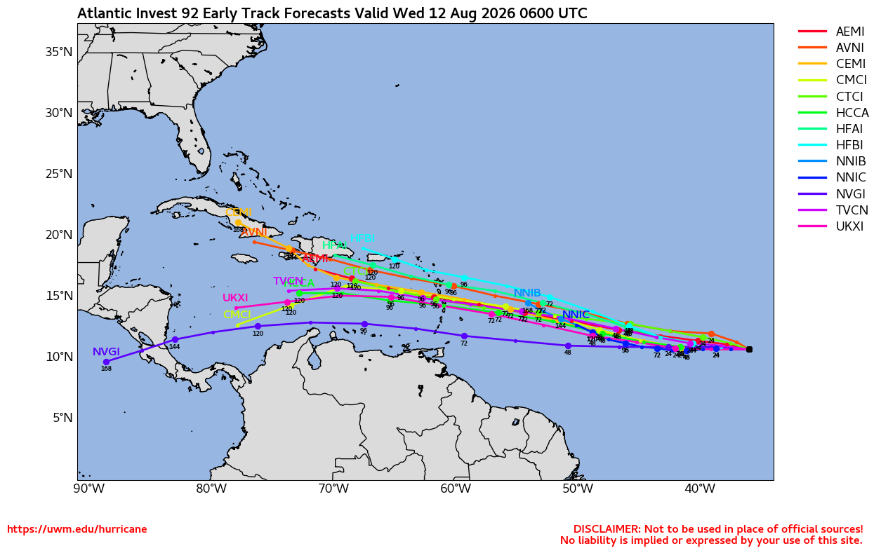
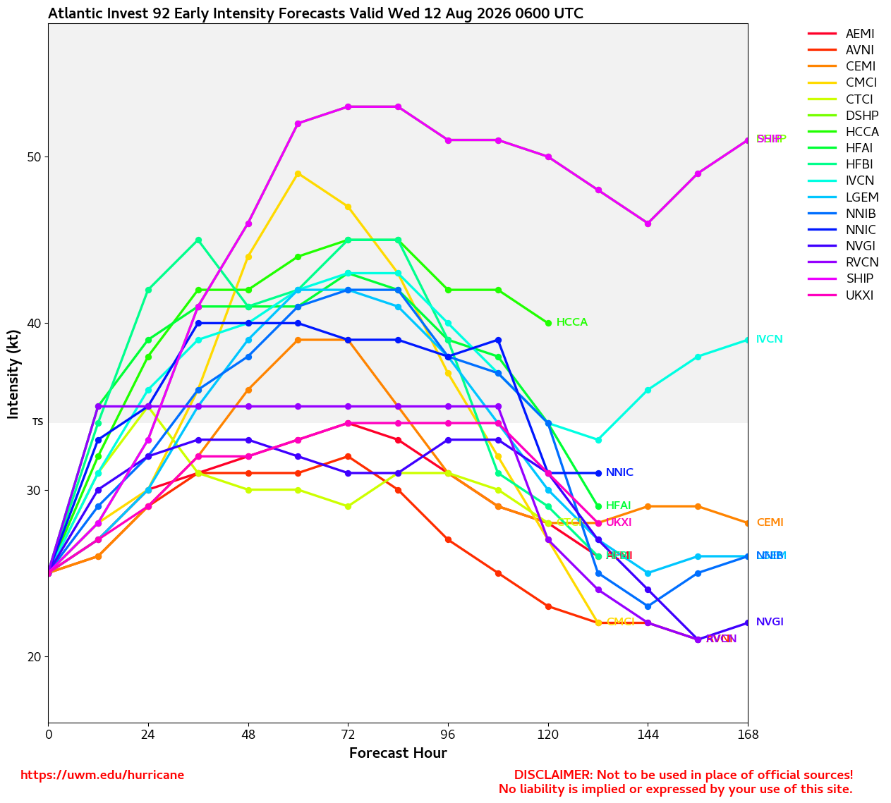
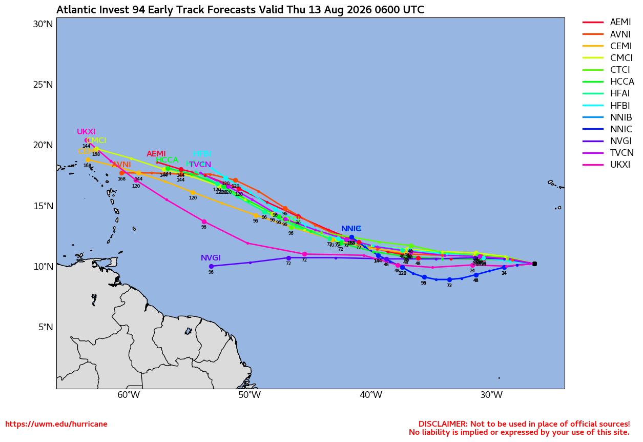
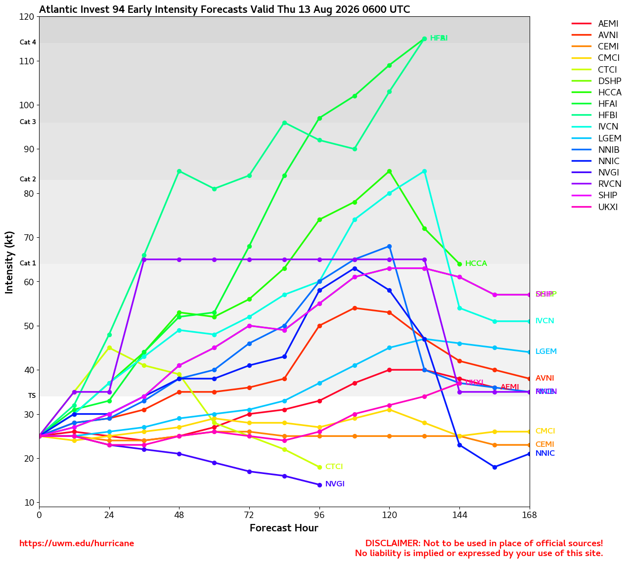
In the Main Development Region of the Atlantic basin, Invest 92L is approaching the Lesser Antilles today with a large area of showers and thunderstorms. Development odds per have dropped dramatically, now just 20%. Nonetheless, some pockets of heavy rain and winds up to 30-40 MPH in spots seems likely. Maybe not the best beach day. Behind 92L, 94L continues to have better model support for development potential and still assigns it a coin-flip shot of development within the next 7 days. All in all, this historic and record-setting El Niño has drastically hampered attempts of development and/or strengthening in the Atlantic.
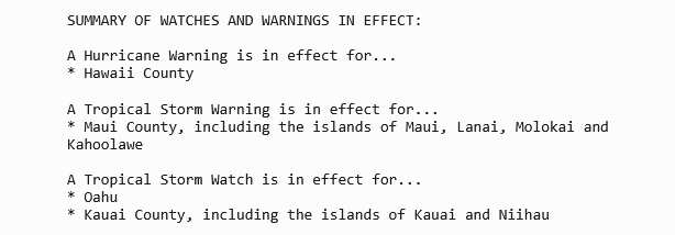
On the other side of the , Hawaii is facing a significant threat of serious impacts from Tropical Storm Lala, which is forecast to be at or near hurricane intensity during passage very near or directly over the Big Island. Preparations on the Big Island to protect life and property should be rushed to completion today. Life-threatening flooding, mudslides, winds, surge and waves are likely over the weekend.
Ciel
11:30AM ET 13, August, 2026 Update
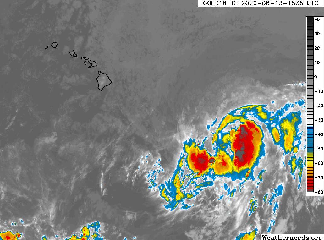
Above: Tropical Storm Lala on approach to Hawaii. Image credit: Weathernerds.org
A Hurricane Watch has been issued for the Big Island of Hawaii. Now Tropical Storm Lala is forecast to be at or near hurricane strength as it crosses the Hawaiian island. Very heavy rain will begin to impact the Big Island tomorrow, Friday, and spread throughout the chain over the weekend, resulting in potentially life-threatening flooding and mudslides.We have a Forecast Lounge up for Lala.
Elsewhere, the Atlantic basin is less than favorable for development and seeming to trend more and more inhospitable by the day. Invests 92L and 94L struggle in the Main Development Region and it is nowhere near certain that either one gets named.
Ciel
2:30AM ET 13, August, 2026 Update
Very challenging conditions for development abound throughout the Atlantic basin. The northernmost feature, a subtropical trof that broke off to the northeast, actually picked up the name Cristobal, and might be the saddest looking tropical storm of the year so far. But, there's still time for a challenger to take that title away. Invests 92L and 94L are trying.
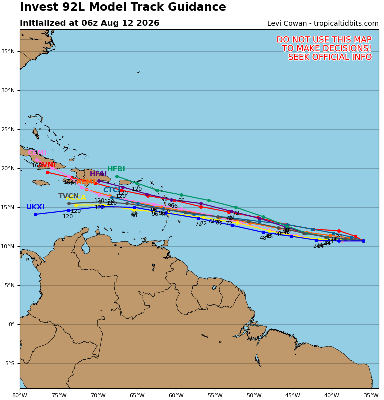
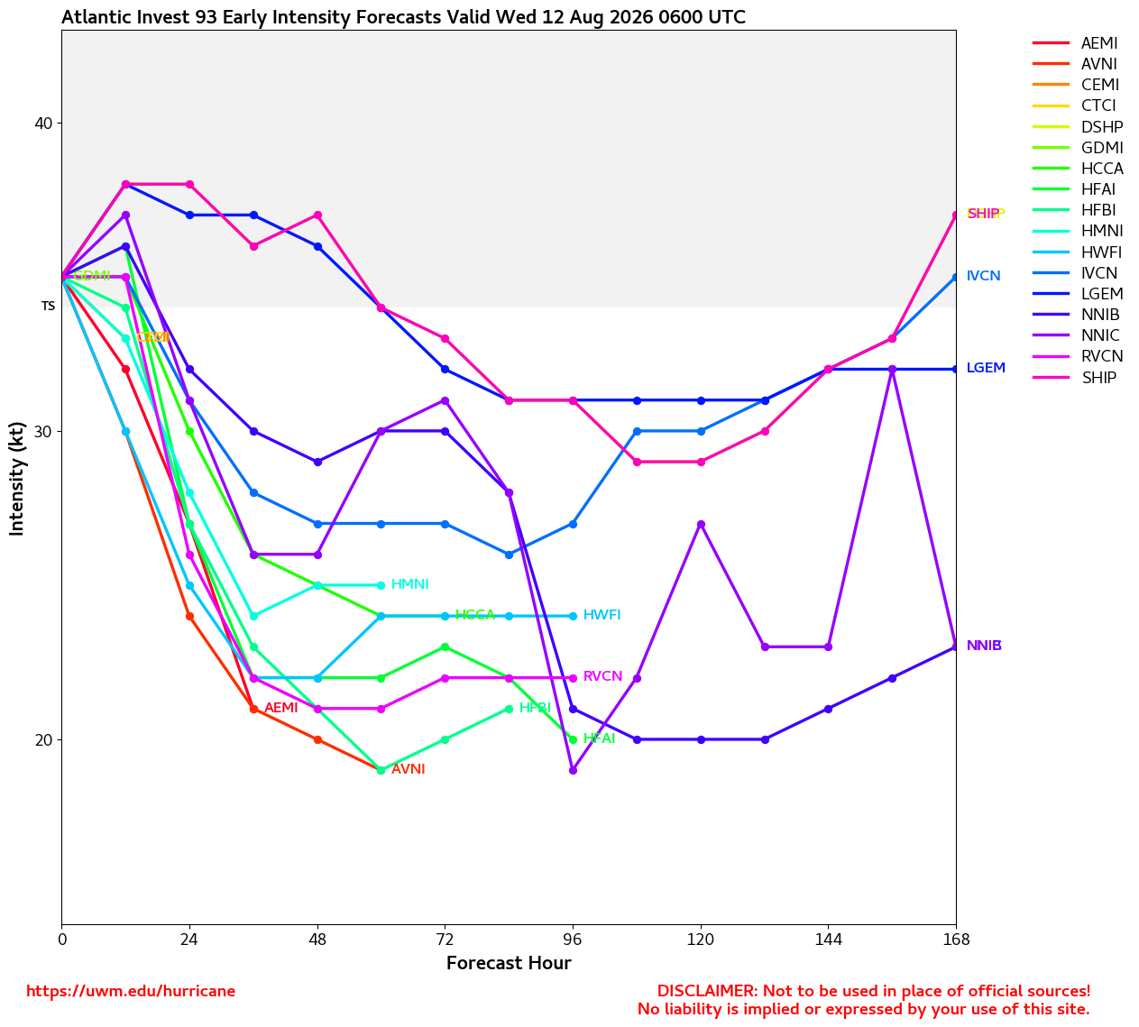
92L has been a borderline TD for at least a half a day now. One could understand if went ahead and numbered it. Models keep backing down on its potential, most now never strengthening it beyond a low-end tropical storm or depression.
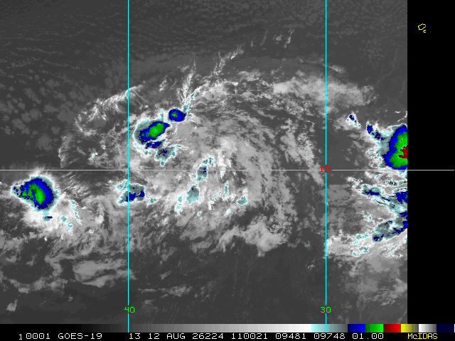
94L is not especially organized still, despite occasionally sporting beefier convection than either 92L or Cristobal. Fewer ensemble models seem to want to develop this one now, also.
In the central Pacific, all eyes are on Storm One-C, still a "Potential Tropical Cyclone," but one that is already producing winds of tropical storm force. The expectation is that its elongated circulation with presently two vorticity maxima comes together as one and intensifies as it heads towards Hawaii, but this is still a little uncertain. Nonetheless, interests in Hawaii may want to begin paying very close attention, as even if One-C does not organize much more (low chance, but possible), heavy, flooding rains and strong winds will still be likely.
Ciel
Original Update
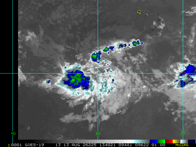
The Atlantic has three areas of interest this morning. The first area is new, the northern one, quickly moving east. It could develop into a short live system before it hits cooler waters. This has a 10% chance according to the National Hurricane Center.
The second area is the leading wave in the Central Atlantic is heading west with a 10% chance also, this one is less likely to develop and if it does likely to hit shear from the ahead of it keeping it from developing, those in the Caribbean will want to watch it still however for around Thursday.
The last area is east of there, south of the Cape Verde islands, with a 60% chance to develop, this one is likely the most prime candidate to develop, however, none of them have been invest tagged yet (this one may get tagged later today or tomorrow). It could be the one that slips through the shear, however more likely to miss the islands to the north. But those in the Caribbean still should watch this coming weekend to Monday if this system is weaker than expected. Bermuda also may want to watch much later for mid to late next week as it could get close. That's currently the most likely scenario right now, but it could change. Watch here or the lounge on flhurricane for a bit more speculation. Lounge thread https://flhurricane.com/cyclone/showflat...;vc=#Post116098 The general high shear environment of el nino is still there, and this system is likely to struggle to develop.
In the Central Pacific, invest CP93 has a 90% chance, and Hawaii should watch closely.
Edited by cieldumort (Sat Aug 15 2026 05:05 PM)
|
cieldumort
Moderator

Reged:
Posts: 2765
Loc: Austin, Tx
|
|
Preliminary Local Storm Report
National Weather Service Honolulu HI
1008 AM HST Sat Aug 15 2026
..TIME... ...EVENT... ...CITY LOCATION... ...LAT.LON...
..DATE... ....MAG.... ..COUNTY LOCATION..ST.. ...SOURCE....
..REMARKS..
0820 AM Non-Tstm Wnd Gst 2 WNW Maalaea 20.80N 156.54W
08/15/2026 M75 MPH Maui HI Mesonet
Mesonet station 001HE Meco Kealaloloa Ridge.
0820 AM Non-Tstm Wnd Gst 6 ESE Kawaihae 20.02N 155.75W
08/15/2026 M72 MPH Hawaii HI Mesonet
Mesonet station 114HE Hawaii 202602.
0835 AM Non-Tstm Wnd Gst 5 SE Kula 20.70N 156.27W
08/15/2026 M68 MPH Maui HI Mesonet
Mesonet station DVI08828 Kula.
0830 AM Non-Tstm Wnd Gst 5 ENE Kawaihae 20.08N 155.76W
08/15/2026 M66 MPH Hawaii HI Mesonet
Mesonet station 056HE Helco Kohala Mountain
Rd.
0815 AM Non-Tstm Wnd Gst 5 ENE Kawaihae 20.06N 155.75W
08/15/2026 M64 MPH Hawaii HI Mesonet
Mesonet station 062HI Puuloa.
0825 AM Non-Tstm Wnd Gst 7 ESE Kaunakakai 21.07N 156.92W
08/15/2026 M63 MPH Maui HI Mesonet
Mesonet station TT918 Mokolelau 1.
0830 AM Non-Tstm Wnd Gst 1 NW Ukumehame Beach Pa 20.81N 156.59W
08/15/2026 M63 MPH Maui HI Mesonet
Mesonet station 030HE Meco Ukumehame Gulch.
0800 AM Non-Tstm Wnd Gst 7 NNE Mauna Kea Summit 19.92N 155.42W
08/15/2026 M61 MPH Hawaii HI Mesonet
Mesonet station PMLH1 Puu Mali.
0824 AM Non-Tstm Wnd Gst 17 WNW Kaunakakai 21.22N 157.25W
08/15/2026 M60 MPH Maui HI Mesonet
Mesonet station TT917 Ilio 1.
|
cieldumort
Moderator
Reged:
Posts: 2765
Loc: Austin, Tx
|
|
Preliminary Local Storm Report
National Weather Service Honolulu HI
1133 AM HST Sat Aug 15 2026
..TIME... ...EVENT... ...CITY LOCATION... ...LAT.LON...
..DATE... ....MAG.... ..COUNTY LOCATION..ST.. ...SOURCE....
..REMARKS..
1131 AM Non-Tstm Wnd Gst Mauna Kea Summit 19.81N 155.47W
08/15/2026 M127 MPH Hawaii HI Mesonet
CFHT/GEM sensor on Maunakea Summit.
|
cieldumort
Moderator
Reged:
Posts: 2765
Loc: Austin, Tx
|
|
Preliminary Local Storm Report
National Weather Service Honolulu HI
1215 PM HST Sat Aug 15 2026
..TIME... ...EVENT... ...CITY LOCATION... ...LAT.LON...
..DATE... ....MAG.... ..COUNTY LOCATION..ST.. ...SOURCE....
..REMARKS..
1214 PM Non-Tstm Wnd Gst Mauna Kea Summit 19.81N 155.47W
08/15/2026 M140 MPH Hawaii HI Public
CFHT/GEM station on Maunakea Summit.
|
cieldumort
Moderator
Reged:
Posts: 2765
Loc: Austin, Tx
|
|
Hurricane Lala Local Statement Advisory Number 15
National Weather Service Honolulu HI CP012026
538 PM HST Sat Aug 15 2026
This product covers the Hawaiian islands
**LIFE-THREATENING WINDS AND FLOODING RAIN WILL EXPAND TO THE REST
OF THE STATE AS LALA CONTINUES GENERALLY WESTWARD**
NEW INFORMATION
---------------
* CHANGES TO WATCHES AND WARNINGS:
- None
* CURRENT WATCHES AND WARNINGS:
- A Hurricane Warning is in effect for Big Island East, Big
Island Interior, Big Island North, Big Island South, Big Island
Southeast, Big Island Summits, Kohala, and Kona
- A Tropical Storm Warning is in effect for Central Oahu, East
Honolulu, Ewa Plain, Haleakala Summit, Honolulu Metro,
Kahoolawe, Kauai East, Kauai Mountains, Kauai North, Kauai
South, Kauai Southwest, Kipahulu, Koolau Leeward, Koolau
Windward, Lanai Leeward, Lanai Mauka, Lanai South, Lanai
Windward, Maui Central Valley North, Maui Central Valley South,
Maui Leeward West, Maui Windward West, Molokai Leeward South,
Molokai North, Molokai Southeast, Molokai West, Molokai
Windward, Niihau, Oahu North Shore, Olomana, South Haleakala,
South Maui/Upcountry, Waianae Coast, Waianae Mountains, and
Windward Haleakala
* STORM INFORMATION:
- About 220 miles southeast of Honolulu or about 70 miles south
of Kailua-Kona
- 18.7N 156.0W
- Storm Intensity 80 mph
- Movement Northwest or 320 degrees at 9 mph
SITUATION OVERVIEW
------------------
Hurricane Lala will continue to bring damaging winds, heavy rainfall
leading to flash flooding, and dangerously high surf to portions of
the state through the weekend. Impacts are ongoing over portions of
the Big Island of Hawaii, spreading westward across Maui County and
Oahu this evening into tonight, and Kauai late tonight into Sunday
morning. Lala is skirting the southern end of the Big Island of
Hawaii this evening and will pass just south of the rest of the
island chain through Sunday. Damaging winds and heavy rainfall are
expected to spread westward across the rest of the state through the
remainder of the weekend, with the Big Island of Hawaii likely
seeing the greatest impacts. Do not focus on the exact forecast
track or intensity of Lala at this time, and be prepared for changes
in future forecasts. It is very important to note that the
mountainous terrain of the islands will likely produce localized
areas of highly enhanced and damaging winds, even well away from the
tropical cyclone center.
Flooding rain will continue for portions of the Big Island of Hawaii
as Lala passes. The threat for flooding will increase over Maui
County this evening and spread to the rest of the state later
tonight through Sunday. Heavy rainfall could persist into Monday for
some areas, mainly over the western end of the island chain. Lala is
expected to produce additional rainfall totals of 5 to 10 inches
across the Big Island and Maui County and 4 to 6 inches across the
remainder of the island chain. Locally higher amounts are possible.
While the highest rainfall amounts will be focused over windward
areas and higher terrain, leeward areas will also have a significant
flood risk.
The large easterly swell generated by Lala peaked earlier today.
Surf along along exposed east and southeast shores will gradually
fade over the next couple of days. However, some increase in surf is
possible along exposed south-facing shores as Lala continues
westward. Significant beach erosion and overwash are still possible
across vulnerable coastal infrastructure.
POTENTIAL IMPACTS
-----------------
* WIND:
Potential impacts from the main wind event are now unfolding across
the Big Island of Hawaii and Maui. Remain well sheltered from
life-threatening wind having additional extensive impacts. If realized,
these impacts include:
- Considerable roof damage to sturdy buildings, with some having
window, door, and garage door failures leading to structural
damage. Mobile homes severely damaged, with some destroyed.
Damage accentuated by airborne projectiles. Locations may be
uninhabitable for weeks.
- Many large trees snapped or uprooted along with fences and
roadway signs blown over.
- Some roads impassable from large debris, and more within urban
or heavily wooded places. Several bridges, causeways, and
access routes impassable.
- Large areas with power and communications outages.
Potential impacts from the main wind event are also now unfolding
across the rest of the state. Remain well sheltered from dangerous
wind having additional limited to significant impacts.
* SURGE:
Potential impacts from the main surge event are now unfolding across
the Big Island of Hawaii and Maui. Remain well away from locally hazardous
surge having possible limited impacts. If realized, these impacts
include:
- Localized inundation with storm surge flooding mainly along
immediate shorelines and in low-lying spots, or in areas
farther inland near where higher surge waters move ashore.
- Sections of near-shore roads and parking lots become overspread
with surge water. Driving conditions dangerous in places where
surge water covers the road.
- Moderate beach erosion. Heavy surf also breaching dunes, mainly
in usually vulnerable locations. Strong rip currents.
- Minor to locally moderate damage to marinas, docks, boardwalks,
and piers. A few small craft broken away from moorings.
* FLOODING RAIN:
Potential impacts from the flooding rain are still unfolding across
the Big Island of Hawaii and Maui. Remain well guarded against
life-threatening flood waters having additional extensive impacts.
If realized, these impacts include:
- Major rainfall flooding may prompt many evacuations and rescues.
- Rivers and tributaries may rapidly overflow their banks in
multiple places. Small streams, creeks, canals, arroyos, and
ditches may become dangerous rivers. In mountain areas,
destructive runoff may run quickly down valleys while
increasing susceptibility to rockslides and mudslides. Flood
control systems and barriers may become stressed.
- Flood waters can enter many structures within multiple
communities, some structures becoming uninhabitable or washed
away. Many places where flood waters may cover escape routes.
Streets and parking lots become rivers of moving water with
underpasses submerged. Driving conditions become dangerous.
Many road and bridge closures with some weakened or washed out.
Potential impacts from the flooding rain are still unfolding across
the rest of the state. Remain well guarded against dangerous flood
waters having possible limited to significant impacts.
* TORNADOES:
Potential impacts from tornadoes are still unfolding across the
Hawaiian islands. Remain well braced against a tornado event having
possible limited impacts. If realized, these impacts include:
- The occurrence of isolated tornadoes can hinder the execution
of emergency plans during tropical events.
- A few places may experience tornado damage, along with power
and communications disruptions.
- Locations could realize roofs peeled off buildings, chimneys
toppled, mobile homes pushed off foundations or overturned,
large tree tops and branches snapped off, shallow-rooted trees
knocked over, moving vehicles blown off roads, and small boats
pulled from moorings.
PRECAUTIONARY/PREPAREDNESS ACTIONS
----------------------------------
* EVACUATIONS:
Follow the advice of local officials
* OTHER PREPAREDNESS INFORMATION:
Now is the time to stay inside and away from windows. Listen for
updates and be ready in case you lose electrical power. Keep a
battery-powered radio, charged cell phone and flashlight handy.
During the peak of the storm be ready to move quickly. Keep your
shoes on and rain gear handy. Boots and athletic shoes offer the best
foot protection if you become unexpectedly exposed to the weather.
Keep your cell phone charged and in power-saving mode. If you lose
power, use it sparingly and mainly for personal emergencies and
check-ins.
Do not be a thrill seeker or risk your life for senseless photos or
videos.
Quickly move to the safest place within your shelter if it begins to
fail, preferably an interior room on the lowest floor as long as
flooding is not a concern.
If you are prone to flooding or in an area under a storm surge watch
or warning, be prepared for the possibility of a quick and dramatic
rise in water levels.
* ADDITIONAL SOURCES OF INFORMATION:
- For information on appropriate preparations see ready.gov
- For information on creating an emergency plan see getagameplan.org
- For additional disaster preparedness information see redcross.org
NEXT UPDATE
-----------
The next local statement will be issued by the National Weather
Service in Honolulu HI around 11 PM HST, or sooner if conditions
warrant.
$$
|
|



 Previous
 Index
Index
 Next
Next
 Threaded


 Edit
Edit
 Reply
Reply
 Quote
Quote