cieldumort
Moderator

Reged:
Posts: 2832
Loc: Austin, Tx
|
|
10:30PM CDT 31 August, 2026 Update
A Hurricane Watch and Storm Surge Warning are up for portions of the NW Gulf coast.
SUMMARY OF WATCHES AND WARNINGS IN EFFECT:
A Storm Surge Warning is in effect for High Island to the Vermilion/Cameron Parish Line
A Hurricane Watch is in effect for High Island to the Cameron Louisiana
A Tropical Storm Warning is in effect for Port Bolivar to the Vermilion/Iberia Parish Line
7:00PM CDT 31 August 2026, Update
FIVE has become Tropical Storm Edouard and conditions for further intensification heading towards landfall along the upper Texas coast and/or far southwestern Louisiana are in place.
Ciel
2:00PM ET 31 August, 2026 Update
FIVE has become a tropical cyclone and is now Tropical Depression FIVE (No longer 'Potential'). It was very close and many would argue that could have just classified it a few hours ago, but there is no question now.
Winds to near tropical storm force have recently occurred in the more vigorous band on the south side of the center and FIVE is forecast to become Edouard later today or sometime tonight. As the center was pulled a little further east of its location yesterday in response to a blowup of convection on that side of the system, FIVE will probably now have even more time over the very warm gulf waters. Some model runs ramp it up quite a bit more than the official forecast and this is partly why.
Ciel
1:00PM ET 31 August, 2026 Update
Recon has found sufficient organization within Invest 97L for to begin Advisories on PTC FIVE (Potential Tropical Cyclone). FIVE is expected to become Tropical Storm Edouard tonight and head towards the upper Texas coast.
Elsewhere, Invest Dolly has been decimated by shear while skirting the Greater Antilles. Regeneration odds now only 10%.
Ciel
1:00PM ET 30 August, 2026 Update
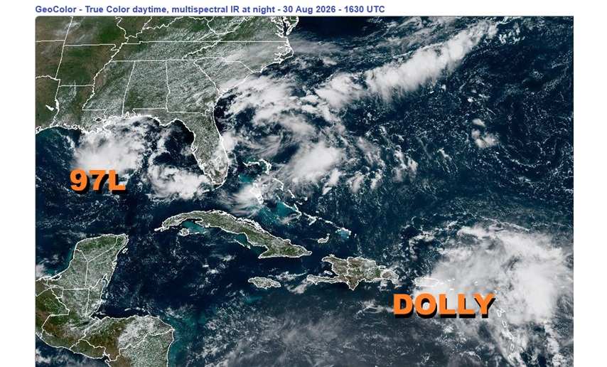
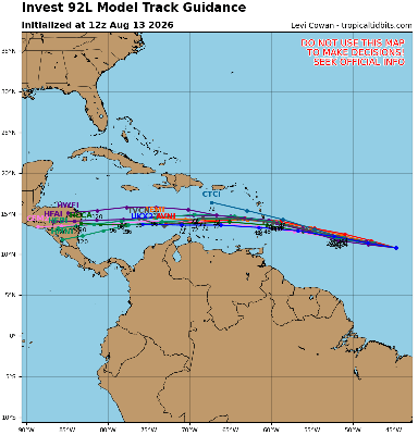
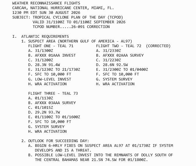
Some very real concerns during strong El Niño years is for waves to be held in check until they are coming much closer to land and also for fronts and/or trofs to linger over the Gulf and/or Gulf stream. We are now seeing these risks in action today as both Invest 97L and Invest Dolly are knocking on our door.
Interests in Louisiana and eastern Texas, perhaps especially the upper Texas coast, may want to begin paying close attention to Invest 97L. Conditions are becoming favorable for further development and a Tropical Depression or Storm could form within 48 hours.
Interests from the Bahamas to Cuba to South Florida may want to begin paying close attention to what we have been calling "Invest Dollly" (Former Tropical Storm Dolly). Conditions in the Gulf and Southwest Atlantic are becoming favorable for further development and a Tropical Depression or Storm could reform within 96 hours.
Ciel
9:30PM ET 29 August, 2026 Update
An area of low pressure that has formed south of Pensacola is presently in hostile conditions for development, but this may change as the system tracks west to west-northwest over the next few days, or at least until it runs into too much land. Considering how close to land Invest 97L already is, despite just 20% odds, "Lemon Odds," we have also now opened up a Lounge for this Area of Interest: Invest FIVE Edouard Lounge
Ciel
11AM ET 28 August, 2026 Update
Dolly has opened back up into an open wave, even sooner than forecast, and the final Advisory on short-lived Dolly has been written. This wave will continue to be monitored for potential regeneration later in the period, much like we monitor any Invest.
Ciel
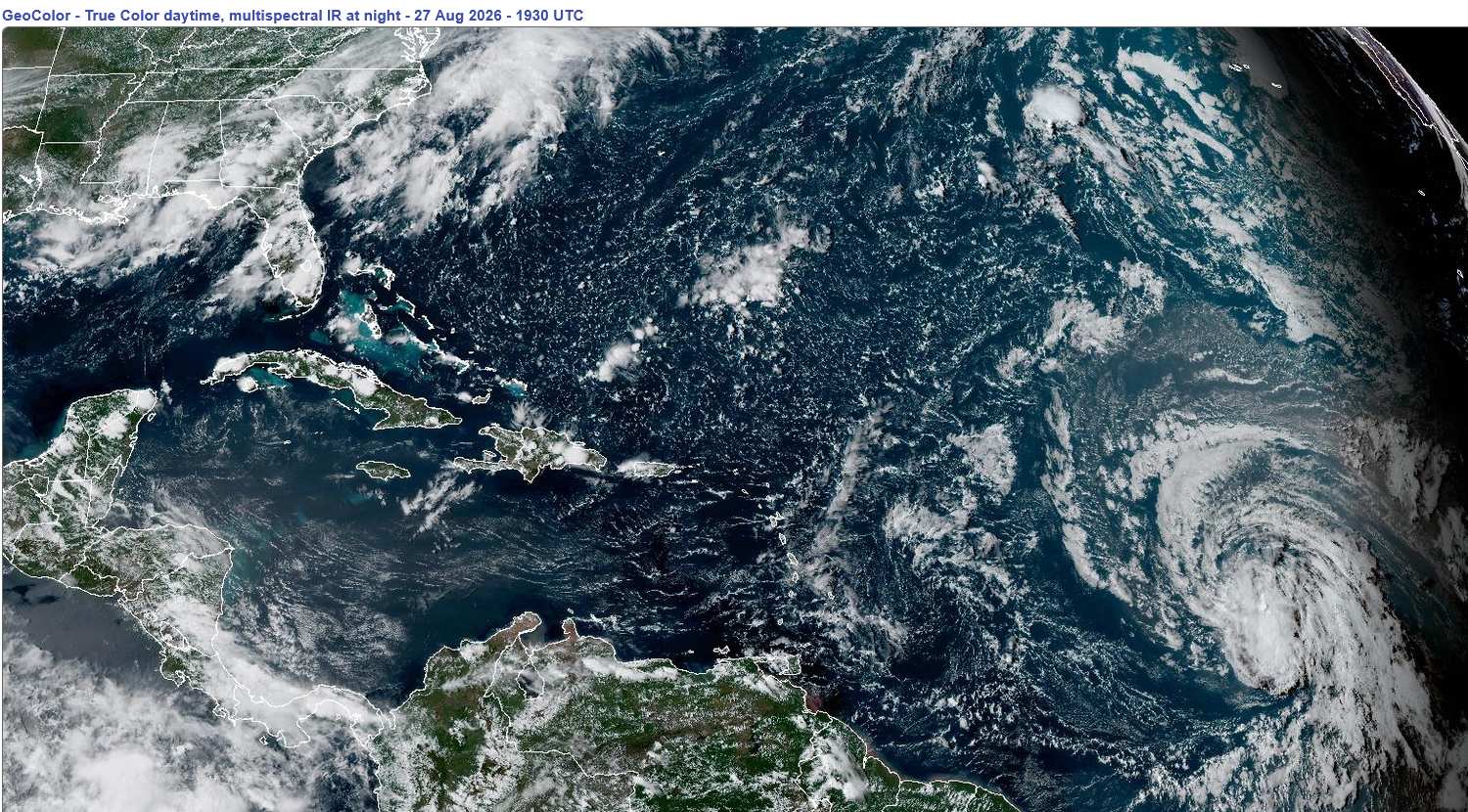
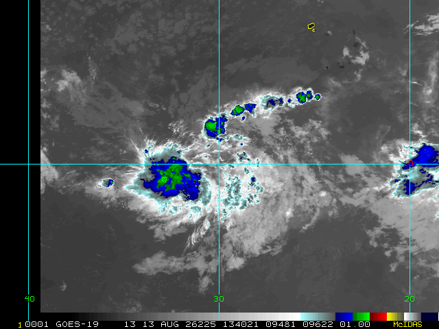
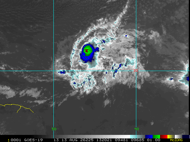
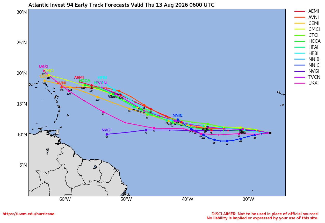
Lower Right: Tropical Storm Dolly in the Main Development Region of the Tropical Atlantic on August 27, 2026 1930z
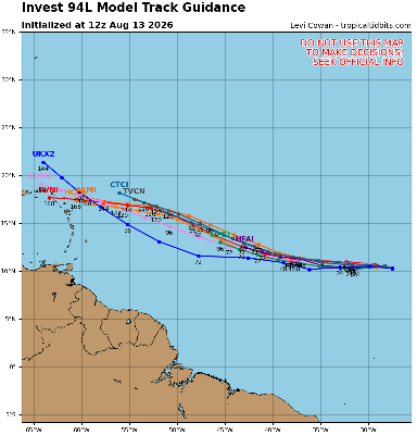
Earlier today, Invest 96L became our first Cape Verde tropical cyclone of the year. Cape Verde tropical cyclone, for a strong El Niño, at any rate. It barely made it, but now Tropical Storm Dolly has formed.
Conditions for Dolly's future aren't looking especially promising, and nearly all models and indeed the official forecast has Dolly opening back up to a stout wave within about 2 days. Some strong blustery wind and heavy showers would still more likely than not affect much of the Antilles, regardless, starting the coming weekend and into at least early next week. After that, a few models and ensembles are warm to regeneration closer to the United States, but this portion of the extended forecast is still very speculative (See Lounge for more on this).
Edited by cieldumort (Mon Aug 31 2026 11:34 PM)
|
cieldumort
Moderator
Reged:
Posts: 2832
Loc: Austin, Tx
|
|
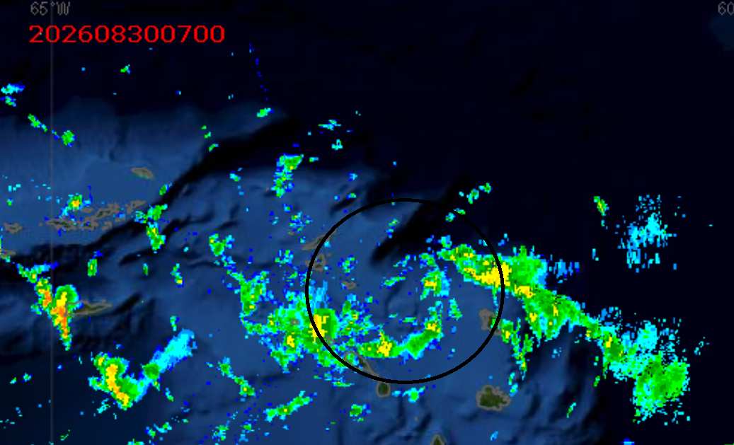
We are starting to see some reports of westerly surface winds on the southern side of Invest Dolly. Maximum sustained winds within Dolly are presently estimated to be around 30 knots, so could be become a sloppy TD or weak TS overnight. Maybe. (Big maybe)
Eastern Caribbean radar does indeed show that a lowerish level circulation exists exactly where the center of Dolly is being tracked (shown below circled in black atop the radar image)
|
cieldumort
Moderator
Reged:
Posts: 2832
Loc: Austin, Tx
|
|
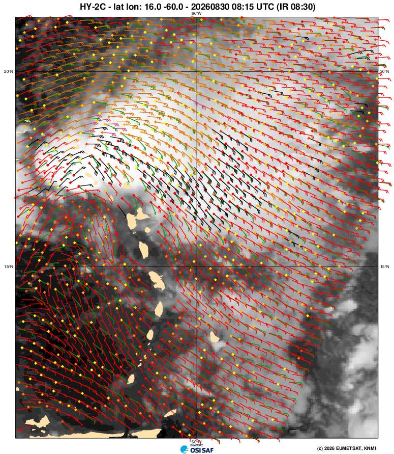
Dolly racing headstrong into more shear this morning. Despite an attempt to fully close off overnight, still very much an open wave.
|
cieldumort
Moderator
Reged:
Posts: 2832
Loc: Austin, Tx
|
|
|
cieldumort
Moderator
Reged:
Posts: 2832
Loc: Austin, Tx
|
|
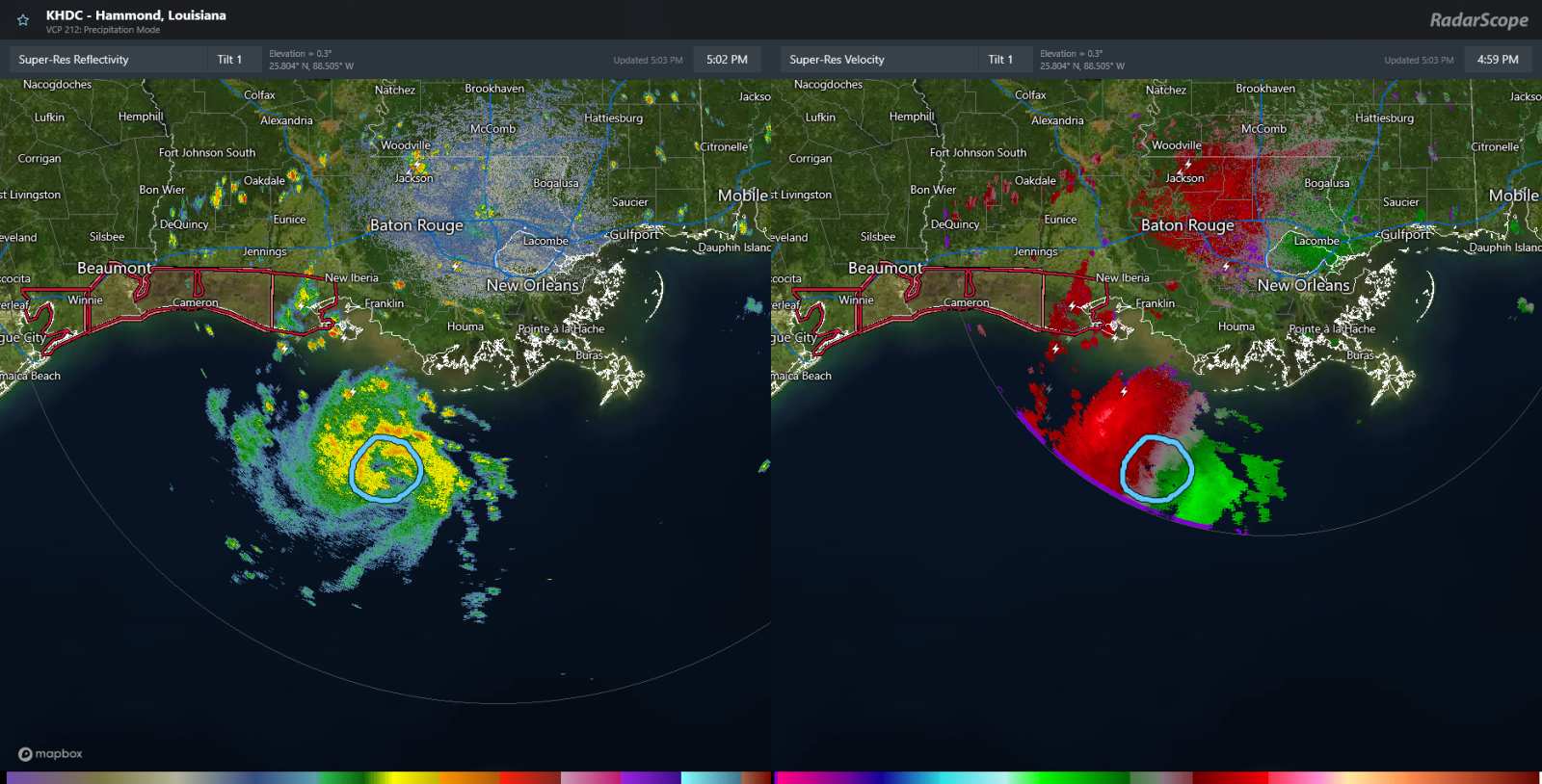
FIVE appears to be in the process of developing a solid inner core this afternoon. Overnight, conditions for Rapid Intensification could come together.
As can be seen in the radar images below (side-by-side Reflectivity and Velocity), conditions for the formation of an eye - and RI into a hurricane - are coming into place.
At 4PM CDT, went above model guidance to forecast 60 MPH heading into landfall. This could already be behind the curve.
|
MikeC
Admin
Reged:
Posts: 4859
Loc: Orlando, FL
|
|
It may get just shy of hurricane,. But I doubt it gets to hurricane strength. The el nino effect still applies here. Convection on satellite is warming (weakening) tonight, could pop up again over dmax, check back in the morning.
Tiny systems can change intensity fairly quickly (up AND down).
Recon heading out now to it, my guess it would be borderline if it's a TS.
|
MikeC
Admin
Reged:
Posts: 4859
Loc: Orlando, FL
|
|
Recon found 1005mb, but winds right around minimal tropical storm force winds. Mid level dry air is keeping a lid on Edouard so far tonight, and has been losing convection on satellite (in fact the center is exposed right now). Dmax may kick it up again overnight, but currently is slightly right of forecast track and holding strength.
|
cieldumort
Moderator
Reged:
Posts: 2832
Loc: Austin, Tx
|
|
Product: Air Force Vortex Message (URNT12 KNHC)
Transmitted: 1st day of the month at 2:30Z
Agency: United States Air Force
Aircraft: Lockheed WC-130J Hercules with reg. number AF97-5303
Tropical Depression: Five (flight in the North Atlantic basin)
Mission Number: 2
Observation Number: 09
A. Time of Center Fix: 1st day of the month at 2:01:30Z
B. Center Fix Coordinates: 28.55N 91.74W
B. Center Fix Location: 116 statute miles (187 km) to the S (171°) from Lafayette, LA, USA.
C. Minimum Height at Standard Level: 1,480m (4,856ft) at 850mb
D. Minimum Sea Level Pressure: 1006mb (29.71 inHg)
E. Dropsonde Surface Wind at Center: From 150° at 7kts (From the SSE at 8mph)
F. Eye Character: Not Available
G. Eye Shape: Not Available
H. Estimated (by SFMR or visually) Maximum Surface Wind Inbound: 23kts (26.5mph)
I. Location & Time of the Estimated Maximum Surface Wind Inbound: 1 nautical miles to the SSW (205°) of center fix at 2:01:00Z
J. Maximum Flight Level Wind Inbound: From 211° at 28kts (From the SSW at 32.2mph)
K. Location & Time of the Maximum Flight Level Wind Inbound: 23 nautical miles (26 statute miles) to the SE (142°) of center fix at 1:53:30Z
L. Estimated (by SFMR or visually) Maximum Surface Wind Outbound: 29kts (33.4mph)
M. Location & Time of the Estimated Maximum Surface Wind Outbound: 4 nautical miles to the N (3°) of center fix at 2:03:00Z
N. Maximum Flight Level Wind Outbound: From 125° at 38kts (From the SE at 43.7mph)
O. Location & Time of the Maximum Flight Level Wind Outbound: 3 nautical miles to the NNE (31°) of center fix at 2:02:30Z
P. Maximum Flight Level Temp & Pressure Altitude Outside Eye: 16°C (61°F) at a pressure alt. of 1,527m (5,010ft)
Q. Maximum Flight Level Temp & Pressure Altitude Inside Eye: 19°C (66°F) at a pressure alt. of 1,526m (5,007ft)
R. Dewpoint Temp (collected at same location as temp inside eye): 18°C (64°F)
R. Sea Surface Temp (collected at same location as temp inside eye): Not Available
S. Fix Determined By: Penetration, Radar, Wind, Pressure and Temperature
S. Fix Levels (surface & flight level centers within 5nm of each other): Surface and 850mb
T. Navigational Fix Accuracy: 0.02 nautical miles
T. Meteorological Accuracy: 2 nautical miles
Remarks Section - Remarks That Were Decoded...
Maximum Flight Level Wind: 38kts (~ 43.7mph) which was observed 3 nautical miles to the NNE (31°) from the flight level center at 2:02:30Z
Remarks Section - Additional Remarks...
EYEWALL BEGINNING TO FORM NW SIDE
|



 Previous
 Index
Index
 Next
Next
 Threaded


 Edit
Edit
 Reply
Reply
 Quote
Quote