Excessive Rainfall Discussion
NWS Weather Prediction Center College Park MD
1133 AM EDT Mon Sep 28 2026
Day 1
Valid 16Z Mon Sep 28 2026 - 12Z Tue Sep 29 2026
...THERE IS A MODERATE RISK OF EXCESSIVE RAINFALL FOR PORTIONS OF THE SOUTHWEST...
...16Z Update...
A few smaller changes were made to the risk areas with this update.
The Moderate Risk was expanded southwest down the Colorado River to
include the CA/AZ/NV tripoint region in coordination with VEF/Las
Vegas, NV forecast office. Numerous pieces of guidance suggest a
small cluster or line of slow-moving thunderstorms will develop
there later this afternoon during peak heating, driven by clearing
skies there now allowing maximum heating there by this afternoon,
with plentiful moisture available.
The Marginal and Slight risk areas were expanded northward for many
of the same reasons along the NV/UT border. Showers developing
there now could develop into nearly stationary lines by this
afternoon, leading to a higher flooding threat.
Fortunately, much of the rainfall ongoing currently across Arizona
has been stratiform in nature, due to the lack of instability. Well
above normal levels of moisture and the flash-flood-prone nature of
the area due to wet ls still favor flooding occurring, though
it's on the low end of the MDT risk category. The very flashy
nature of southern UT, with plentiful slot canyons and burn scars,
the San Juan Mountains of Colorado oriented perpendicular to the
southwest flow, and much of NM due to saturated antecedent
conditions still appear on track, with no changes made.
No changes were made to the Slight Risk area across ND/MN, as that
event is ongoing.
Wegman
...Previous Discussion...
...Southwest...
The predecessor rainfall event (PRE), from the combination of
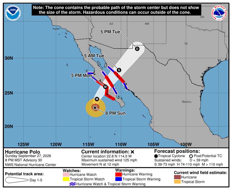
Odalys and the approach of Polo is still expected to produce a
widespread 1-3 inches of rain across the Four Corners Region, where
most ls are already at or near saturation from recent heavy
rainfall. As PWs increase to 2-3.5 std dev above normal across much of the
region, strong upper level divergence combined with amplified
southwesterly flow orthogonal to the terrain will support
significant synoptic and orographic forcing. The Moderate Risk
forks a bit further south in New Mexico to include the Lordsburg,
NM area, where numerous burn scars are, and to include the rest of
the Sacramento Mountains in south- central Colorado. The flow will
be uniformly be out of the southwest, south and west facing slopes
along the Mogollon Rim, and the San Juans are likely to see the
most rainfall. Rocky ls, burn scars, and slot canyons will all
locally exacerbate any flooding from the widespread rainfall.
https://www.wpc.ncep.noaa.gov/discussions/hpcdiscussions.php?disc=qpferd
|




 Previous
 Index
Index
 Next
Next
 Threaded





 Edit
Edit
 Reply
Reply
 Quote
Quote