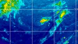
Current Radar or Satellite Image

Flhurricane.com - Central Florida Hurricane Center - Tracking Storms since 199531 Years of Hurricanes Without the Hype - Since 1995


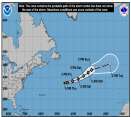
Josephine forms from 93L. Forecast to become a hurricane-force fish spinner. Watching off SE for potential new Area of Interest this weekend.
Days since last Hurricane Landfall — US Any: 12 (Isaias), US Major: 742 (Milton), FL Any: 12 (Isaias), FL Major: 742 (Milton)
FlHurricane Atlantic Tropical Cyclone Tracking 🌀 Since 1995
39.2N 67.3W
Wind: 65MPH
Pres: 988mb
Moving:
Present movement...ne or 45 degrees at 12 mph...19 km/h
Click for Storm Spotlight
HypeScale:
2.50
0510
Communication
Storm Data
Content
Follow & Connect


General Discussion >> Disaster Forum

Jump to first unread post. Pages: 1
Margie
Senior Storm Chaser


Reged:
Posts: 1191
Loc: Twin Cities
News from Pascagoula here
      #53614 - Fri Sep 02 2005 08:53 PM

For anyone interested in news about Pascagoula, check out www.gulflive.com. I am still spending every night web-fishing, and just found out that The Mississippi Press has been publising online every day since the storm. All local stuff.

One of the things I read in the Tuesday edition: the highest wind gust before instrument failure was 137mph, and stronger winds followed

--------------------
Katrina's Surge: http://www.wunderground.com/hurricane/Katrinas_surge_contents.asp


Post Extras: Print Post   Remind Me!   Notify Moderator  
Pages: 1


Extra information
0 registered and 0 anonymous users are browsing this forum.

Moderator:  CFHC, Ed Dunham, Colleen A., danielw, Clark, RedingtonBeachGuy, Bloodstar, tpratch, typhoon_tip, cieldumort 

Print Topic

Forum Permissions
      You cannot start new topics
      You cannot reply to topics
      HTML is disabled
      UBBCode is enabled

Rating:
Topic views: 3756

Rate this topic

Jump to