Ed Dunham
Former Meteorologist & CFHC Forum Moderator (Ed Passed Away on May 14, 2017)
Reged:
Posts: 2565
Loc: Melbourne, FL
|
|
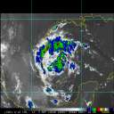
At 06/18Z, Invest 92L was located near 13.6N 46.7W or roughly 800 miles to the east of the Lesser Antillies previously moving to the west northwest at 8 knots but expected to slow considerably as the system has hit a wall of strong westerly windshear. Convection has increased significantly today but the shear is not likely to abate for two or three days so additional development will be held in check for awhile. The strong upper shear may actually decouple the system with the weak 1012MB low level circulation moving slowly westward leaving the convection well behind it to the east of the lower center. The current model suite moves the system too rapidly to the west. SSTs in the area of the low center are 27C. If the low-level center can survive, it could regenerate convection in a few days as the shear weakens. Something to watch in this active early season.
ED
|
berrywr
Weather Analyst

Reged:
Posts: 387
Loc: Opelika, AL
|
|
Wind shear aloft is 50 to 60 knots and of course our dear old friend the Central Atlantic Ocean to the west...I wish that disturbance all the best!
--------------------
Sincerely,
Bill Berry
"Survived Trigonometry and Calculus I"
|
Ed Dunham
Former Meteorologist & CFHC Forum Moderator (Ed Passed Away on May 14, 2017)
Reged:
Posts: 2565
Loc: Melbourne, FL
|
|
With the stronger shear lifting north, westerly windshear over the low level center has decreased to about 35 knots, however as suggested above, the shear has decreased and displaced the convection well to the east of the low level circulation center. Visible satellite images show a weak low level center near 16.5N 51.5W at 07/14Z moving to the west northwest at 15mph in the low-level flow, however, survival of this center is questionable given its weak nature. If it does survive, it will move into an area of more favorable upper level conditions in a couple of days.
ED
|


 Threaded


