Current Radar or Satellite Image

Flhurricane.com - Central Florida Hurricane Center - Tracking Storms since 199531 Years of Hurricanes Without the Hype - Since 1995


20% chance area off the southeast coast.
Days since last Hurricane Landfall — US Any: 625 (Milton), US Major: 625 (Milton), FL Any: 625 (Milton), FL Major: 625 (Milton)
FlHurricane Atlantic Tropical Cyclone Tracking 🌀 Since 1995
None
HypeScale:
0.20
0510
Communication
Storm Data
Content
Follow & Connect


Archives 2010s >> 2014 News Talkbacks

Pages: 1
MikeCAdministrator
Admin


Reged:
Posts: 4835
Loc: Orlando, FL
Watching a wave (94L) In the East Atlantic
      #95198 - Sun Aug 10 2014 04:43 PM

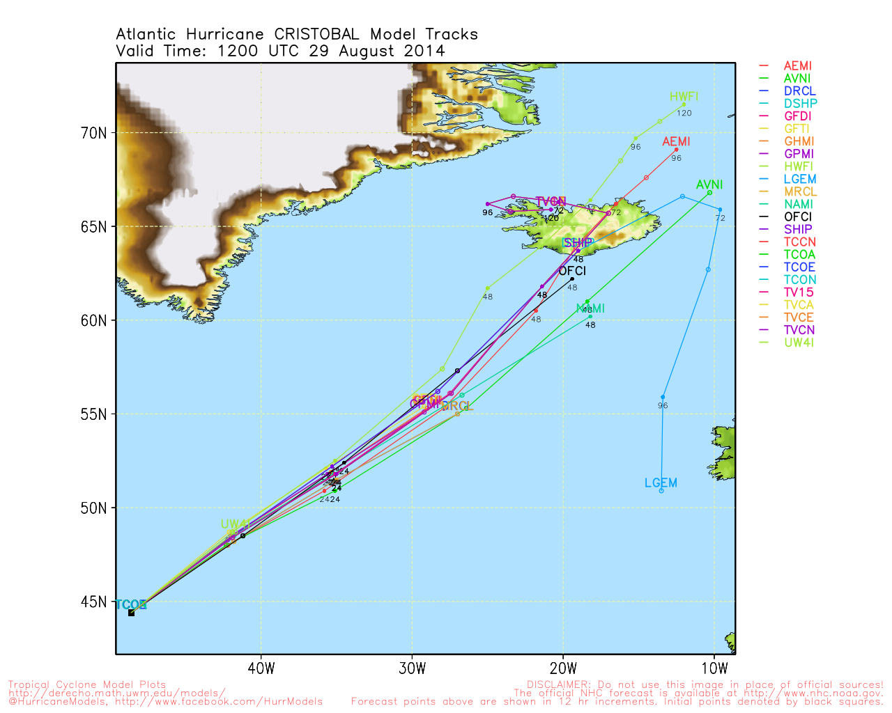
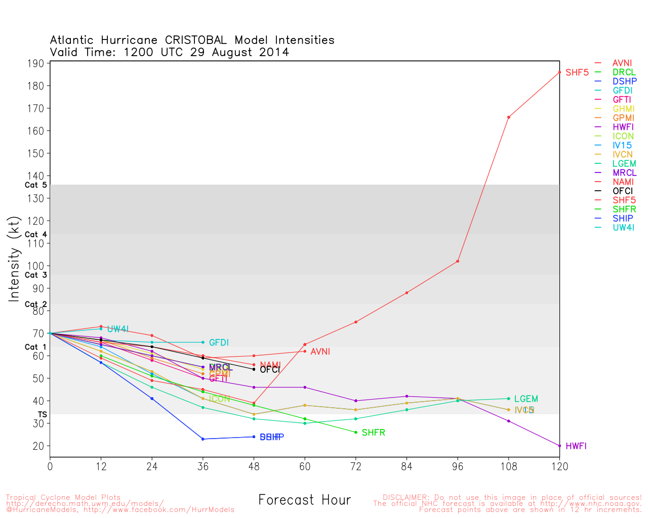
Another wave with a 40% chance for development over the next 5 days is being watched in the east Atlantic. This wave, tracked as 94L, has quite a bit of dry air and poor conditions to traverse before entering more favorable areas. Most of the Atlantic east of the Caribbean is currently awash in generally dry conditions.

However it is approaching the start of the peak season, in mid August that runs through mid October. So it is important to watch this and any other tropical disturbances that may develop.


More to come later.


Post Extras: Print Post   Remind Me!   Notify Moderator  
Pages: 1


Extra information
0 registered and 1 anonymous users are browsing this forum.

Moderator:  

Print Topic

Forum Permissions
      You cannot start new topics
      You cannot reply to topics
      HTML is disabled
      UBBCode is enabled

Rating:
Topic views: 2211

Rate this topic

Jump to