7:30PM EDT Update 19 Aug 2017
Recon is presently investigating "Harvey" to determine if the area of low pressure is still closed in some way. Assuming that recon is able to close off a low level circulation, the Low could take advantage of some potentially favorable conditions ahead - perhaps as soon as overnight tonight, and so the official forecast does call for restrengthening. Alternatively, if a coherent LLC is not found, "Harvey" would be an open wave, and not a tropical cyclone.

Image above: Marine Graphicast Issued Sat 19 Aug 2017 22:51 UTC
12:30PM EDT Update 19 Aug 2017
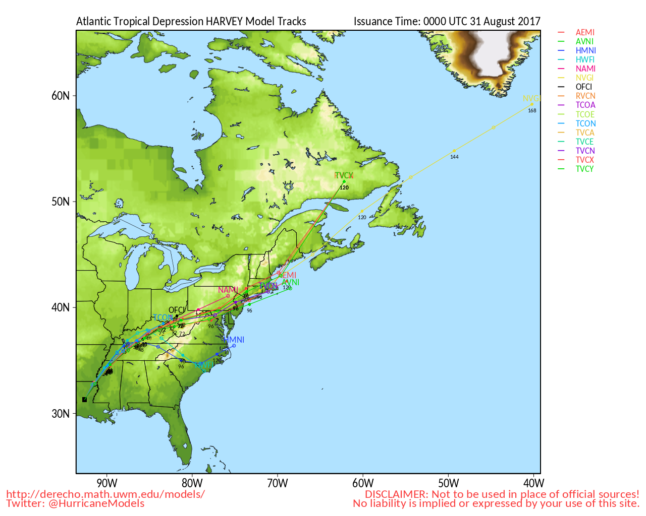
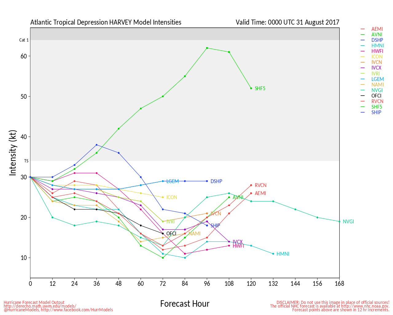
As quickly as the Cabo Verde Season announced its arrival, so too did one of 2017's main themes of anomalously low instability, and in the face of a couple stout upper-level lows and some nearby dry air, it appears that, at least for the time being, Harvey and Invest 92L may be falling apart. We could even see at 5:00 this afternoon that no longer finds enough organization to continue issuing advisories on Harvey altogether, but both features (Harvey, or his remnants, and Invest 92L) would still need to be watched, as conditions for development could improve next week.
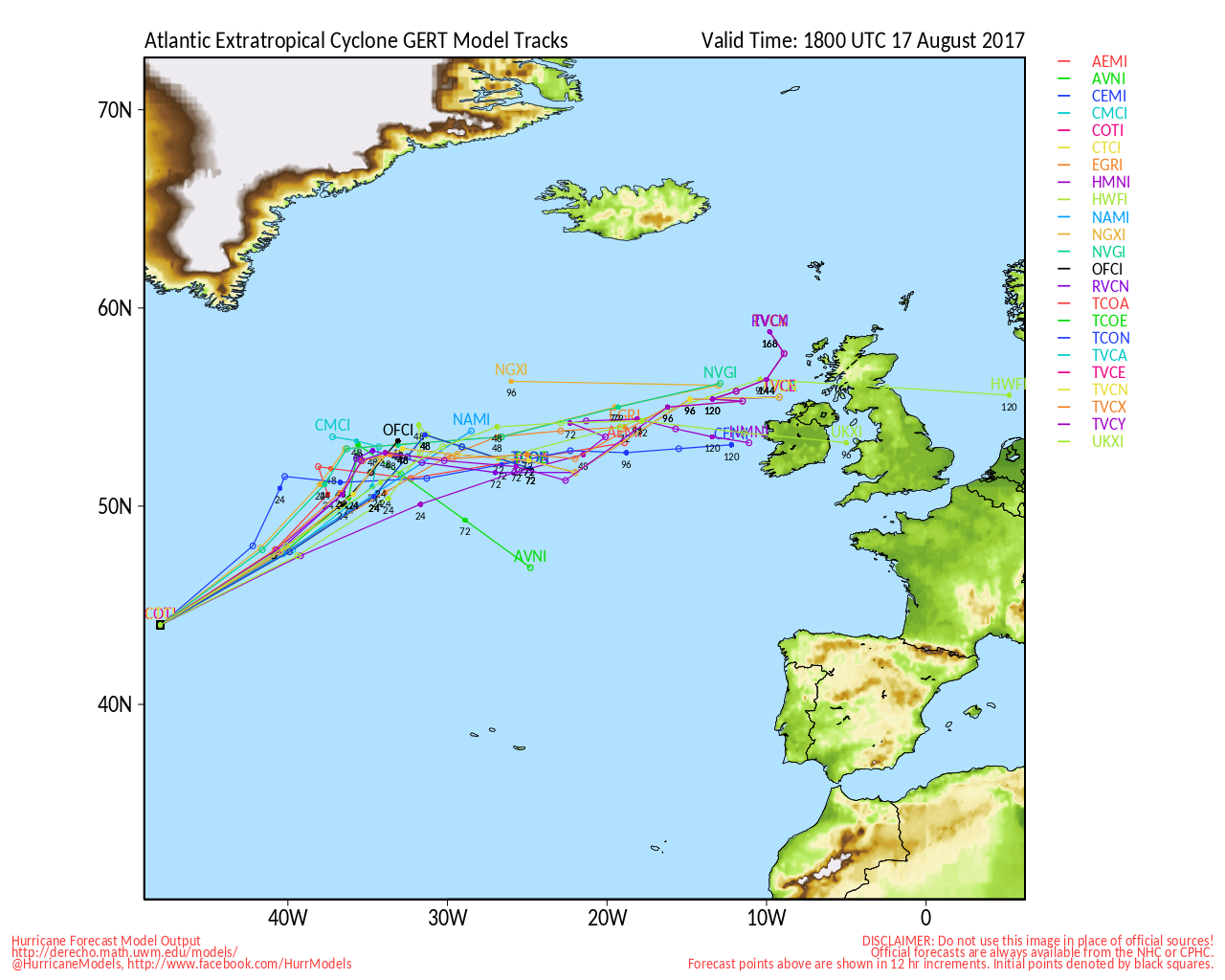
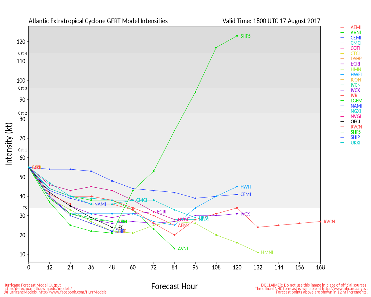
8:30PM EDT Update 17 Aug 2017
Cabo Verde Season has Arrived

10:30AM EDT Update 17 Aug 2017
Full Advisories will begin shortly on PTC NINE (91L). Caribbean impacts likely. Recon may find that it is already Harvey later today.
THE GOVERNMENT OF FRANCE HAS ISSUED A TROPICAL STORM WARNING FOR MARTINIQUE.
THE GOVERNMENT OF BARBADOS HAS ISSUED A TROPICAL STORM WARNING FOR BARBADOS...ST. VINCENT...AND THE GRENADINES.
THE GOVERNMENT OF ST. LUCIA HAS ISSUED A TROPICAL STORM WARNING FOR ST. LUCIA.
THE GOVERNMENT OF BARBADOS HAS ISSUED A TROPICAL STORM WATCH FOR DOMINICA.
A TROPICAL STORM WARNING MEANS THAT TROPICAL STORM CONDITIONS ARE EXPECTED SOMEWHERE WITHIN THE WARNING AREA...IN THIS CASE WITHIN 24-36 HOURS.
10AM EDT Update 17 Aug 2017
Three coherent disturbances continue tracking generally west today (91L, 92L, 93L?), and advisories may begin soon on what is now "91L" - the westernmost of the bunch. Recon has been tasked to head out to 91L at 1800Z to help determine if a tropical cyclone has formed and to assess its intensity.
At least two of the above thee disturbances have the potential to affect land within 72 hours (91L and 92L). The next name on the Atlantic list is Harvey.
Original Entry
Disturbances Entering a Favorable Basin

The Atlantic is phasing into a much more conducive state for tropical cyclogenesis and intensification. This is neither hype, nor speculation, and the regions probably most favorable for formation and/or intensification will include the Main Development Region (a rectangular 'box' that encompass the Tropical Atlantic and some of the Caribbean), as well as also off the southeast coast, and possibly even the Gulf. Pick your poison.
As of this new article, there is one named storm in the Atlantic, Gert, which is forecast to come just shy of hurricane intensity and head out to sea regardless, one active Invest (91L), and one convectively active portion of the Monsoon Trof that is not yet Invest tagged, but which could be, if 91L doesn't absorb it. Beyond that, there is also a bit of a wave train pattern over Africa that is ripe for discussion in the General 2017 Model Watching Lounge .
Edited by MikeC (Tue Aug 22 2017 11:22 PM)


 Threaded


