Current Radar or Satellite Image

Flhurricane.com - Central Florida Hurricane Center - Tracking Storms since 199531 Years of Hurricanes Without the Hype - Since 1995


TROPICAL DEPRESSION TWO LIKELY TO BECOME BERTHA. TROPICAL STORM WATCH ISSUED FOR THE FLORIDA PANHANDLE.
Days since last Hurricane Landfall — US Any: 648 (Milton), US Major: 648 (Milton), FL Any: 648 (Milton), FL Major: 648 (Milton)
FlHurricane Atlantic Tropical Cyclone Tracking 🌀 Since 1995
28.0N -85.1W
Wind: 30MPH
Pres: 1008mb
Moving:
Present movement...nnw or 335 degrees at 3 mph...6 km/h
Click for Storm Spotlight
HypeScale:
4.50
0510
Communication
Storm Data
Content
Follow & Connect


Archives 2010s >> 2019 News Talkbacks

Pages: 1
MikeCAdministrator
Admin


Reged:
Posts: 4835
Loc: Orlando, FL
May 1st Tropics Watching
      #99863 - Wed May 01 2019 10:42 AM

May 1st a month away from the start of the Atlantic Hurricane season (15 days from the East Pacific season) and there is an area over the Bahamas worth watching.

In fact the National Hurricane Center issued a special tropical weather outlook this morning, stating that the area has 20% chance for this area over the Bahamas to develop into something tropical,

What this usually translates to is most likely some rain effects felt in Florida and the Bahamas as it drifts west toward the peninsula and then is forecast to bend back to the east and out to sea, which is the timeframe the 20% chance is for

It is still worth watching for potential nasty weather in Florida Thursday and Friday in parts of South and Central Florida..

As of 10:40AM there was not yet an invest area designated for the disturbance.

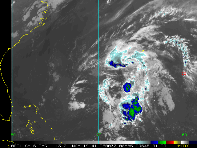
Satellite Image of the disturbance area


Post Extras: Print Post   Remind Me!   Notify Moderator  
Pages: 1


Extra information
0 registered and 4 anonymous users are browsing this forum.

Moderator:  

Print Topic

Forum Permissions
      You cannot start new topics
      You cannot reply to topics
      HTML is disabled
      UBBCode is enabled

Rating:
Topic views: 5893

Rate this topic

Jump to