Current Radar or Satellite Image

Flhurricane.com - Central Florida Hurricane Center - Tracking Storms since 1995Hurricanes Without the Hype! Since 1995


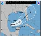
New NHC Advisory with Milton at 180 MPH 905mb. Recon heading back in and could get even stronger still. Tampa may get 10-15' of surge on current forecast track. #FLwx #HurricaneMilton
Days since last H. Landfall - US: Any 10 (Helene) , Major: 10 (Helene) Florida - Any: 10 (Helene) Major: 10 (Helene)
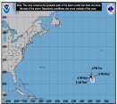
41.7N 38.4W
Wind: 75MPH
Pres: 963mb
Moving:
Ne at 29 mph
Click for Storm Spotlight
17.4N 42.1W
Wind: 80MPH
Pres: 988mb
Moving:
Nw at 14 mph
Click for Storm Spotlight
21.7N 91.3W
Wind: 175MPH
Pres: 911mb
Moving:
E at 9 mph
Click for Storm Spotlight
COMMUNICATION
STORM DATA
CONTENT
FOLLOW US


Profile for danielw
 
Email danw5211@yahoo.com   Picture
Member # 320  
Name Danny  
Title Moderator  
Total Posts 3527  
Homepage  
Occupation Public Safety Communications  
Hobbies Weather, GIS,DTV Dx  
Location Hattiesburg,MS (31.3N 89.3W)  
Bio  
ICQ Number  
Number of Years Tracking Storms Since Betsy 1965 
Registered on Wed Jun 25 2003 05:53 AM  


Send a private message Send a private message | Add to address book | Show all user's posts | Return to Forum Return to Forum

Note: This is NOT an official page. It is run by weather hobbyists and should not be used as a replacement for official sources. 
CFHC's main servers are currently located at Hostdime.com in Orlando, FL.
Image Server Network thanks to Mike Potts and Amazon Web Services. If you have static file hosting space that allows dns aliasing contact us to help out! Some Maps Provided by:
Great thanks to all who donated and everyone who uses the site as well. Site designed for 800x600+ resolution
When in doubt, take the word of the National Hurricane Center