cieldumort
Moderator

Reged:
Posts: 2529
Loc: Austin, Tx
|
 Heading into Season Peak with Several Systems Close to Home
Fri Aug 23 2019 05:17 PM
|
|
|

5PM EST 24 August 2019 Update
FIVE has become a Tropical Storm, Dorian, the fourth named storm of the 2019 Atlantic Hurricane Season.
Dorian is traversing an environment characterized by moderate vertical wind shear and low mid-level humidities. However, shear is forecast to drop by midday Sunday, and remain low or even very low through Tuesday. As the well-defined TC crosses over warm waters while in this very favorable shear, the potential for dry air intrusions could be low, and in fact the official NHC forecast calls for Dorian to become a hurricane within 72 hours.
Key Messages:Quote:
1. Dorian is forecast to strengthen and could be near hurricane strength when it approaches the Lesser Antilles on Tuesday.
2. It is too soon to determine the specific timing or magnitude of impacts in the Lesser Antilles, but tropical storm or hurricane watches may be needed for a portion of the area on Sunday.
Original Entry
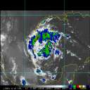
We are just a few weeks away from the climatological peak of the Atlantic Hurricane Season, and there are several systems we are monitoring, three of which are close to or closing in on land: 98L, 99L, W Gulf Low (Very strong 90L candidate).
As these systems are all tending to form in the Western Atlantic, as has been a trend this year, they are far more likely to affect land or interests close to land, including the south and/or southeast U.S.
As of 5PM EDT today August 23, official NHC odds for development are as follows: 98L 90%, 99L 50% (could be conservative), Gulf Low: TBD. Was still under 10% at the 2PM TWO and thus not listed at that time, but this system has continued to impress, with surface pressures falling some and winds increasing some throughout the day today.
Follow along with us in the 2019 Forecast Lounge , as well as here on the Homepage.
Links to individual Forecast Lounges:
Invest 98L Lounge, Tropical Storm Dorian Lounge, W Gulf Low _90L_ Lounge
{{StormLinks|Dorian|5|5|2019|05|Dorian}}
{{StormLinks|98L|90|6|2019|90|Invest 98L}}
{{StormCarib}}
{{EastFloridaRadar}} Invest 98L Lounge Invest 99L Lounge W Gulf Trof Lounge
{{NorthGulfRadar}}
Edited by MikeC (Sun Aug 25 2019 06:31 AM)
|
|


 Flat
Flat


