cieldumort
Moderator

Reged:
Posts: 2327
Loc: Austin, Tx
|
 Re: Fiona Lounge
Sat Sep 17 2022 03:11 AM
|
|
|
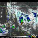
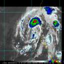
There were some slight south-of-west jogs during recon tonight, with the flight finding some subtle stair-stepping down (south) when Fiona enters a strengthening phase, which is noteworthy. Longer-term, smoothed-out track generally 280 degrees per NHC analysis. Odds still favor the stronger the Fiona, the earlier and more pronounced the recurve prior to threatening CONUS.. But this is not a given. Regardless, P.R. almost certainly now is at much greater risk of a direct strong tropical storm to major hurricane impact.
Some 0z updated runs:
HWRF - Reasonably good initialization. 70KT hurricane by Saturday night. Landfall southeast coast of P.R. as a Cat 1/2 Sunday morning. Recurves after crossing P.R., resumes intensifying - Major Cat 3/4 east of the Bahamas and stays major while tracking generally either side of north through end of run.
HMON - May have initialized a touch north, but not terribly off. Probably a borderline Cat 1 by midday Saturday. Majors overnight Saturday/predawn Sunday on approach to P.R. Rakes P.R. while the center crosses the southwestern side of the island as a Cat 1/2. Passes through the gap between PR and Hispaniola, with another landfall on extreme eastern Hispaniola as Cat 1/2 Sunday night. Majors on approach to the eastern Bahamas. Strikes the eastern Bahamas at Cat 2/3 before hooking N-NNE as a Major.
ECMWF - May have initialized a bit north. Likely Cat 1 by late Saturday night. Strong Trop Storm/Cat 1borderline south of Ponce, PR Sunday morning. Landfall Sunday afternoon in southwestern P.R. as a strong Trop Storm or maybe Cat 1, then a landfall on eastern Hispaniola predawn Monday Cat 1. Apparent Cat 2 across eastern Bahamas Tuesday. Recurves and misses Bermuda to the west while likely undergoing Rapid Intensification on Friday. Landfall in vicinity of Halifax, Nova Scotia early Saturday morning with sub-940mb levels and widespread coastal gusts in excess of 100MPH.
GFS - May have initialized a touch too far northeast and a touch weak. Strong Tropical Storm on approach to eastern P.R. Landfall on the center of the island around dawn Sunday, still as a strong Trop Storm. Tracks NW towards eastern Bahamas, but begins hooking north prior to impacting them. Tracks west of Bermuda as a strong hurricane, and then out to sea. The wind-pressure relationship in this run looks suspect.
|
|


 Flat
Flat


