F
Current Radar or Satellite Image

Flhurricane.com - Central Florida Hurricane Center - Tracking Storms since 1995Hurricanes Without the Hype! Since 1995


Development chances in the Gulf of Mexico are going up and a named storm could be approaching the US next week. Very active period continues. Flhurricane.com
Days since last H. Landfall - US: Any 7 (Helene) , Major: 7 (Helene) Florida - Any: 7 (Helene) Major: 7 (Helene)
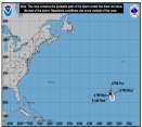
23.7N 49.4W
Wind: 130MPH
Pres: 943mb
Moving:
Nw at 12 mph
Click for Storm Spotlight
10.3N 33.6W
Wind: 70MPH
Pres: 993mb
Moving:
Wnw at 7 mph
Click for Storm Spotlight
COMMUNICATION
STORM DATA
CONTENT
FOLLOW US


General Discussion >> 2024 Forecast Lounge

cieldumort
Moderator


Reged:
Posts: 2427
Loc: Austin, Tx
Re: Beryl Lounge
      Fri Jul 05 2024 02:51 AM

Beryl continues its persistent trend of over-performing, and rather than weakening into a Cat 1 last night as many model runs expected, re-intensified to Cat 3. In addition, looking at many of the ensembles that have been showing a track more westerly into Mexico and then Mexico again (closer to Tampico, MX, with some ensembles even south of there), those members are already quite a bit too far south and generally too weak.

In summary, Beryl probably stands a better chance of retaining more of its inner core while crossing the Yucatan, and may then find itself in the following environment that is both an intensity and steering concern for Texas:

1. Lower shear
2. High Ocean Heat Content
3. A weakness in the ridge over the western Gulf and right up into Texas
4. A risk of weakening of steering currents should/once Beryl be approaching and/or inland over Texas

This combination of ingredients could result in
A. A significantly stronger cyclone than was anticipated even just a day or two ago.
B. A track decidedly more towards the Texas coastline than Mexico's, along with a slowing down of forward speed before, during and/or after, should it make this turn

Net result of a stronger cyclone w slower forward speed: Greater direct coastal impacts along Texas and greater inland flooding

While not yet the official forecast from NHC, the OFCL continues trending this way.


Here are some vort-centered 05/0z runs:
GFS: Landfall just southeast of Corpus Christi very early Monday morning Cat 1
HWRF: Landfall near Baffin Bay/Padre (just southeast of Corpus Christi) Monday morning a high-end Cat 1
HMON: Landfall just southeast of Corpus late Sunday overnight/predawn Monday a strong tropical storm
HAFS-A Landfall just southeast of Brownsville, TX late Sunday night Cat 1
HAFS-B Landfall about 50 miles SSE of Brownsville, TX late Sunday night high-end tropical storm

Worth noting that ICON continues to be the northerly outlier of all the major models and yet the rest of the primary models keep trending more towards it and not the other way around. ICON has generally been advertising a Major landfalling somewhere between Corpus and Galveston Monday morning.

Post Extras Print Post   Remind Me!     Notify Moderator


Entire topic
Subject Posted by Posted on
* Beryl Lounge cieldumort Fri Jul 05 2024 02:51 AM
. * * Re: Beryl Lounge cieldumort   Sun Jul 07 2024 01:16 PM
. * * Re: Beryl Lounge JMII   Sun Jul 07 2024 04:17 PM
. * * Re: Beryl Lounge LoisCane   Sun Jul 07 2024 08:19 PM
. * * Re: Beryl Lounge MikeCAdministrator   Sun Jul 07 2024 09:02 PM
. * * Re: Beryl Lounge cieldumort   Mon Jul 08 2024 12:33 AM
. * * Re: Beryl Lounge cieldumort   Fri Jul 05 2024 05:52 PM
. * * Re: Beryl Lounge cieldumort   Fri Jul 05 2024 05:03 AM
. * * Re: Beryl Lounge cieldumort   Fri Jul 05 2024 02:51 AM
. * * Re: Beryl Lounge cieldumort   Tue Jul 02 2024 06:00 PM
. * * Re: Beryl Lounge Bloodstar   Wed Jul 03 2024 11:14 AM
. * * Re: Beryl Lounge JMII   Wed Jul 03 2024 01:07 PM
. * * Re: Beryl Lounge MichaelA   Wed Jul 03 2024 05:05 PM
. * * Re: Beryl Lounge cieldumort   Sun Jun 30 2024 03:58 AM
. * * Re: Beryl Lounge MikeCAdministrator   Sun Jun 30 2024 06:31 AM
. * * Re: Beryl Lounge JMII   Sun Jun 30 2024 07:54 AM
. * * Re: Beryl Lounge cieldumort   Sun Jun 30 2024 02:52 AM
. * * Re: Beryl Lounge cieldumort   Sat Jun 29 2024 05:38 PM
. * * Re: Beryl Lounge cieldumort   Sat Jun 29 2024 04:24 AM
. * * Re: Beryl Lounge MikeCAdministrator   Sat Jun 29 2024 09:40 AM
. * * Re: Invest 95L Lounge MikeCAdministrator   Fri Jun 28 2024 07:02 AM
. * * Re: Invest 95L Lounge cieldumort   Thu Jun 27 2024 07:36 PM
. * * Re: Invest 95L Lounge cieldumort   Thu Jun 27 2024 04:51 AM
. * * Re: Invest 95L Lounge MikeCAdministrator   Thu Jun 27 2024 06:05 AM
. * * Re: Invest 95L Lounge cieldumort   Thu Jun 27 2024 04:17 AM

Extra information
1 registered and 44 anonymous users are browsing this forum.

Moderator:  


Forum Permissions
      You cannot start new topics
      You cannot reply to topics
      HTML is disabled
      UBBCode is enabled

Rating:
Thread views: 9329

Rate this thread

Jump to

Note: This is NOT an official page. It is run by weather hobbyists and should not be used as a replacement for official sources. 
CFHC's main servers are currently located at Hostdime.com in Orlando, FL.
Image Server Network thanks to Mike Potts and Amazon Web Services. If you have static file hosting space that allows dns aliasing contact us to help out! Some Maps Provided by:
Great thanks to all who donated and everyone who uses the site as well. Site designed for 800x600+ resolution
When in doubt, take the word of the National Hurricane Center