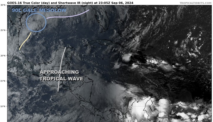
Above: Approaching Tropical Wave southeast of the south-drifting Mesolow and front. Base image cr: Tropical Tidbits
A somewhat healthy tropical wave crossing the Yucatan this weekend and starting to peek out into the extreme southeastern Bay of Campeche is now highlighted by NHC with 50% "Code Orange" development odds within the next 7 days (mostly focusing on the early to middle part of next week). As the wave is presently mostly over land, any meaningful development out of this feature is very unlikely until at least late Saturday at the earliest.
Invest 90L, which has now been dropped from the NHC website but still exists tonight as a mostly non-tropical frontal mesolow, continues to be forecast by many models to interact with this approaching wave later this weekend to early next week. NHC broadly focuses on the interaction of 90L's parent front itself with this wave.
With 90L having reconnected with the aforementioned front, this wave's interaction with the entire frontal boundary and not just a spinoff mesolow would likely have implications for where a TC (if one forms) tracks and how strong it will get. More time over water could give it more time to intensify, if all other conditions allow.
Sea Surface Temps in the Gulf are record high.
More details to come
The wave has been entering the extreme southern Bay of Campeche a bit ahead of schedule and has just been Invest tagged, 91L, and the title has been updated accordingly. 91L INVEST 07 SEP 2024 1300Z
Invest 91L is now a tropical storm force PTC SIX and could be named later today. The title has been updated accordingly. 9/8/24 3PM CDT Ciel
PTC SIX has sufficiently organized to be classified as a tropical cyclone and with winds already at or above the threshold, is being upgraded to Francine and the title has been updated accordingly. 09 SEP 2024 1330Z


 Flat
Flat