F
Current Radar or Satellite Image

Flhurricane.com - Central Florida Hurricane Center - Tracking Storms since 1995Hurricanes Without the Hype! Since 1995


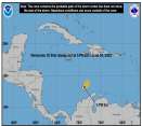
Historic #HurricaneBeryl now in the Caribbean with a day or few left before shear is expected to increase. Elsewhere, Invest 96L is not doing so well.
Days since last H. Landfall - US: Any 306 (Idalia) , Major: 306 (Idalia) Florida - Any: 306 (Idalia) Major: 306 (Idalia)
12.4N 61.3W
Wind: 140MPH
Pres: 956mb
Moving:
Wnw at 20 mph
Click for Storm Spotlight
20.2N 97.8W
Wind: 35MPH
Pres: 1007mb
Moving:
Wnw at 7 mph
Click for Storm Spotlight
Invest 96LClick for Invest Information from CIMSS
COMMUNICATION
STORM DATA
CONTENT
FOLLOW US


News Talkback >> 2004 News Talkbacks

Steve
Senior Storm Chaser


Reged:
Posts: 1063
Loc: Metairie, LA
Re: October activity
      Tue Oct 19 2004 03:51 PM

Time to look back on my forecast and see what happened.


>>...I’ll stay with the flow and guess that we’ll see about 13 named storms, 8 hurricanes and 3 Intense Hurricanes.

Far too low.

>>Based on everything I’m looking at, it looks as though any trend toward a quiet Gulf year will be again interrupted in 2004...Factoring in some of the analog years seems to indicate a better than average chance for a strong hit on Texas and/or NW Florida.

That was 50/50 (NW FL paid).

Landfall forecast areas:

>>Brownsville, TX to Lafayette, LA = 2 named storm hits and potentially a strong to major hurricane hit.

Wrongo. 1 Tropical storm hit.

>>Lafayette, LA to Pascagoula, MS = 1-2 hits, most likely weaker systems (e.g. Tropical Storms)

Right. 1 storm hit (Matthew)

>>MS/AL line to Cedar Key, FL = 2 named storm hits with the potential for a strong to intense storm between Panama City Beach, FL and Mobile Bay, AL. It should be noted that areas north of there in Southern Georgia are currently experiencing drought conditions. One of the ways out of droughts is through the influx of tropical moisture. However, the drought conditions there are not considered severe at this time.

Good job by me there. We had two (actually 3 with Bonnie) systems go up through that area. The call of a potentially severe storm between Mobile Bay and PCB was pretty good if I don't mind an extra pat on my own back.

>>West Coast of Florida south of Cedar Key = potential for 1 tropical storm or weaker (Cat 1) Hurricane. No definite hit predicted.

Lots of pass-thru activity. Charley had a fairly rare track for the time of year. He was a big-ticket item.

>>FL Keys = Impossible to predict. Based on the NHC’s probability tables for active storms (a storm passes within 65 miles of a specific area), one would expect the keys to see a brush by.

Charley blew up between the Keys and SW FL.

>>Homestead, FL to Duval County, FL = Possible impact from a hurricane cutting west beneath anticipated ridging off the SE Coast. No specific hits predicted.

Way off here. I got the "cutting west" part right, but who knew that we'd see serious impacts from two strong hurricanes?

>>GA & SC Coasts = No hits predicted. Possible impacts from Gulf systems coming up from the South.

We definitely had that but we also had Gaston in SC.

>>NC Coast – You can never discount coastal North Carolina as it, along with FL and SE LA seems to be at least brushed every year by a system. I don’t see any early direct hits but depending on the evolution of the late summer to early fall, it’s possible that we could see some coastal impact on the Outer Banks. I do expect there will be several fish spinners during ‘low tide” of the Atlantic Ridge. This will most likely provide good surfing at different points during the hurricane season.

Alex sort of fits this bill.

>>Virginia Coast to Delmarva Peninsula = No anticipated landfalls. Possible impact from storms coming up from the SW.

Got that pretty good.

>>New Jersey = No anticipated landfalls.

Check

>>Long Island through coastal Maine = Potential late season impact if the warm waters off the NC Coast remain intact for most of the summer. Impact could be from phasing later in the season or from a hurricane curving out to sea and clipping the Cape in MA.

Got the curving out TS in Hermine and some other effects from inland storms recurving

>>Canadian Maritimes = 2 anticipated landfalls. Because of late season blocks, it’s possible that any system off the east coast of the United States will move N or NNE on its way to distribute heat from the tropics to the north. Bear in mind that the Maritimes extend east to 53W and provide an easy target for a north moving or late curving storm.

A little light there. We had effects from a few storms in the Maritimes, but there was only one real impact (Nicole)
----------------------------------------------------
I think this was my worst landfall forecast BY FAR in the 3 years I've been doing them. It warrants probably a solid "C", but that ain't good enough especially after the success in 2001 and 2002. I'll try harder next year to come up with better ideas.

Steve

--------------------
MF'n Super Bowl Champions

Post Extras Print Post   Remind Me!     Notify Moderator


Entire topic
Subject Posted by Posted on
* A Change of Season Ed DunhamAdministrator Tue Oct 19 2004 03:51 PM
. * * October activity Clark   Mon Oct 18 2004 06:40 PM
. * * Re: October activity Keith234   Mon Oct 18 2004 06:56 PM
. * * Re: October activity James88   Tue Oct 19 2004 11:59 AM
. * * Re: October activity Keith234   Tue Oct 19 2004 02:39 PM
. * * Re: October activity HanKFranK   Tue Oct 19 2004 03:02 PM
. * * Re: October activity Wxwatcher2   Fri Oct 22 2004 10:12 PM
. * * Re: October activity James88   Sat Oct 23 2004 02:17 PM
. * * Otto? James88   Sat Oct 23 2004 04:11 PM
. * * Re: Otto? Keith234   Sat Oct 23 2004 05:09 PM
. * * Re: Otto? LI Phil   Sat Oct 23 2004 06:16 PM
. * * Re: October activity Keith234   Tue Oct 19 2004 03:52 PM
. * * October Over? LI Phil   Tue Oct 19 2004 09:42 PM
. * * Re: October Over? ShanaTX   Wed Oct 20 2004 12:21 AM
. * * Re: October Over? MoparMitch   Wed Oct 20 2004 10:06 AM
. * * Re: October Over? James88   Thu Oct 21 2004 03:19 PM
. * * Re: October Over? LI Phil   Thu Oct 21 2004 06:13 PM
. * * Re: October Over? James88   Thu Oct 21 2004 06:35 PM
. * * Re: October Over? Keith234   Fri Oct 22 2004 09:07 PM
. * * Re: October Over? GuppieGrouper   Thu Oct 21 2004 07:04 PM
. * * Re: October Over? Steve   Wed Oct 20 2004 12:02 AM
. * * Re: October activity Steve   Tue Oct 19 2004 03:51 PM
. * * Re: October activity Steve hirschb.   Tue Oct 19 2004 02:55 PM
. * * Re: October activity LONNY307   Tue Oct 19 2004 01:07 PM
. * * Re: October activity Storm Cooper   Tue Oct 19 2004 01:56 PM
. * * Re: A Change of Season ShanaTX   Thu Oct 14 2004 01:44 AM
. * * Re: A Change of Season LI Phil   Thu Oct 14 2004 10:24 AM
. * * Re: A Change of Season Rabbit   Thu Oct 14 2004 07:12 PM
. * * Numbers... LI Phil   Thu Oct 14 2004 07:52 PM
. * * Re: Numbers... Matt033   Thu Oct 14 2004 09:17 PM
. * * Re: Weekend Weather!! Not Whether danielwAdministrator   Fri Oct 15 2004 05:43 AM
. * * Re: Weekend Weather!! Not Whether Steve hirschb.   Fri Oct 15 2004 11:28 AM
. * * Re: Weekend Weather!! Not Whether Keith234   Fri Oct 15 2004 02:32 PM
. * * Re: Weekend Weather!! Not Whether LI Phil   Fri Oct 15 2004 02:51 PM
. * * Re: Weekend Weather!! Not Whether Keith234   Fri Oct 15 2004 03:23 PM
. * * Re: Weekend Weather!! Not Whether HanKFranK   Fri Oct 15 2004 05:30 PM
. * * Re: Weekend Weather!! Not Whether GuppieGrouper   Sat Oct 16 2004 09:13 AM
. * * Re: N of Panama summercyclone   Sun Oct 17 2004 12:25 PM
. * * Re: N of Panama Storm Cooper   Sun Oct 17 2004 12:32 PM
. * * Re: N of Panama Hurric   Mon Oct 18 2004 08:30 AM
. * * Re: N of Panama Ed in Va   Mon Oct 18 2004 01:59 PM
. * * Recapitulate of Weather Keith234   Mon Oct 18 2004 05:41 PM
. * * Forgot link Ed in Va   Mon Oct 18 2004 02:12 PM
. * * Re: N of Panama Keith234   Sun Oct 17 2004 03:20 PM
. * * looks like it's getting a bit of organization Bloodstar   Thu Oct 14 2004 01:34 AM
. * * Re: A Change of Season Keith234   Wed Oct 13 2004 04:06 PM
. * * Re: A Change of Season DroopGB31   Wed Oct 13 2004 04:17 PM
. * * Re: A Change of Season LI Phil   Wed Oct 13 2004 11:32 AM
. * * Re: A Change of Season Steve hirschb.   Wed Oct 13 2004 12:54 PM
. * * Re: A Change of Season HanKFranK   Wed Oct 13 2004 04:19 PM
. * * Re: A Change of Season DroopGB31   Wed Oct 13 2004 04:37 PM
. * * Re: A Change of Season LI Phil   Wed Oct 13 2004 04:38 PM
. * * Re: A Change of Season DroopGB31   Wed Oct 13 2004 04:43 PM
. * * Re: A Change of Season LI Phil   Wed Oct 13 2004 04:44 PM
. * * Re: A Change of Season recmod   Wed Oct 13 2004 09:38 PM
. * * Re: A Change of Season MikeCAdministrator   Wed Oct 13 2004 09:50 PM
. * * Attachments recmod   Wed Oct 13 2004 09:55 PM
. * * Re: Attachments danielwAdministrator   Wed Oct 13 2004 11:05 PM
. * * OT: Before Charlie hit Florida... RedingtonBeachGuy   Wed Oct 13 2004 10:47 PM
. * * Re: OT: Before Charlie hit Florida... Redbird   Thu Oct 14 2004 05:59 PM
. * * Attachments LI Phil   Wed Oct 13 2004 09:51 PM
. * * Re: A Change of Season MikeCAdministrator   Wed Oct 13 2004 05:29 PM

Extra information
0 registered and 811 anonymous users are browsing this forum.

Moderator:  


Forum Permissions
      You cannot start new topics
      You cannot reply to topics
      HTML is disabled
      UBBCode is enabled

Rating: *****
Thread views: 34893

Rate this thread

Jump to

Note: This is NOT an official page. It is run by weather hobbyists and should not be used as a replacement for official sources. 
CFHC's main servers are currently located at Hostdime.com in Orlando, FL.
Image Server Network thanks to Mike Potts and Amazon Web Services. If you have static file hosting space that allows dns aliasing contact us to help out! Some Maps Provided by:
Great thanks to all who donated and everyone who uses the site as well. Site designed for 800x600+ resolution
When in doubt, take the word of the National Hurricane Center