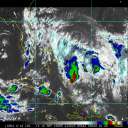
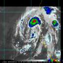
This post is inspired by a request from HanKFranK about the future evolution of Arlene. Bear in mind that it may be slightly technical; please do feel free to ask questions if there is anything that isn't clear!
So, Arlene has made landfall along the Florida coastline near Pensacola and is moving across central Alabama as we speak. What lies ahead for the storm? A lot of rain is likely along its path -- 3-5" locally possible -- but what about the structure of the storm itself? Most of the available model guidance is in agreement on gradually recurving the remnants of the storm to the northeast and east, gradually merging with another area of low pressure and moving offshore into the Atlantic in 3-4 days...but as an extratropical cyclone. We can get a feel for this by considering the structure of a tropical versus a mid-latitude cyclone.
A tropical cyclone has a warm core, where the temperatures in the center of the storm are warmer than those outside of the storm. It has a profile of winds which, excluding areas close to the surface (where frictional effects play a role), decreases in strength with height, e.g. the winds are stronger closer to the surface. It is driven by energy from its underlying surface, or the warm waters of the oceans, and weakens in response to a loss of that energy as well as other factors such as wind shear & dry air. Its strongest effects are felt very near the center and such systems are generally rather symmetric (convection patterns, wind field, and so on).
An extratropical cyclone -- generally speaking -- has a cold core, with temperatures in the center colder than those away form the center. Winds in such a storm increase with increasing height, meaning they are weakest near the surface. A developing extratropical cyclone has its upper level center located to the west of the surface center. It is driven by a series of complicated energy conversions in the atmosphere related to strong wind shear -- for those familiar with processes of kinetic and potential energy, it draws kinetic energy for development from potential energy through shearing processes; for those not, just keep the first part in mind. Its greatest impacts are felt far away from the center and such storms are generally asymmetric (convection, wind fields, and so on).
Fundamentally, these are two different situations. So, how can the former -- a tropical cyclone -- become an extratropical (mid-latitude) cyclone? This is where the process of extratropical transition comes into play. Unfortunately, much remains to be determined with regards to the process lifecycle, but generally extratropical transition occurs when the upper-level patterns are favorable for midlatitude surface cyclone development. The tropical cyclone provides an helping hand at triggering this development (assuming it stays strong enough to do so, whether over land or cold water), while the environment itself brings about structural changes upon the cyclone, resulting in the differences between the two types of storms noted above. It is in the step-by-step process as well as a complete physical understanding of how and why all of what occurs actually occurs that there remains work to be done.
Over the next few days, we'll likely see Arlene gradually undergo such a process. It is not one limited to storms that recurve offshore in the Atlantic, nor is it limited to hurricanes alone. Arlene fits neither of those categories, yet is likely to undergo transition. It may even reintensify after transition, perhaps to a stronger storm than it was during its tropical lifecycle; that remains to be seen. The factors that influence that development are related to the orientation of the trough & ridge pattern in the upper-levels and the position of the storm in relation to those features; a paper will be coming out late this year on this very topic, of which I am a co-author.
Watch satellite imagery over the next few days -- water vapor and infrared -- of the remnants of Arlene. Particularly, watch for how the convective elements change between now and 3 or 4 days from now. They will likely become separated well away from the center in curved bands, perhaps even with frontal structures extending east and south of the storm. This is one of the ways to determine an ongoing extratropical transition; another is to use model data to analyze the storm, but that is beyond the topic of this post. I'll be happy to provide the link to the page & a personal tutorial on what it all means if anyone is interested, just send me a private message.
--------------------
Current Tropical Model Output Plots
(or view them on the main page for any active Atlantic storms!)
|


 Flat
Flat


