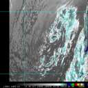
Noon 16.June Update
The Recon flight for today has been cancelled, as the system is moving over land.
Right now there is nothing imminent for tropical development, and probably won't be much to watch until perhaps the weekend or next week.
Rain over the disturbance areas will likely still be heavy.
11:30AM 15.June Update
USAFR Hurricane Hunter aircraft have been tasked for recon flights in the Bay of Campeche on Thursday for a suspect area that has been showing up lately. Modelling has been vacillating on developing this system, but NHC obviously thinks it is important enough to monitor closely with recon. Will have further updates in the blogs later this afternoon...JK
6PM 13.June Update
The area in the western Caribbean seems to be dropping in pressure, and it's enough to consider it investigation area 92L by the weather services. Which means models will start to be ran on it. The Current thinking is that it will drift west northwestward, and perhaps north, more toward a cuban/bahama event than toward the US.
It is too early to tell if it will become Bret, but if it persists into tomorrow we may have a better idea. Aircraft recon is scheduled to check it out tomorrow. Still I think the overall chances for this to develop are quite low.
Is it really June?
Original Update
Early season Tropical Storm Arlene has come and gone, and we'd hope for a quiet rest of the month. But we've got a few more areas to watch, one is more likely than the other to develop, but still the June climatology goes against both of them.
The first area, North of the Leeward Islands, is fairly large, and extends quite a ways, it's a bit far north for this time of year, plus the associated upper level low is moving through rather hostile conditions for development.
The chance for development graph for this system:
Code:
forget it) 0 1 2 3 4 5 6 7 8 9 10 (sure thing)

          [-*-------------------]
In the Western Caribbean, not too far from where Arlene came from, is another area of disturbed weather. This is between Jamaica and South America. It's a little more possible because of how relaxed winds may become north of it as time progresses. Right now the winds are a bit more hostile for development to the north than where it sits now, but this will change. It would take a few days of persistence for me to really go for it.
Code:
forget it) 0 1 2 3 4 5 6 7 8 9 10 (sure thing)

          [-----*----------------]
After the Arlene warm up, I'd rather not watch these. But it's a good idea to watch, even if the chances aren't all that great for these systems. Again, if this were August, the scale would probably be much further to the right. Time will tell this week.

Event Related links:
Animated Model plot for western Caribbean area (92L)
Animated Model plot for Bay of Campeche area (93L)


 Flat
Flat


