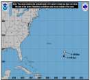
Quote: Right now its looking like this.......The flow in the midlevels of the atmosphere are almost e-w with a bend to the wnw as Emily moves sw of a strong ridge in the Central Atlantic. Now a 200mb high will be located over her giving her excellent outlfow for the next 2 days then possibly some sw sheer near hispaniola. Right now we cant tell if it will go S or N or over it. Will know by Weds eve. By Thurs a ridge will form over the mid-atlantic states and off the east coast. This will push anything south of 30N and 70W more westerly...especially in the carribean. IF Emily is over Hispaniola or south of there....then expect her to continue more west to threaten Jamiaca and southern Cuba to the Yucitan of Mex. In the long range,,the GFS and Euro has been consistant on a trough digging through the great lakes and ohio valley during next week. It then might influence it towards the western gulf states or not pick it up at all. Now should Emily be north of Hispaniola it will most likely threaten the bahamas Friday into Saturday and Sunday florida into Monday.. after that...again the trough coming down might take this NW towards the central gulf states again.. Hold on though....for 1 this is way ahead of us. We dont know in the long run how much of the trough will dig down next week and where it will be located. Also for the near term we dont know after Puerto Rico on Thurs will it go south or north of that island. In general most storms that head south of there stay in the carribean till after Jamaica. This will happen due to the mid-atlantic ridge. Anyways will update again..... scottsvb
0 registered and 794 anonymous users are browsing this forum.
Moderator:
Forum Permissions
You cannot start new topics
You cannot reply to topics
HTML is disabled
UBBCode is enabled
Rating:
Thread views: 147023
Note: This is NOT an official page. It is run by weather hobbyists and should not be used as a replacement for official sources.
CFHC's main servers are currently located at Hostdime.com in Orlando, FL.
Image Server Network thanks to Mike Potts and Amazon Web Services. If you have static file hosting space that allows dns aliasing contact us to help out! Some Maps Provided by:
Great thanks to all who donated and everyone who uses the site as well.
Site designed for 800x600+ resolution
When in doubt, take the word of the National Hurricane Center