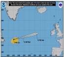
Today marks the start of the Eastern Pacific Hurricane Season. Atlantic Outlooks also begin today.
Days since last Hurricane Landfall —
US Any:
593 (Milton),
US Major:
593 (Milton),
FL Any:
593 (Milton),
FL Major:
593 (Milton)
Ed Dunham
Former Meteorologist & CFHC Forum Moderator (Ed Passed Away on May 14, 2017)
Reged:
Posts: 2565
Loc: Melbourne, FL
|
Area of Interest - East of Southern Windward Islands
Thu Sep 15 2005 10:54 AM
|
|
|
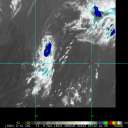
Large tropical wave well east of the southern Windward Islands continues to slowly develop with a possible evolving circulation near 9N 48W at 15/15Z. Wave is moving west at 12mph and an eventual movement to the west northwest and northwest is anticipated over the next few days. Strong shear projected just to the north of the system may be slightly overdone. Excellent convective envelope will continue to slowly organize over the next couple of days as the system moves to the west northwest and a more rapid development is possible over the weekend. This system has an excellent ppotential to become Philippe (pronounced without the 'e'). Cheers, ED
|
|
0 registered and 9 anonymous users are browsing this forum.
Moderator:
|
Forum Permissions
You cannot start new topics
You cannot reply to topics
HTML is disabled
UBBCode is enabled
|
Rating:
Thread views: 12853
|
|
|
|
|
|
Note: This is
NOT an official page. It is run by weather hobbyists and should not be used as a replacement for official sources.
CFHC's main servers are currently located at
Hostdime.com in Orlando, FL.
Image Server Network thanks to Mike Potts and Amazon Web Services. If you have static file hosting space that allows dns aliasing contact us to help out! Some Maps Provided by:
Great thanks to all who
donated and everyone who uses the site as well.
Site designed for 800x600+ resolution
When in doubt, take the word of the
National Hurricane Center