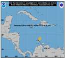
Statement as of 10:00 am CDT on September 23, 2005
...Rita a little weaker...still a very dangerous hurricane...
a Hurricane Warning is in effect from Port O'Connor Texas to Morgan City Louisiana. A Hurricane Warning means that hurricane conditions are expected within the warning area within the next 24 hours. Preparations to protect life and property should be rushed to completion.
At 10 am CDT...1500z...the Tropical Storm Warning south of Port Aransas has been discontinued.
A Tropical Storm Warning remains in effect for the southeastern coast of Louisiana east of Morgan City to the mouth of the Pearl River including metropolitan New Orleans and Lake Pontchartrain ...And from south of Port O'Connor to Port Aransas. A Tropical Storm Warning means that tropical storm conditions are expected within the warning area within the next 24 hours.
For storm information specific to your area...including possible inland watches and warnings...please monitor products issued by your local weather office.
At 10 am CDT...1500z...the center of Hurricane Rita was located near latitude 27.4 north...longitude 91.9 west or about 220 miles southeast of Galveston Texas and about 210 miles southeast of Port Arthur Texas.
Rita is moving toward the northwest near 10 mph and this motion is expected to continue during the next 24 hours. On this track...the core of Rita will make landfall near the southwest Louisiana and Upper Texas coasts early Saturday.
Maximum sustained winds have decreased to near 135 mph with higher gusts. Rita is at the border of category four and three hurricane on the Saffir-Simpson scale. Slight weakening is possible before landfall...but Rita is expected to come ashore as a major hurricane. Hurricane force winds extend outward up to 85 miles from the center...and tropical storm force winds extend outward up to 205 miles.
Latest minimum central pressure reported by an Air Force reconnaissance plane was 929 mb...27.43 inches. Coastal storm surge flooding of 15 feet above normal tide levels... locally up to 20 feet at head of bays and nearby rivers...with large and dangerous battering waves...can be expected near and to the east of where the center makes landfall. Tides are currently running about 2 feet above normal along the Louisiana...Mississippi and Alabama coasts in the areas affected by Katrina. Tides in those areas will increase to 3 to 5 feet and be accompanied by large waves...and residents there could experience coastal flooding. Large swells generated by Rita will likely affect most portions of the Gulf Coast.
Rita is expected to produce rainfall accumulations of 8 to 12 inches...with isolated maximum amounts of 20 inches over southeastern Texas and southwestern Louisiana as it moves inland. Rainfall amounts of 3 to 5 inches are possible over southeastern Louisiana including metropolitan New Orleans with isolated heavier amounts possible. Since Rita is forecast to slow down significantly after making landfall...total accumulations in excess of 25 inches are possible over the next several days across eastern Texas into western Louisiana.
0 registered and 594 anonymous users are browsing this forum.
Moderator:
Forum Permissions
You cannot start new topics
You cannot reply to topics
HTML is disabled
UBBCode is enabled
Rating:
Thread views: 80090
Note: This is NOT an official page. It is run by weather hobbyists and should not be used as a replacement for official sources.
CFHC's main servers are currently located at Hostdime.com in Orlando, FL.
Image Server Network thanks to Mike Potts and Amazon Web Services. If you have static file hosting space that allows dns aliasing contact us to help out! Some Maps Provided by:
Great thanks to all who donated and everyone who uses the site as well.
Site designed for 800x600+ resolution
When in doubt, take the word of the National Hurricane Center