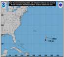
Quote: I don't think the 20% reduction from 950mb winds for max intensity is appropriate in this case, considering that the pressure drops to around 898mb in the 12Z GFDL and the eyewall pressure would be quite a bit lower than 950mb in such a system. Based on the pressure forecast (the lowest I've ever seen from the GFDL), it is forecasting a cat 5 storm. Obviously, that doesn't mean it is going to happen, but we can safely say that the GFDL model thinks conditions will be favorable for intensification.
The latest SHIPS model only brings it up to around 80 knots.
True - good voice of reason... A compromise is certainly in order... One contention I have with all the models is that they don't seem to be initializing the system all that well (the rarely do when in infancy)... It may take a depthier presentation in the intialization for the physics to latch onto this... Could be that the barotropic nature of the GFDL may just be more effective in processing for a developmental curve under such restrictions. That said at risk of making myself sound biased toward a deeper system, but, there is a modeled U/A anti-cylone and a system that is slated to pass over (as said in an earlier assertion) ssts that are phenomenal! That tends to draw one's thinking...
We'll see - but good points. I'd also add the ambient slp in the area isn't all that stellar high, so a system's pressure could be lower at a given wind velocity than say...Katrina, which was at the other end of the spectrum.
0 registered and 1029 anonymous users are browsing this forum.
Moderator:
Forum Permissions
You cannot start new topics
You cannot reply to topics
HTML is disabled
UBBCode is enabled
Rating:
Thread views: 46937
Note: This is NOT an official page. It is run by weather hobbyists and should not be used as a replacement for official sources.
CFHC's main servers are currently located at Hostdime.com in Orlando, FL.
Image Server Network thanks to Mike Potts and Amazon Web Services. If you have static file hosting space that allows dns aliasing contact us to help out! Some Maps Provided by:
Great thanks to all who donated and everyone who uses the site as well.
Site designed for 800x600+ resolution
When in doubt, take the word of the National Hurricane Center