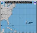
18Z GFS has shifted back to the right again through 84 hours, with the center of Wilma passing over the western tip of Cuba. After that, the track is similar to the previous run, taking the storm NE over the Keys and south FL.
Exactly how this storm approaches the Gulf (if it does at all) and how quickly it makes a possible turn to the NE will have an impact on its intensity when it potentially threatens Florida. First of all, if it brushes the Yucutan or Cuba, it is more likely to weaken somewhat than if it shoots through the Yucutan channel. If it makes more of a gradual bend to the NE, it will track farther north, spending more time over increasingly cool water in an environment of increasing wind shear. If it makes a sharp turn to the E, it will impact sooner and further south, where the shear will be somewhat less. Occasionally, you will see storms undergo a baroclinically enhanced intensification as they are captured by a mid-level system. Such intensification is usually temporary, but if it makes a quick southern landfall after turning to the NE, that may be a factor as well. Obviously, other factors will have an impact on intensity as well, such as any eyewall-replacement cycles that may occur if the system becomes very strong over the NW Carribbean.
0 registered and 782 anonymous users are browsing this forum.
Moderator:
Forum Permissions
You cannot start new topics
You cannot reply to topics
HTML is disabled
UBBCode is enabled
Rating:
Thread views: 44348
Note: This is NOT an official page. It is run by weather hobbyists and should not be used as a replacement for official sources.
CFHC's main servers are currently located at Hostdime.com in Orlando, FL.
Image Server Network thanks to Mike Potts and Amazon Web Services. If you have static file hosting space that allows dns aliasing contact us to help out! Some Maps Provided by:
Great thanks to all who donated and everyone who uses the site as well.
Site designed for 800x600+ resolution
When in doubt, take the word of the National Hurricane Center