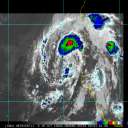
Currently, the trough over the easter contiguous U.S. that has brought cooler than normal weather for many areas east of 85W - in lieu of Wilma - and adjoining large-scale features are being transitioned into a new pattern. That is beginning to take place this morning!
The new regime will feature zonal to at times a very progressive trough above about 37N during the week and accompanied by flat ridging building into the areas of the deep south... Meanwhile, the counterpart expression of these large scale changes will tend a subtropical ridge dominance in the Atlantic Basin as well; which may in fact become connected to all and really drive a warm 3-5 day period for the southern 1/3 of the U.S..
Again, the infancy of all these changes beginning today.. As a side note, areas of the northeast U.S., currently getting unseasonably cool conditions with even some wet snow associated with a last gasp of foresaid trough, are going to experience a 20F temperature jump as close by in time as Sunday afternoon, do to these large scale changes. This is stated to demonstrate the rapidity in which these types of pattern changes can occur, and this will do so and most likely block any N moving tropical disturbances. Pattern at large is changing; the indexes that are used to determine the confidence levels for that prognostic are also quite lending to that confidence.
In simple terms, Beta has a very short lease on life... Yesterday in a post I stated that the TC had about 18 hours left of more N component to motion, then the ridge of the deep south and adjacent areas would begin to steer the system more W. The only fly in the ointment of that philosophy then was the exact degree of amplitude of the ridge that was replacing the trough, currently leaving the East Coast. Those uncertainties are disappearing per the last 24 hours of model runs combined with verfication of pressure/height rises currently taking place over the eastern Gulf and SE U.S.. These features mean that it is extremely unlikely that Beta will find the wherewithal to move much further N than the latitude already achieved. Any errors that were seemingly present in the models from 3 days ago, regarding the timing of such turn are finally ironing out - as indeed it appears the only error was that there was perhaps a bias to turn W too quickly... Those are no longer relevant from this point forward however; a, it's in the past, and b, large scale changes are more readily observed, present in the models, and will therefore begin to dictate more concertedly where Beta will motion - not this wobbly to the N routine... Definitely very W in nature over the next 24 hours.
Beyond the immediate storm surge and wind impacts at the shores, this is unfortunately likely to produce a tremendous amount of heavy rain over a landscape that has a particularly exaggerated vulnerability to flooding and mudslide activity. Extensive developmental practices of the land have caused erosion prone hill-scapes. I'm familiar with the wet season climatology of the area being April through December - however, rarely does this include these types of TC. There's been little to test the land-slidable loose hill-side sediments (save Mitch?). These are going have to take large rainfall deposition where formerly there were rain forests and/or deeper vegation root systems in general. The pre-developed era aided in preventing much of that... Remove those root systems and change the land-scape for hill-side farming and the soil loosens, and it's a nasty feed-back scenario where thousands of years of no mud-slides because of healthy flora system can result extreme short-duration catastrophics affects for having removed that system. In other words, "disaster potential" is exaggerated and needs lesser of triggers to have larger results... So, there are some uniquenesses about the geography of that area anyway, and over the last 100 years those in situ risks have been augmented by the presents and activities of man.
It simply is going to be a very rough day tomorrow and beyond for Central America; the last thing we need is this SHIPs hyper intensity guidance to go up to 65% on the last run! ...which it has.
Other than Beta...NHC mentions that the wave in the Central Caribbean still might get absorbed into Beta... I'm disinclined to agree. Beta has a very small, compact circulation that is equally small in how it controls the surrounding environment. Moreover, as soon as it moves inland it will begin losing potential influence.. In fact, from the statellite obs I've studied this moring, the wave is not being affected by Beta's presents at all, not even for outflow. To mention, there are subtlties in the steering levels for respective disturbances that don't really suggest an interaction is looming... It is for these reasons that I believe Beta will continue to migrate with increasing W component, move inland, while whatever the wave does it will likely do so unperturbed by Beta's evolution over the next 24-36 hours.
There is also a notable mid-U/A low that is tumbling though, decelerating into the eastern Caribbean Sea. These types of systems need some relatively rare scenarios to bore down to the surface to where they can couple with the SST's and begin transitioning into warm core systems... The current Caribbean arena is hostile to those situations.. It is more likely this feature will weaken as it move NW and lose identity altogether over the next 3 days.
Another system is approaching the Lesser Antilles from about 600naut miles (est by sat)...This wave occasionally hints at cyclonic orientation but seems to lose it again.. Provided the above mentioned U/A low is out of the area of the Caribbean - attenuation - this feature would likely encounter a favorable U/A as it enters the area; so something to watch.
|


 Flat
Flat


