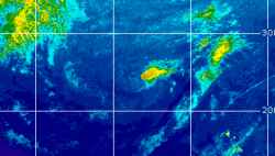
Current Radar or Satellite Image

Flhurricane.com - Central Florida Hurricane Center - Tracking Storms since 199531 Years of Hurricanes Without the Hype - Since 1995


Possible hybrid development near east coast over weekend into early next week now a 20% odds Area of Interest with NHC
Days since last Hurricane Landfall — US Any: 39 (Isaias), US Major: 769 (Milton), FL Any: 39 (Isaias), FL Major: 769 (Milton)
FlHurricane Atlantic Tropical Cyclone Tracking 🌀 Since 1995
None
HypeScale:
0.66
0510
Communication
Storm Data
Content
Follow & Connect


General Discussion >> Hurricane Ask/Tell

GuppieGrouper
Weather Master


Reged:
Posts: 596
Loc: Polk County, Florida
Inverted V on Satellite Signature?
      Tue Aug 22 2006 10:20 AM

DESPITE THE WAVE BEING BENEATH AN UPPER RIDGE...WEAK
LOW LEVEL INVERTED-V CURVATURE IS OBSERVED ON INFRARED SATELLITE
IMAGERY. SCATTERED SHOWERS/ISOLATED THUNDERSTORMS ARE FROM
17N-20N BETWEEN 75W-78W.
I have seen this statement before. Is there a brief explanation of what they are referring to? Is this a situation that could develop. or is it an indication of no more than clouds and rain?

--------------------
God commands. Laymen guess. Scientists record.

Post Extras Print Post   Remind Me!     Notify Moderator


Entire topic
Subject Posted by Posted on
* Inverted V on Satellite Signature? GuppieGrouper Tue Aug 22 2006 10:20 AM
. * * Re: Inverted V on Satellite Signature? ClarkModerator   Tue Aug 22 2006 11:36 AM

Extra information
0 registered and 0 anonymous users are browsing this forum.

Moderator:  CFHC, Ed Dunham, Colleen A., danielw, Clark, RedingtonBeachGuy, Bloodstar, tpratch, typhoon_tip, cieldumort 


Forum Permissions
      You cannot start new topics
      You cannot reply to topics
      HTML is disabled
      UBBCode is enabled

Rating:
Thread views: 6077

Rate this thread

Jump to