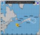
Current Radar or Satellite Image

Flhurricane.com - Central Florida Hurricane Center - Tracking Storms since 199531 Years of Hurricanes Without the Hype - Since 1995


Now looking at a chance for two TDs in the Atlantic (low threat to land), but likely development in the Pacific nearing Hawaii.
Days since last Hurricane Landfall — US Any: 669 (Milton), US Major: 669 (Milton), FL Any: 669 (Milton), FL Major: 669 (Milton)
FlHurricane Atlantic Tropical Cyclone Tracking 🌀 Since 1995
None
HypeScale:
0.85
0510
Communication
Storm Data
Content
Follow & Connect


General Discussion >> Hurricane Ask/Tell

Humanriff
Verified CFHC User


Reged:
Posts: 24
Loc: Davenport, FL
AL 962006
      Wed Sep 20 2006 10:41 AM

Can anyone explain to me why the western part of the Horn of Africa and the Atlantic close to it are "blacked out" on most of the satellite images? This is where a lot of the storms form, and it is frustrating not to be able to see this part of the world. I know that it didn't used to be like this. Is this political or technical?

Edited by Humanriff (Wed Sep 20 2006 10:48 AM)

Post Extras Print Post   Remind Me!     Notify Moderator


Entire topic
Subject Posted by Posted on
* AL 962006 Humanriff Wed Sep 20 2006 10:41 AM
. * * Re: AL 962006 ClarkModerator   Wed Sep 20 2006 11:32 AM
. * * Re: AL 962006 Myles   Tue Sep 26 2006 06:37 AM
. * * Re: AL 962006 ClarkModerator   Thu Sep 28 2006 09:05 PM
. * * Re: AL 962006 Ed DunhamAdministrator   Thu Sep 28 2006 11:17 PM
. * * Re: AL 962006 Gibli   Thu Sep 21 2006 01:25 PM

Extra information
0 registered and 37 anonymous users are browsing this forum.

Moderator:  CFHC, Ed Dunham, Colleen A., danielw, Clark, RedingtonBeachGuy, Bloodstar, tpratch, typhoon_tip, cieldumort 


Forum Permissions
      You cannot start new topics
      You cannot reply to topics
      HTML is disabled
      UBBCode is enabled

Rating:
Thread views: 10312

Rate this thread

Jump to